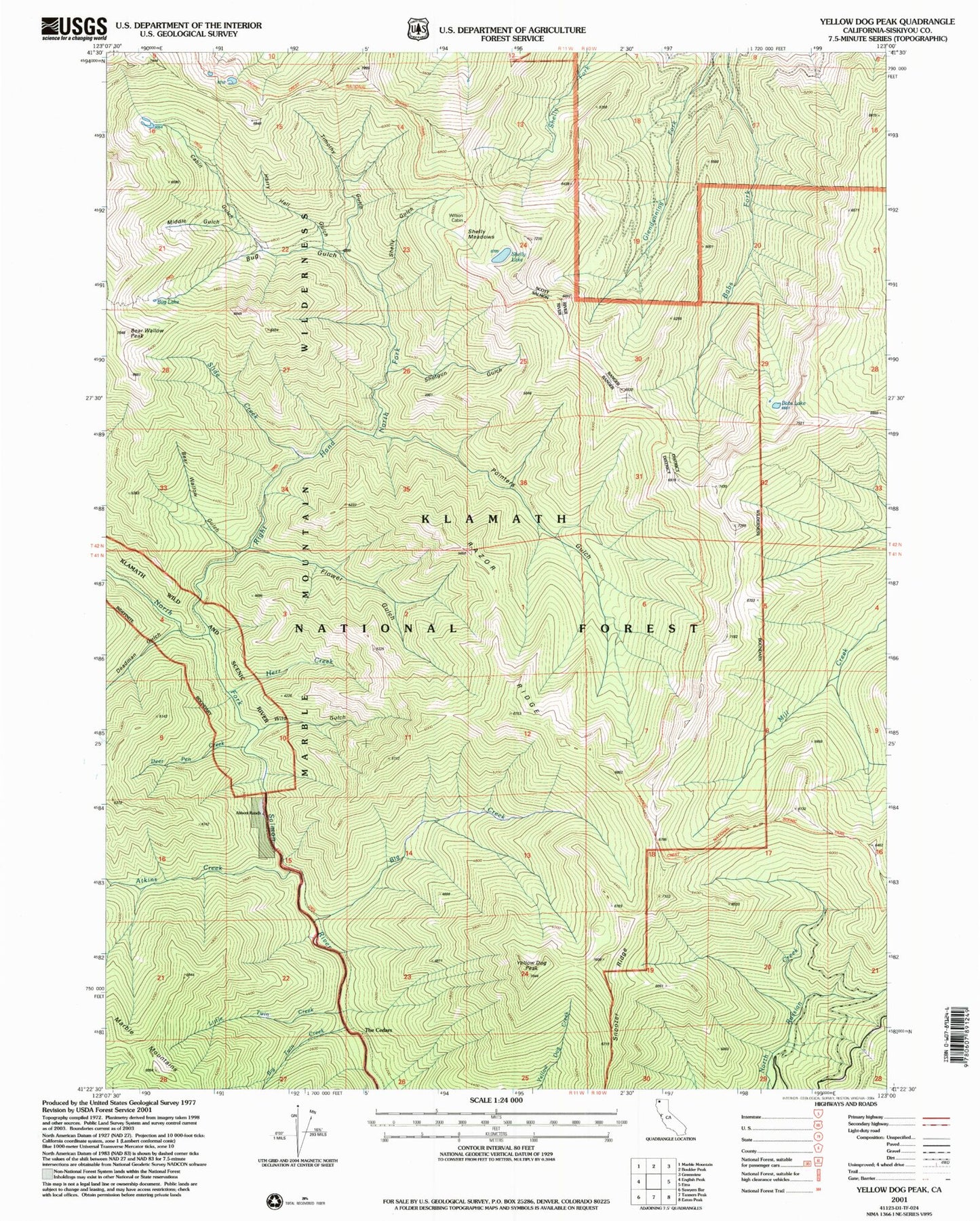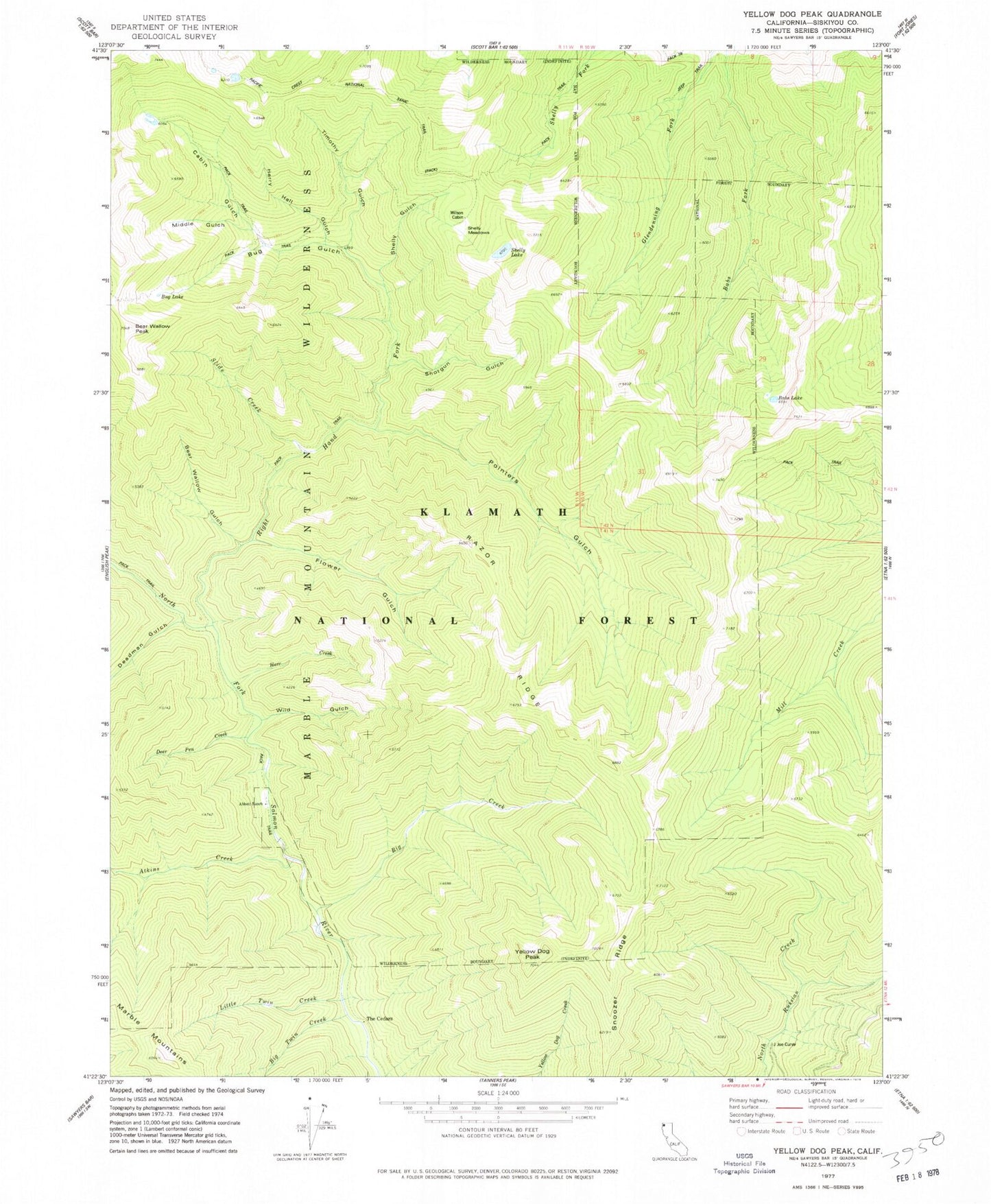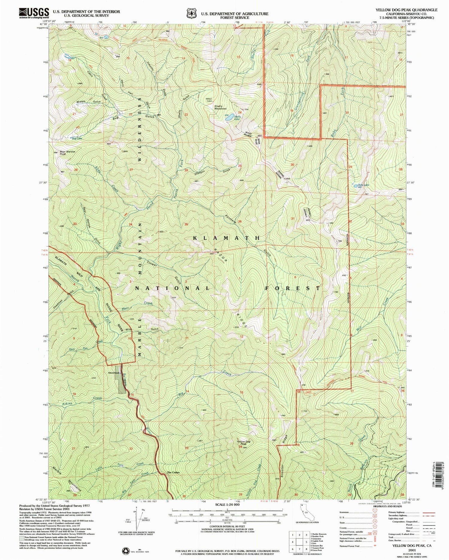
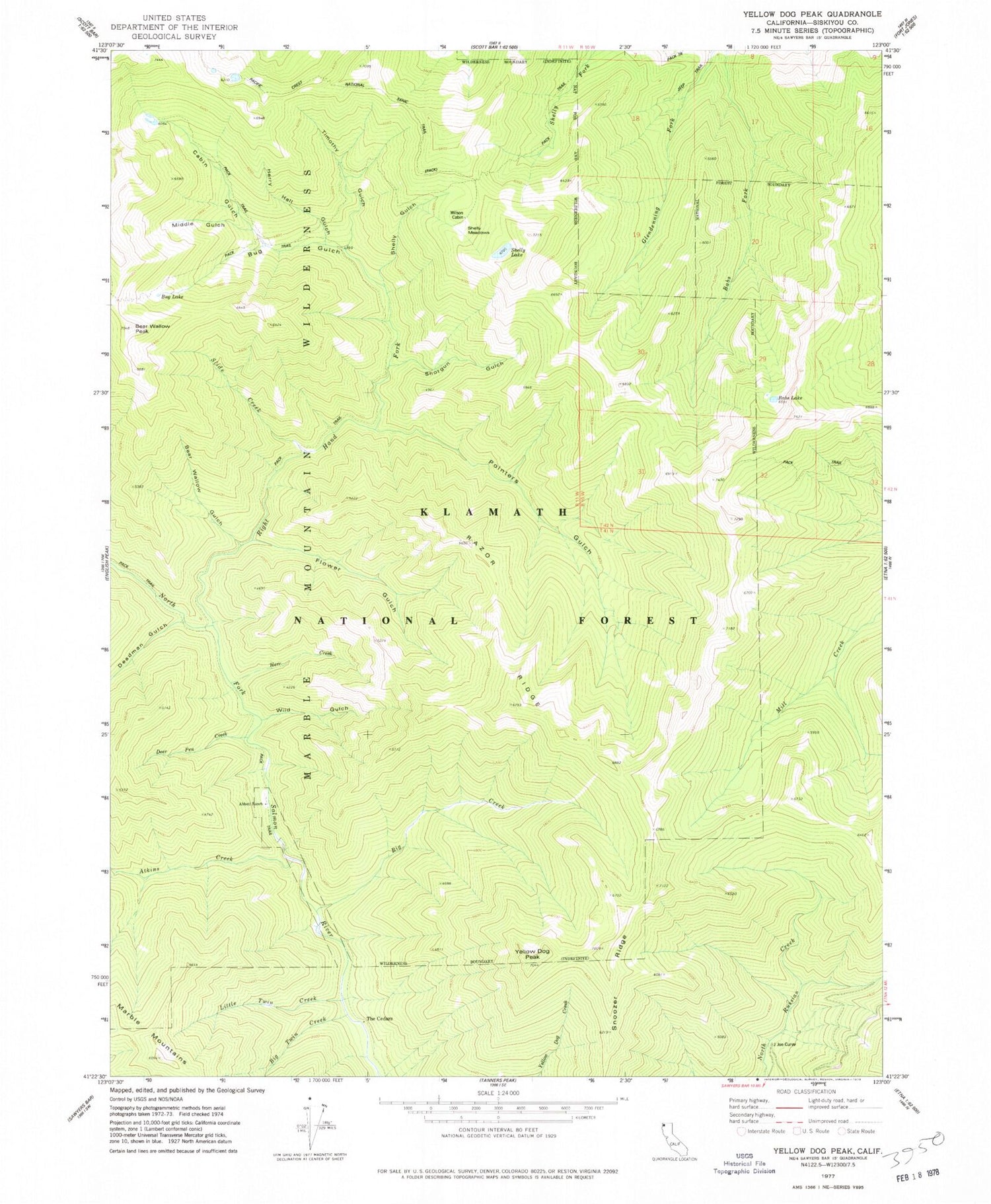
MyTopo
Classic USGS Yellow Dog Peak California 7.5'x7.5' Topo Map
Couldn't load pickup availability
Historical USGS topographic quad map of Yellow Dog Peak in the state of California. Map scale may vary for some years, but is generally around 1:24,000. Print size is approximately 24" x 27"
This quadrangle is in the following counties: Siskiyou.
The map contains contour lines, roads, rivers, towns, and lakes. Printed on high-quality waterproof paper with UV fade-resistant inks, and shipped rolled.
Contains the following named places: Abbott Ranch, Atkins Creek, Babs Lake, Bear Wallow Gulch, Bear Wallow Peak, Big Creek, Big Twin Creek, Bug Gulch, Bug Lake, Cabin Gulch, Deadman Gulch, Deer Pen Creek, Flower Gulch, Harry Hall Gulch, Herr Creek, J Joe Curve, Little Twin Creek, Middle Gulch, Pointers Gulch, Razor Ridge, Right Hand Fork North Fork Salmon River, Shelly Gulch, Shelly Lake, Shelly Meadows, Shotgun Gulch, Slide Creek, Snoozer Ridge, The Cedars, Timothy Gulch, Wild Gulch, Wilson Cabin, Yellow Dog Peak, ZIP Code: 96027