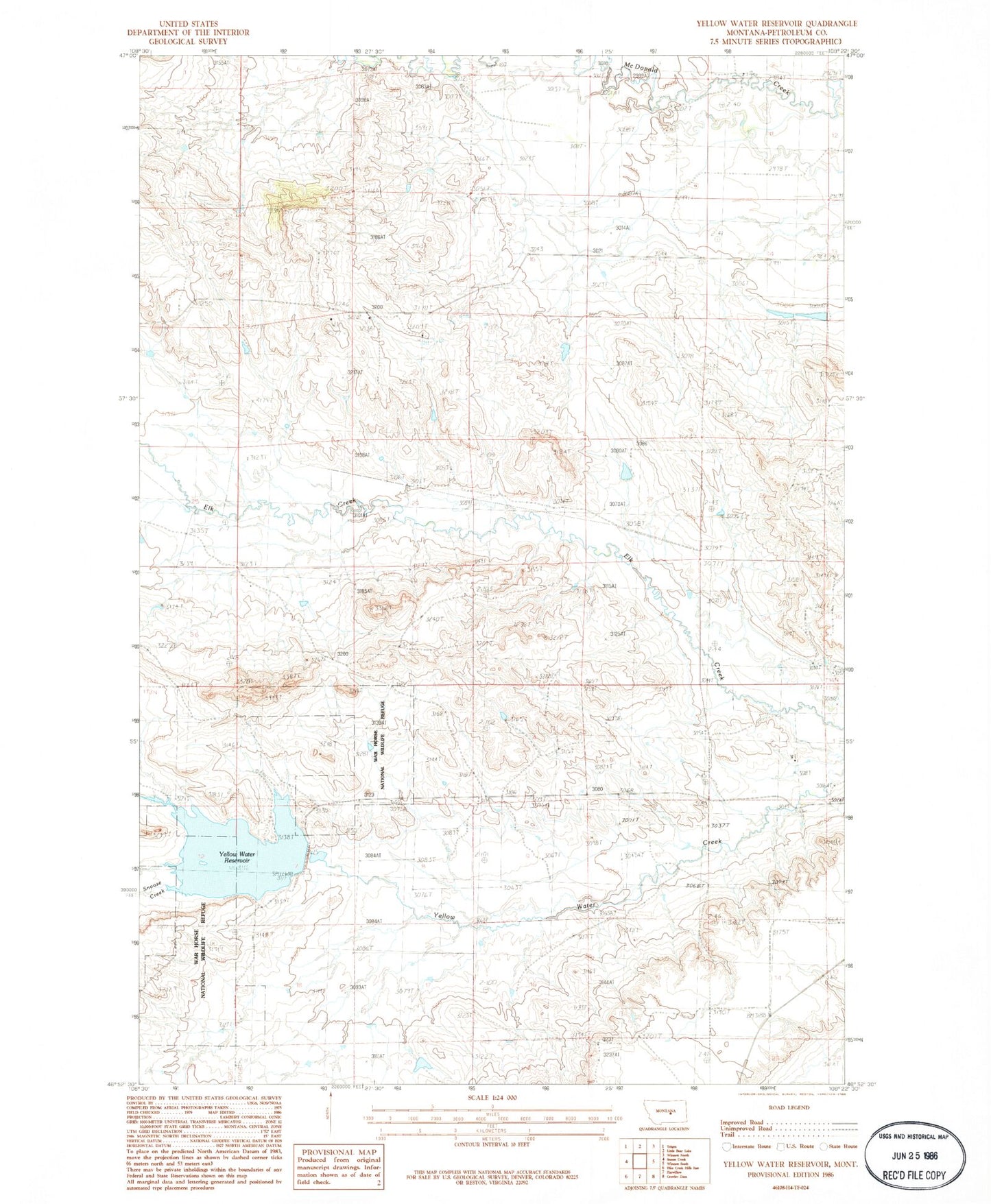
MyTopo
Classic USGS Yellow Water Reservoir Montana 7.5'x7.5' Topo Map
Regular price
$16.95
Regular price
Sale price
$16.95
Unit price
per
Couldn't load pickup availability
Historical USGS topographic quad map of Yellow Water Reservoir in the state of Montana. Map scale may vary for some years, but is generally around 1:24,000. Print size is approximately 24" x 27"
This quadrangle is in the following counties: Petroleum.
The map contains contour lines, roads, rivers, towns, and lakes. Printed on high-quality waterproof paper with UV fade-resistant inks, and shipped rolled.
Contains the following named places: 14N26E35ACC_01 Well, 14N26E35AD__01 Well, Elk Creek School, J King Number 1 Dam, J King Number 2 Dam, Snoose Creek, Walker School, War Horse National Wildlife Refuge, Yellow Water Dike, Yellow Water Main Dam, Yellow Water Reservoir