MyTopo
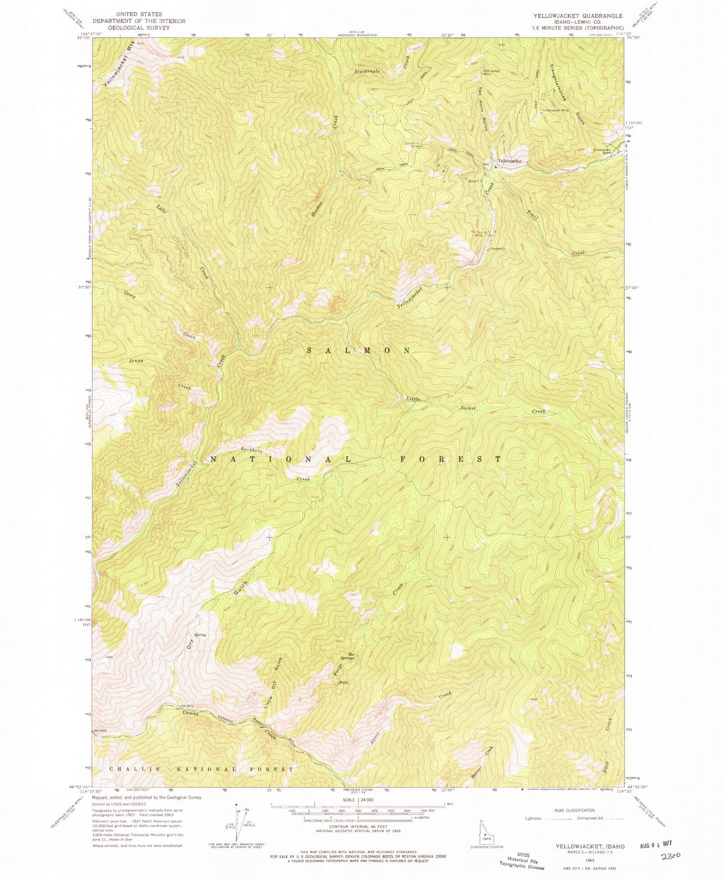
Classic USGS Yellowjacket Idaho 7.5'x7.5' Topo Map
Couldn't load pickup availability
Historical USGS topographic quad map of Yellowjacket in the state of Idaho. Map scale may vary for some years, but is generally around 1:24,000. Print size is approximately 24" x 27"
This quadrangle is in the following counties: Lemhi.
The map contains contour lines, roads, rivers, towns, and lakes. Printed on high-quality waterproof paper with UV fade-resistant inks, and shipped rolled.
Contains the following named places: Anvil Creek, Blackeagle Creek, Buckhorn Creek, Camp Creek, Columbia Mine, Dry Gulch, Forge Creek, Hoodoo Creek, Hot Springs, Jenny Creek, Lake Creek, Little Dry Gulch, Little Jacket Creek, Red Jacket Mine, Slaughterhouse Gulch, Tin Cup Mine, Trail Creek, Van Horn Gulch, Yellowjacket, Yellowjacket Mine, Yellowjacket Ranch