MyTopo
Classic USGS Yemassee South Carolina 7.5'x7.5' Topo Map
Couldn't load pickup availability
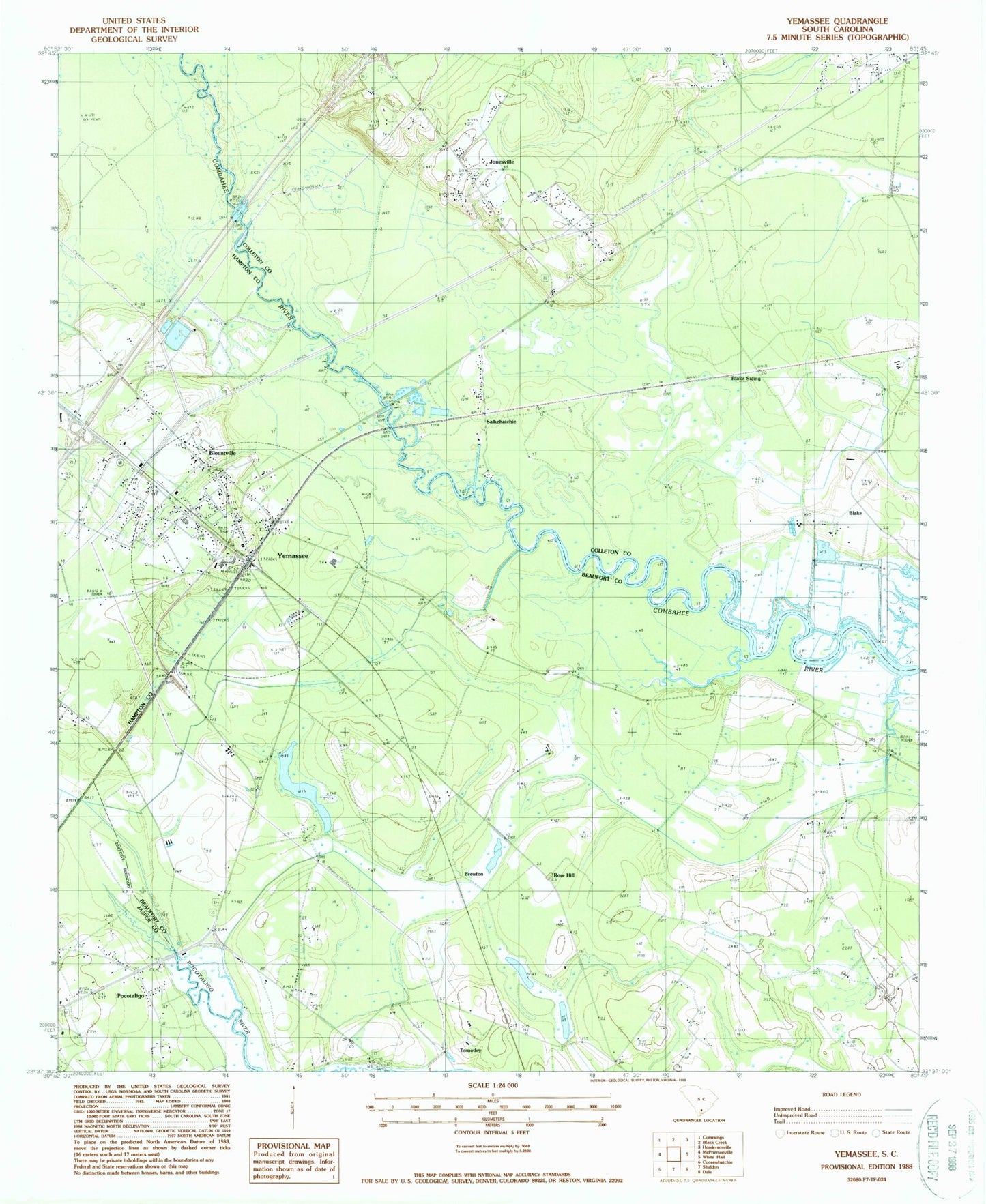
Historical USGS topographic quad map of Yemassee in the state of South Carolina. Map scale may vary for some years, but is generally around 1:24,000. Print size is approximately 24" x 27"
This quadrangle is in the following counties: Beaufort, Colleton, Hampton, Jasper.
The map contains contour lines, roads, rivers, towns, and lakes. Printed on high-quality waterproof paper with UV fade-resistant inks, and shipped rolled.
Contains the following named places: Auld Brass Plantation, Bindon Plantation, Blake, Blake Siding, Blountville, Brewton, Brewton Plantation, Castle Hall Plantation, Cherokee Plantation, Cherokee School, Coe Plantation, Colleton Fire Department Station 13, Cotton Hall Plantation, Fennell Elementary School, Fort Balfour, Gregorie Pond, Jasper Fire Department Station 33, Jericho Plantation, Jones Chapel, Jonesville, Jonesville Elementary School, Mount Nebo Church, Mount Nevo Church, Pocotaligo, Pocotaligo Church, Pocotaligo School, Roadside School, Rose Hill, Salkehatchie, Salkehatchie Cemetery, Saltketcher Bridge, Thicken Ham Plantation, Tomotley, Yemassee, Yemassee Fire Department Station 70, Yemassee Police Department, Yemassee Post Office, Yemassee School, ZIP Code: 29945