
MyTopo
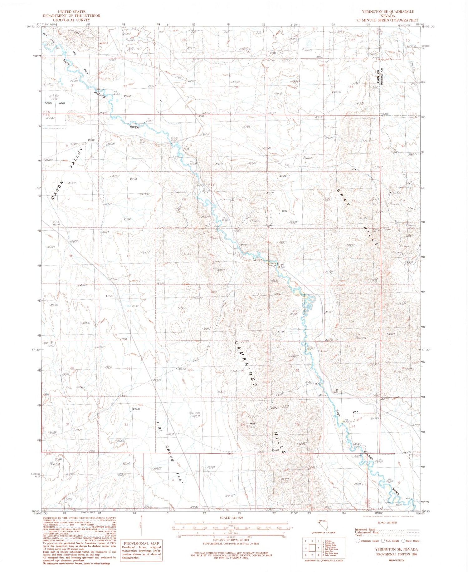
Classic USGS Yerington SE Nevada 7.5'x7.5' Topo Map
Regular price
$16.95
Regular price
Sale price
$16.95
Unit price
per
Couldn't load pickup availability
Historical USGS topographic quad map of Yerington SE in the state of Nevada. Map scale may vary for some years, but is generally around 1:24,000. Print size is approximately 24" x 27"
This quadrangle is in the following counties: Lyon, Mineral.
The map contains contour lines, roads, rivers, towns, and lakes. Printed on high-quality waterproof paper with UV fade-resistant inks, and shipped rolled.
Contains the following named places: Cambridge Hills, Lantana Ranch Airport, Lower Charlebois Ditch, Missouri Flat Extension Fence, Strosnider East Ditch, Strosnider Ranch, Strosnider West Ditch, Upper Charlebois Ditch, Wheeler Flat Drift Fence


