
MyTopo
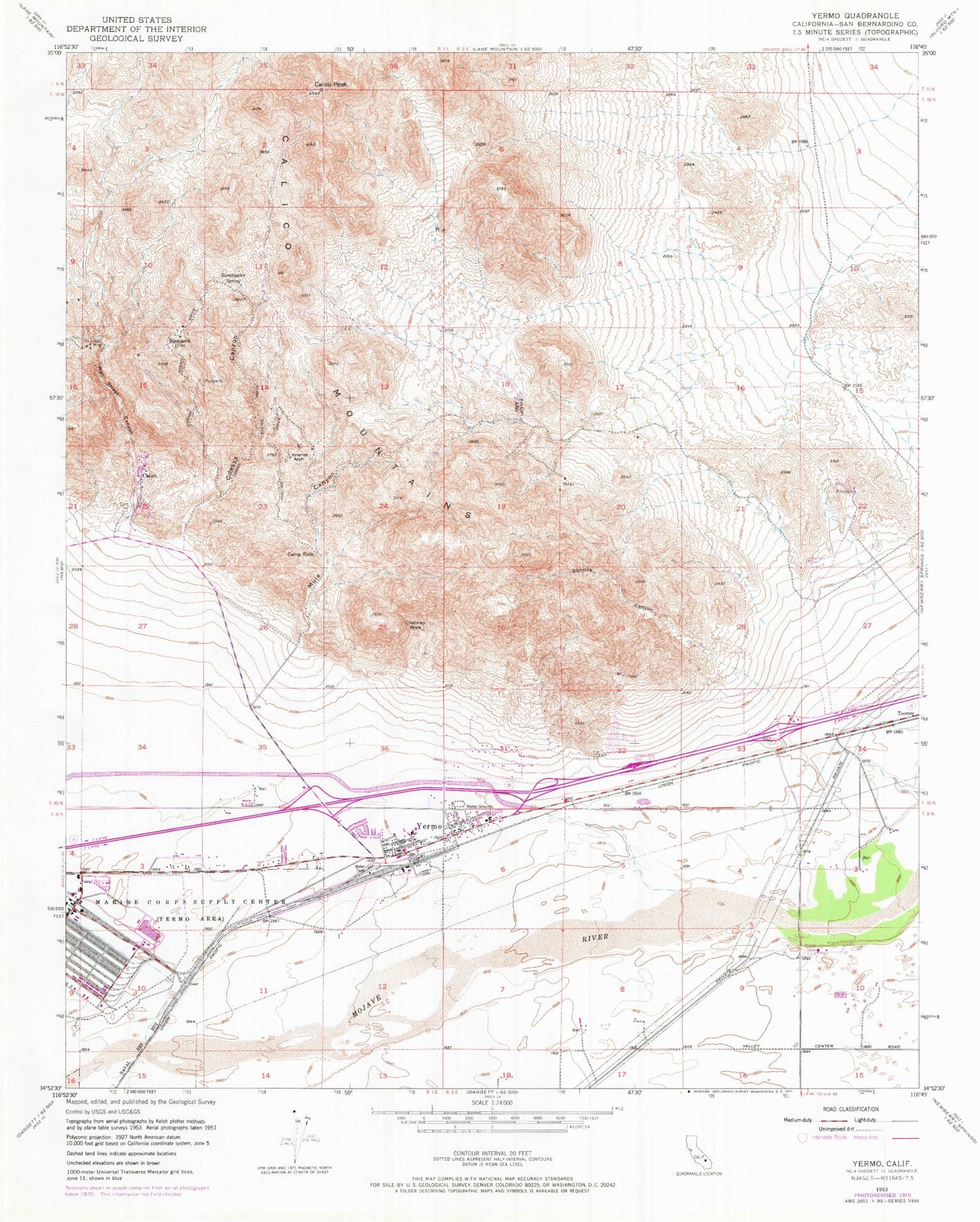
Classic USGS Yermo California 7.5'x7.5' Topo Map
Couldn't load pickup availability
Historical USGS topographic quad map of Yermo in the state of California. Typical map scale is 1:24,000, but may vary for certain years, if available. Print size: 24" x 27"
This quadrangle is in the following counties: San Bernardino.
The map contains contour lines, roads, rivers, towns, and lakes. Printed on high-quality waterproof paper with UV fade-resistant inks, and shipped rolled.
Contains the following named places: Calico Peak, Camp Rock, Chimney Rock, Kramer Arch, Mule Canyon, Odessa Canyon, Saint Louis Mine, Sunrise Canyon, Sweetwater Spring, Tin Can Alley, Wall Street Canyon, Yermo, Bismarck (historical), Calico, Calico Mountains, KRXV-FM (Yermo), Hurst Park, Smith Park, Yarrow Ravine Rattlesnake Habitat Area, Yermo Bible Church, Yermo Elementary School, Yermo Volunteer Fire Department, Green Ash Hills, Calico Cemetery, Yermo Census Designated Place, Yermo Post Office


