MyTopo
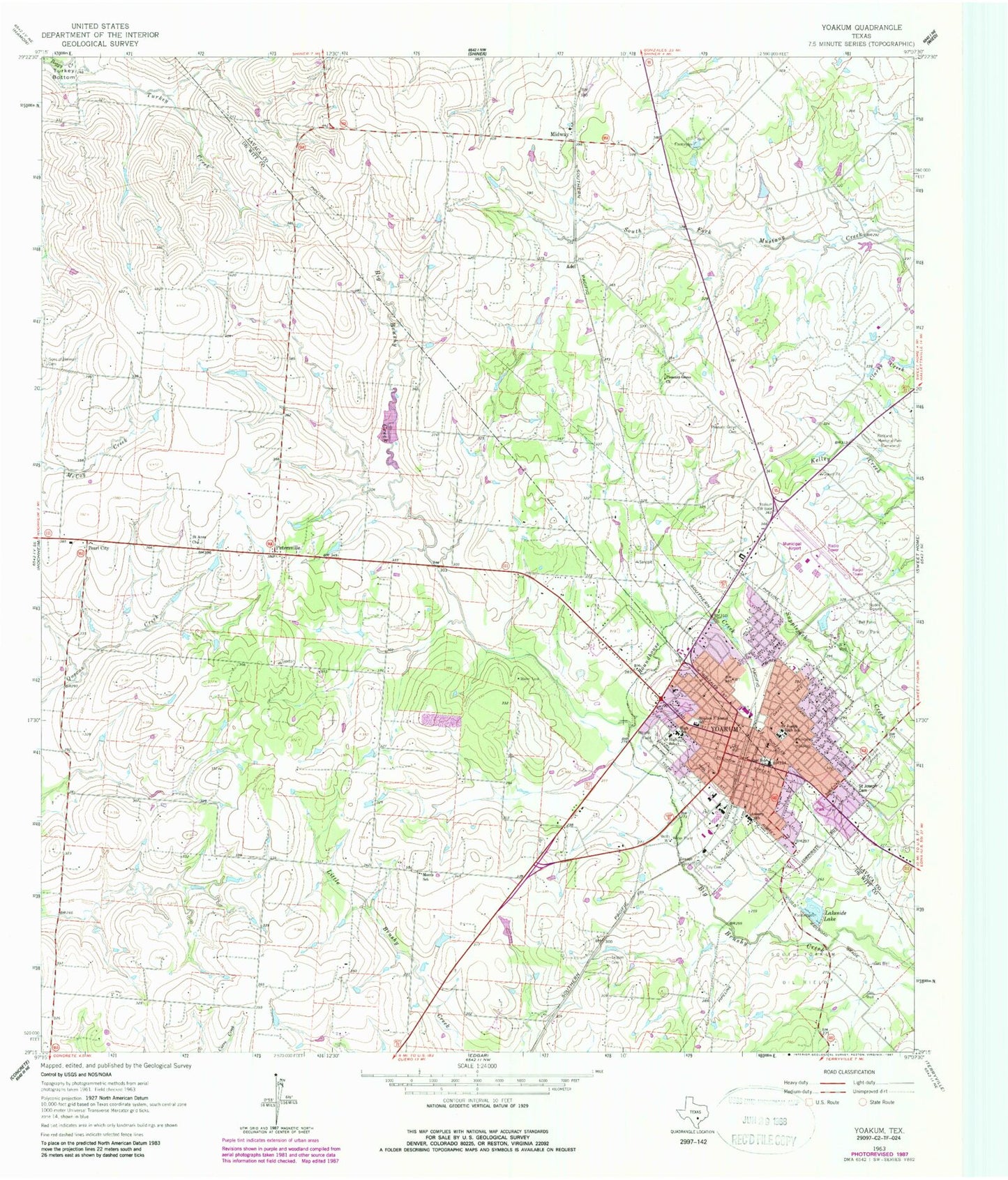
Classic USGS Yoakum Texas 7.5'x7.5' Topo Map
Couldn't load pickup availability
Historical USGS topographic quad map of Yoakum in the state of Texas. Map scale may vary for some years, but is generally around 1:24,000. Print size is approximately 24" x 27"
This quadrangle is in the following counties: DeWitt, Lavaca.
The map contains contour lines, roads, rivers, towns, and lakes. Printed on high-quality waterproof paper with UV fade-resistant inks, and shipped rolled.
Contains the following named places: Adel, Asberry School, Austin Street Baptist Church, Baker House, City of Yoakum, East Side School, First Baptist Church, First Presbyterian Church, Florine P Kaiser Dam, Forrest Street Church of God in Christ, Holy Communion Episcopal Church, KYOC-FM (Yoakum), Lakeside Lake, May-Hickey House, Midway, Morris School, Mount Sinai Baptist Church, Municipal Power Plant, Oak Grove Cemetery, Pearl City, Pearson Ranch Private Airport, Petersville, Pleasant Grove Cemetery, Pleasant Grove Church, Restland Memorial Park, Roundhouse Creek, Saint Anns Church, Saint Johns Baptist Church, Saint Joseph Cemetery, Saint Joseph High School, Saint Josephs Catholic Church, Saint Josephs Elementary School, South Yoakum Oil Field, Stephen F Austin School, Teppim Cemetery, Texas No Name Number 45 Dam, Yoakum, Yoakum City Hall, Yoakum City Park, Yoakum Community Hospital, Yoakum Fire Department, Yoakum High School, Yoakum Intermediate School, Yoakum Junior High School, Yoakum Municipal Airport, Yoakum Municipal Building, Yoakum Municipal Park, Yoakum Police Department, Yoakum Post Office, Yoakum Primary School