MyTopo
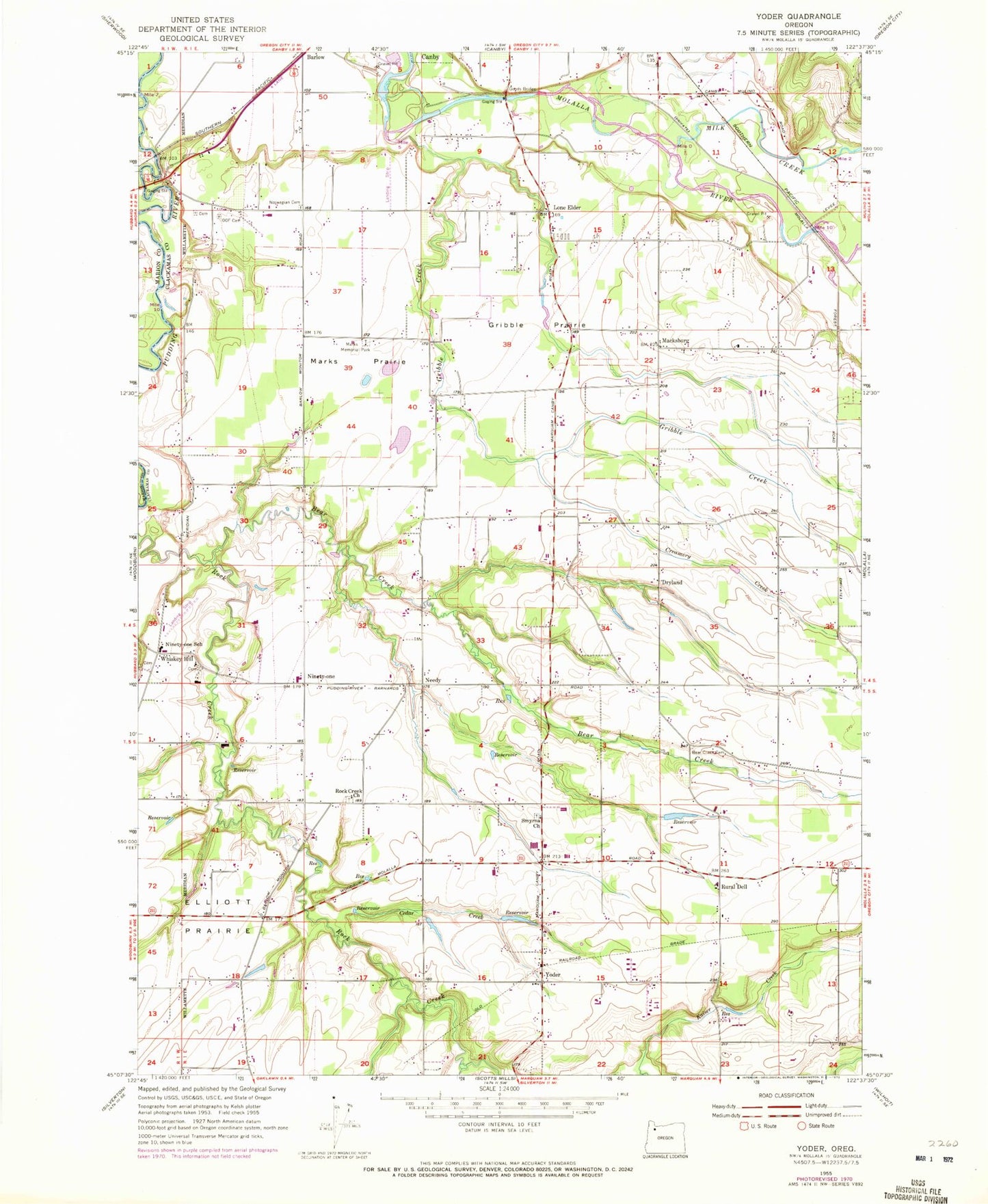
Classic USGS Yoder Oregon 7.5'x7.5' Topo Map
Couldn't load pickup availability
Historical USGS topographic quad map of Yoder in the state of Oregon. Map scale may vary for some years, but is generally around 1:24,000. Print size is approximately 24" x 27"
This quadrangle is in the following counties: Clackamas, Marion.
The map contains contour lines, roads, rivers, towns, and lakes. Printed on high-quality waterproof paper with UV fade-resistant inks, and shipped rolled.
Contains the following named places: Aamodt Dairy, Aamodt Dairy Reservoir, Aamodt Flashboard Dam, Adams Airport, Aurora IOOF Cemetery, Bachert Creek, Barlow Flats, Bear Creek, Bear Creek Cemetery, Bremer Reservoir, Busch, Calvary Mennonite Church, Canby Fire District Substation 65, Cedar Creek, Compton Airport, Creamery Creek, Dove Creek, Dryland, Gleason Cemetery, Goods Bridge, Gribble, Gribble Cemetery, Gribble Creek, Gribble Prairie, Gut Creek, Hamricks Corner, Hitchman, Irvin Family Cemetery, Kern Reservoir, Kraft, Kyllo Reservoir, Lenhardt Airpark, Lone Elder, Macksburg, Macksburg Lutheran Church, Macksburg Post Office, Marks Memorial Park, Marks Prairie, Milk Creek, Monitor Rural Fire Protection District Number 73 Yoder Station, Muddy Creek, Murry Creek, Needy, Needy Post Office, Netter Creek, Ninety - One School, Ninety-one, Norwegian Cemetery, Orville Post Office, Platt, Rock Creek Church, Rose Reservoir, Rural Dell, Rural Dell Elementary School, Schneider Reservoir, Scott, Smyrna Cemetery, Smyrna Church, Smyrna United Church of Christ, Tile Factory Bridge, Wheeler Creek, Whiskey Hill, Wills Creek, Workman Airpark, Yew Creek, Yoder, Yoder Division, Yoder Seventh Day Adventist School, Zion Mennonite Cemetery, Zion Mennonite Church, ZIP Code: 97013


