
MyTopo
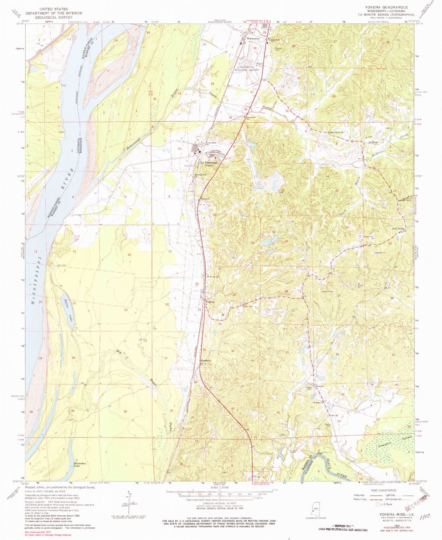
Classic USGS Yokena Mississippi 7.5'x7.5' Topo Map
Couldn't load pickup availability
Historical USGS topographic quad map of Yokena in the states of Mississippi, Louisiana. Map scale may vary for some years, but is generally around 1:24,000. Print size is approximately 24" x 27"
This quadrangle is in the following counties: Claiborne, Madison, Warren.
The map contains contour lines, roads, rivers, towns, and lakes. Printed on high-quality waterproof paper with UV fade-resistant inks, and shipped rolled.
Contains the following named places: Beach Grove Church, Beard Cemetery, Bedford Bend, Cedars Cemetery, Cedars School, Diamond Island Cutoff, Glass Cemetery, Grace Church, Hennesseys Bayou, Hopewell Church, Horseshoe Lake, Immanuel Church, Jeff Davis, Jeff Davis Lookout Tower, Jeff Davis School, Kellogg Lake Dam, Kimberly, King Davis Church, Le Tourneau, Letourneau Lake Dam, Letourneau Volunteer Fire Department, Letourneau Volunteer Fire Department Station 1, Morning Star Church, Mount Giving Cemetery, Mount Vernon Post Office, Oak Bend, Oak Bend Landing, Oak Bend Upper Bar, Paces Bayou, Paine Lake, Purks Lake Dam, Redbone, Redbone Church, Redbone Creek, Reid-Bedford Bend, Reid-Bedford Revetment, Rings Lake, Sadler Cemetery, Saint John Church, Simmons Lake, Simrall, Southall Lake, Southall Lake Dam, Supervisor District 4, Taylor Landing, Vicksburg Fire Department Station 5, Vicksburg Municipal Airport, W R Farris Lake Dam, Warrenton, Warrenton Elementary School, Warrenton Heights, Warrenton Heights Recreation Lake Dam, Wright Cemetery, Yokena


