MyTopo
Classic USGS York Butte Oregon 7.5'x7.5' Topo Map
Couldn't load pickup availability
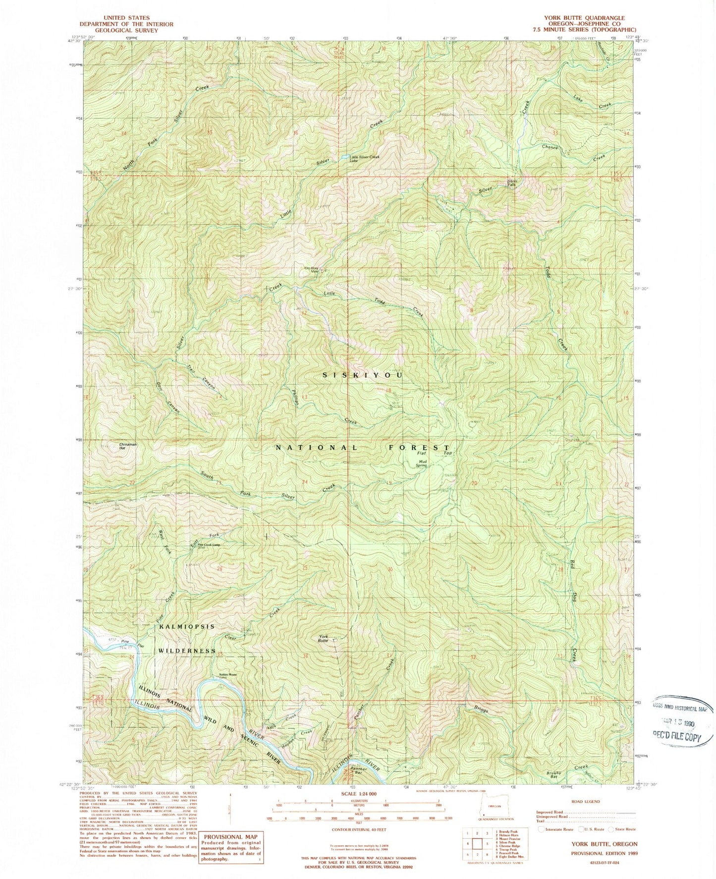
Historical USGS topographic quad map of York Butte in the state of Oregon. Map scale may vary for some years, but is generally around 1:24,000. Print size is approximately 24" x 27"
This quadrangle is in the following counties: Josephine.
The map contains contour lines, roads, rivers, towns, and lakes. Printed on high-quality waterproof paper with UV fade-resistant inks, and shipped rolled.
Contains the following named places: Briggs Creek, Briggs Creek Recreation Site, Brushy Bar, Chance Creek, Chinaman Hat, Clear Creek, Dasher Meadow, Dorr Canyon, East Fork Pine Creek, Flat Top, Hayden Creek, Illinois Wild and Scenic River, Lake Creek, Little Silver Creek, Little Silver Creek Lake, Little Todd Creek, Moon Creek, Mud Springs, Nobles House, Old Glory Mine, Panther Bar, Panther Creek, Phillips Creek, Pine Creek, Pine Creek Shelter, Pine Flat, Rawhide Creek, Red Dog Creek, Silver Falls, Soldier Creek, Todd Creek, Trail Canyon, Weaver Ranch, West Fork Pine Creek, York Butte, York Creek, York Creek Botanical Area