MyTopo
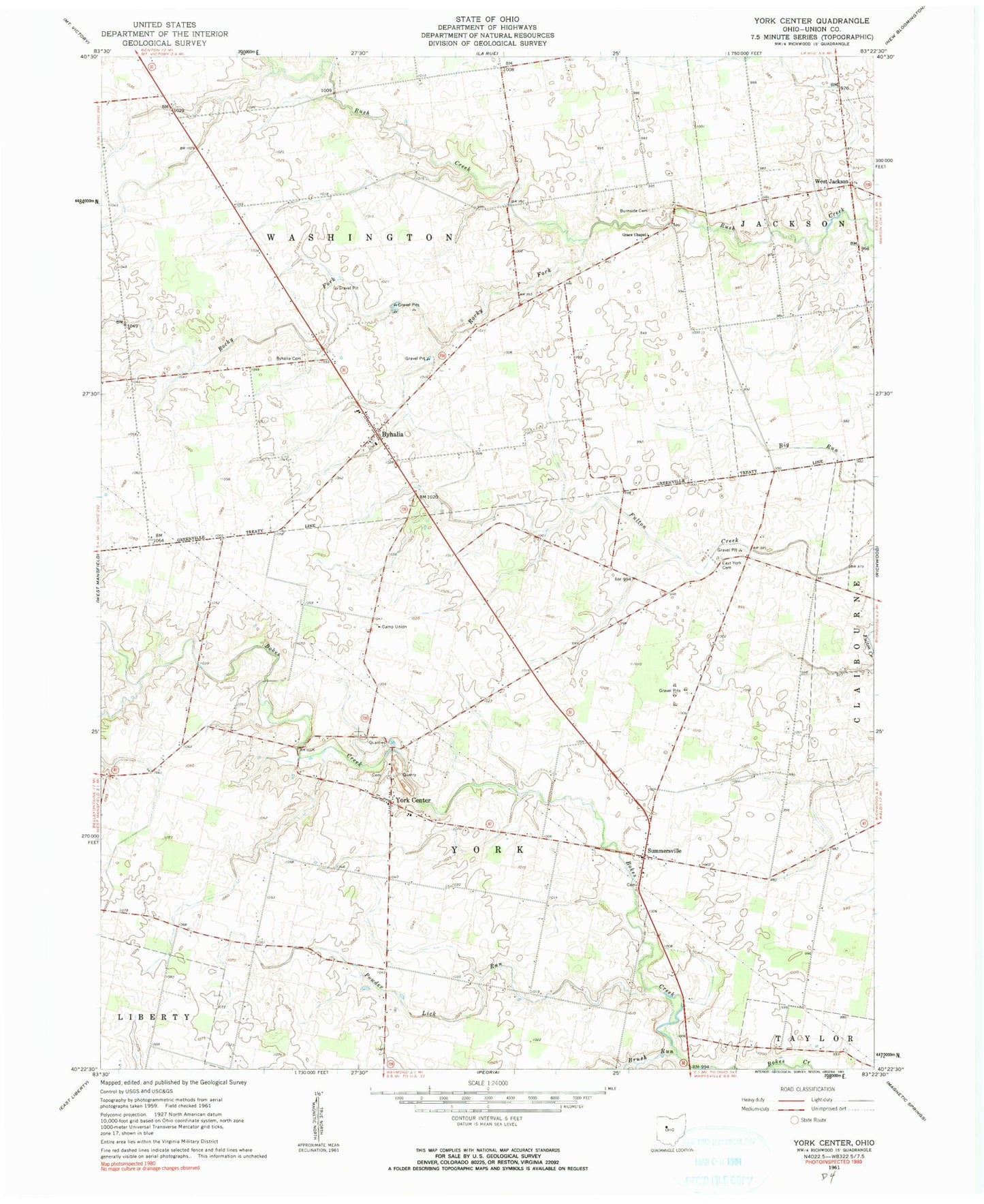
Classic USGS York Center Ohio 7.5'x7.5' Topo Map
Couldn't load pickup availability
Historical USGS topographic quad map of York Center in the state of Ohio. Map scale may vary for some years, but is generally around 1:24,000. Print size is approximately 24" x 27"
This quadrangle is in the following counties: Union.
The map contains contour lines, roads, rivers, towns, and lakes. Printed on high-quality waterproof paper with UV fade-resistant inks, and shipped rolled.
Contains the following named places: Arbela, Arbela Post Office, Beechdale School, Bolenbaugh School, Brush Run, Burnside Cemetery, Byhalia, Byhalia Cemetery, Byhalia Post Office, Cahill School, Camp Union, Day Lay Egg Farm, East York Cemetery, Fountain Grove School, Fouts School, Grace Chapel, Grace Temple School, Haynesville, Howard School, Mad River Egg Farm, Merit School, Middle Branch Bokes Creek, Middleton School, Miller School, Pleasant Valley School, Powder Lick Run, Rocky Fork, Sherwood School, Sommersville Cemetery, Summersville, Township of Washington, Township of York, Union Baptist Church, Washington Township Hall, West Jackson, Wilderness School, York Center, York Center Cemetery