MyTopo
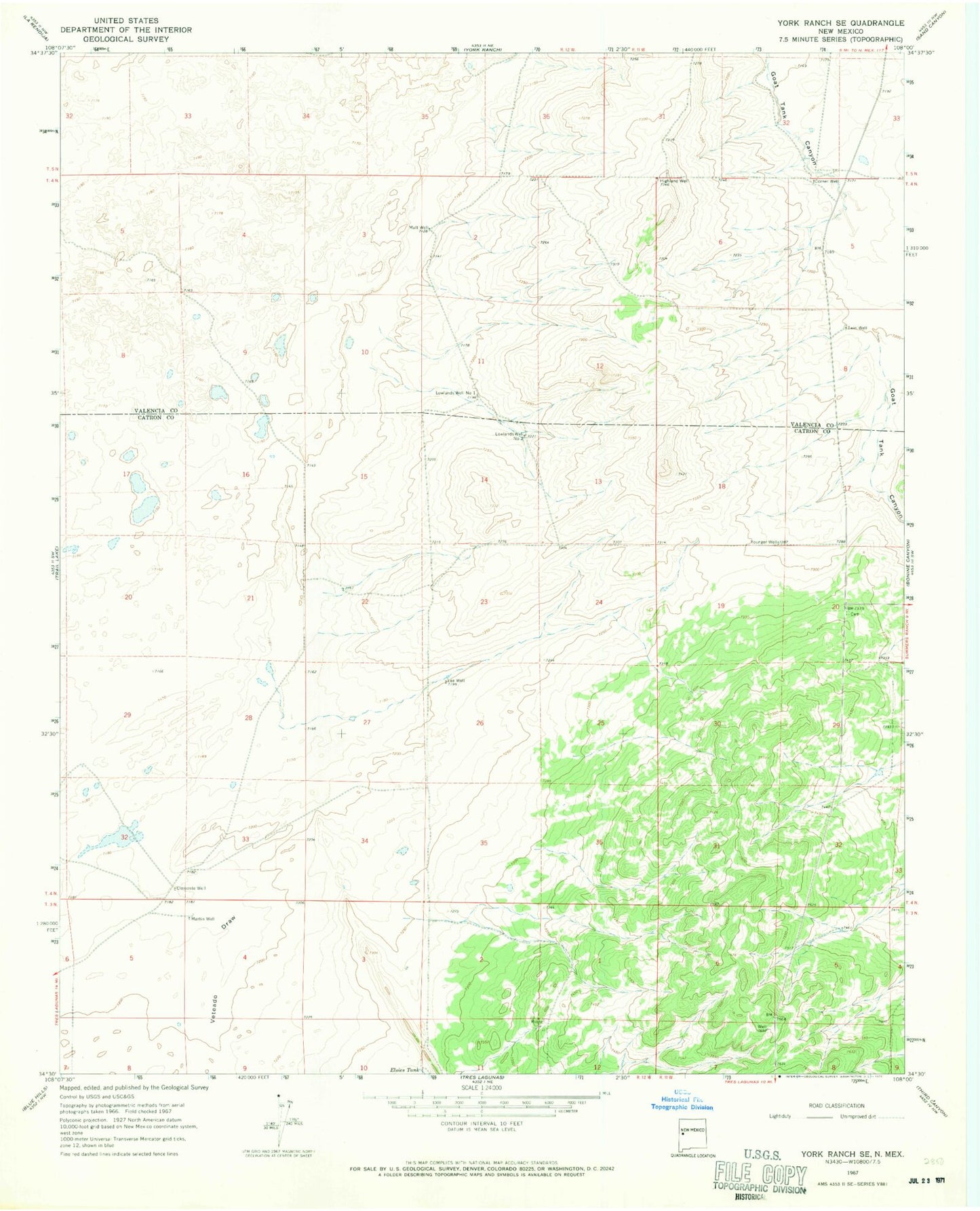
Classic USGS York Ranch SE New Mexico 7.5'x7.5' Topo Map
Couldn't load pickup availability
Historical USGS topographic quad map of York Ranch SE in the state of New Mexico. Map scale may vary for some years, but is generally around 1:24,000. Print size is approximately 24" x 27"
This quadrangle is in the following counties: Catron, Cibola.
The map contains contour lines, roads, rivers, towns, and lakes. Printed on high-quality waterproof paper with UV fade-resistant inks, and shipped rolled.
Contains the following named places: Camp Water Well, Clemente Well, Corner Water Well, Corner Well, Cox Trap Water Well, Elsies Tank, Field Water Well, Greer Cemetery, Highland Well, Lee Well, Lowlands Water Well, Lowlands Well Number 1, Lowlands Well Number 2, Malt Water Well, Malt Well, Martin Well, Porcupine Ridge Airport, Twin Well, Twin Wll A Water Well, Twin WLL B Water Well, Veteado Draw, Younger Well