MyTopo
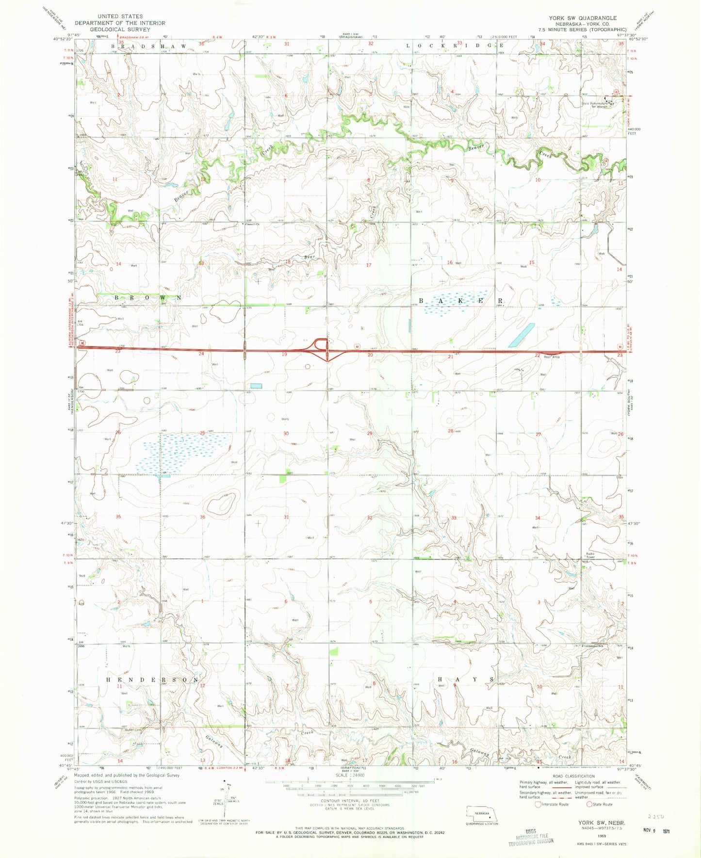
Classic USGS York SW Nebraska 7.5'x7.5' Topo Map
Couldn't load pickup availability
Historical USGS topographic quad map of York SW in the state of Nebraska. Map scale may vary for some years, but is generally around 1:24,000. Print size is approximately 24" x 27"
This quadrangle is in the following counties: York.
The map contains contour lines, roads, rivers, towns, and lakes. Printed on high-quality waterproof paper with UV fade-resistant inks, and shipped rolled.
Contains the following named places: Baker Election Precinct, Bear Creek, Centennial School, Charlestown, Charlestown Post Office, Council Church, Kirkpatrick Basin North State Wildlife Management Area, Kirkpatrick Basin South State Wildlife Management Area, Mennonite Cemetery, Nebraska City-Fort Kearny Cut-off Historical Marker, Nebraska Correctional Center for Women, Recharge Lake, Township of Baker, York Rest Area - Eastbound