MyTopo
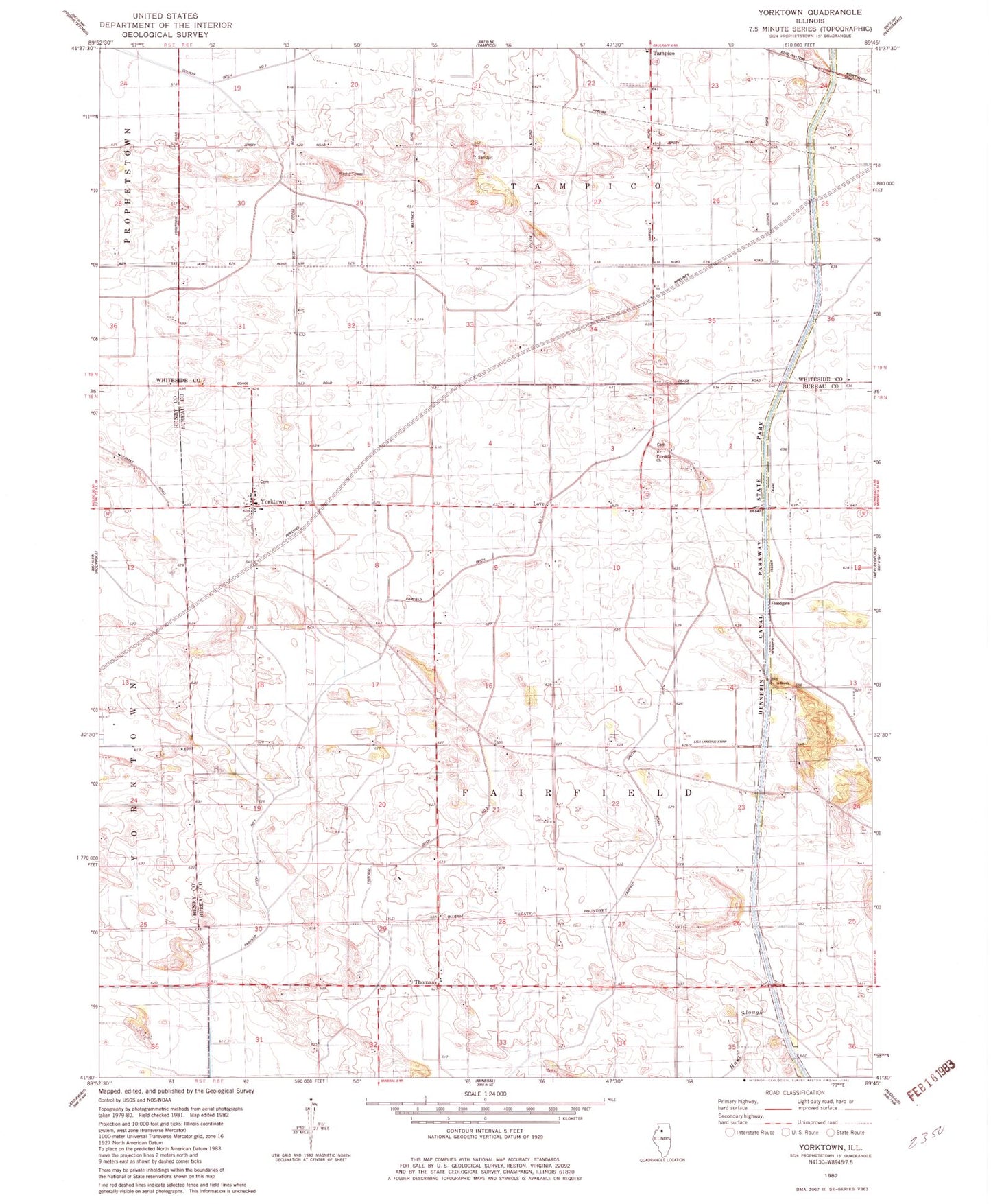
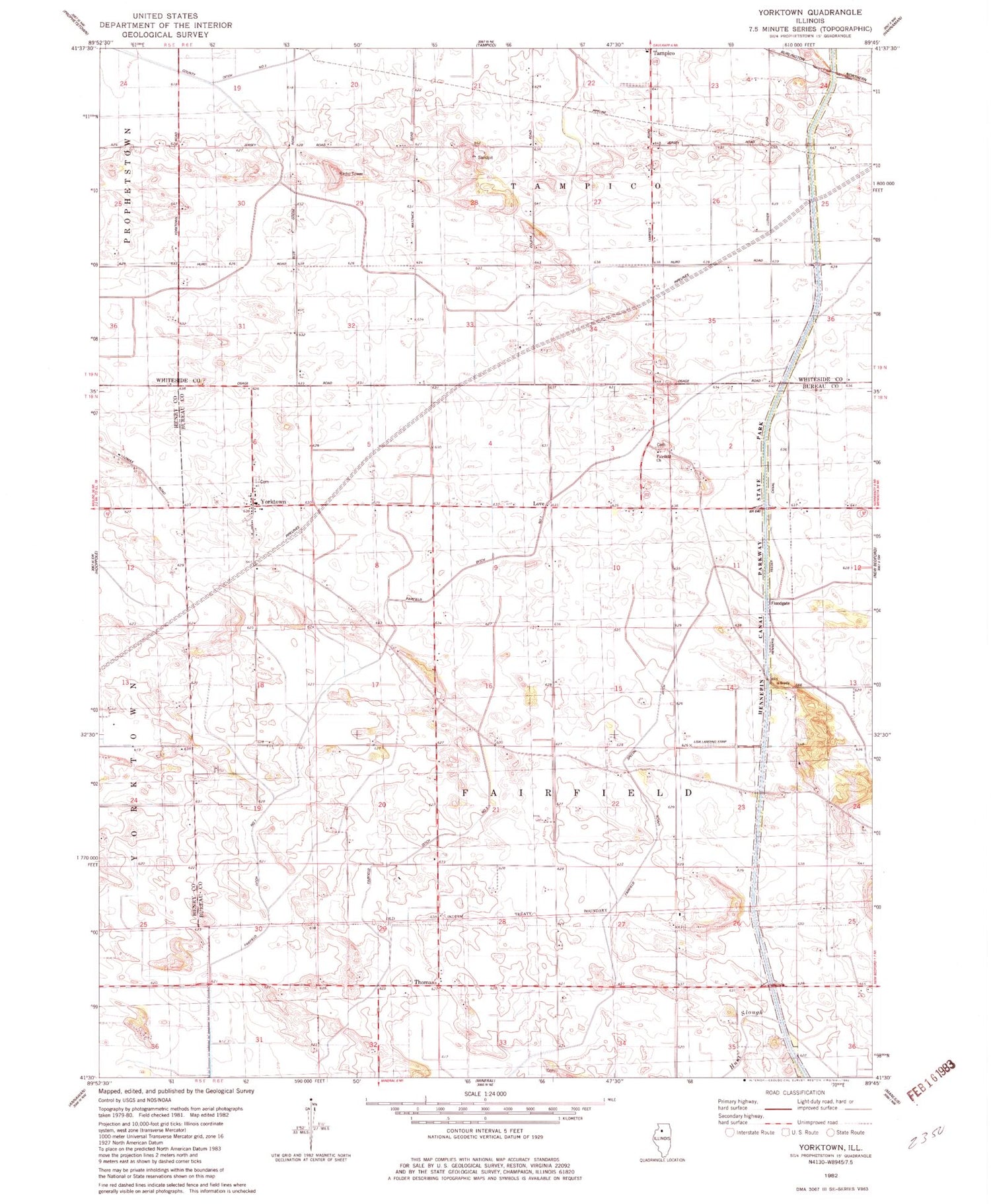
Classic USGS Yorktown Illinois 7.5'x7.5' Topo Map
Couldn't load pickup availability
Historical USGS topographic quad map of Yorktown in the state of Illinois. Map scale may vary for some years, but is generally around 1:24,000. Print size is approximately 24" x 27"
This quadrangle is in the following counties: Bureau, Henry, Whiteside.
The map contains contour lines, roads, rivers, towns, and lakes. Printed on high-quality waterproof paper with UV fade-resistant inks, and shipped rolled.
Contains the following named places: Anderson Family Cemetery, Burden School, Center School, Cloverdale School, County Ditch Number 2, Fairfield Amish Mennonite Cemetery, Fairfield Church, Fairfield Ditch Number 1, Fairfield Union Special Ditch, Harms Airstrip, Hennepin Feeder Canal, Johnson School, Lisa Landing Strip, Love, Pleasant Hill School, Sunnyside School, Tampico Rural Fire Protection District Station 2, Thomas, Township of Fairfield, Whittington School, Yorktown, Yorktown Cemetery, ZIP Code: 61283