
MyTopo
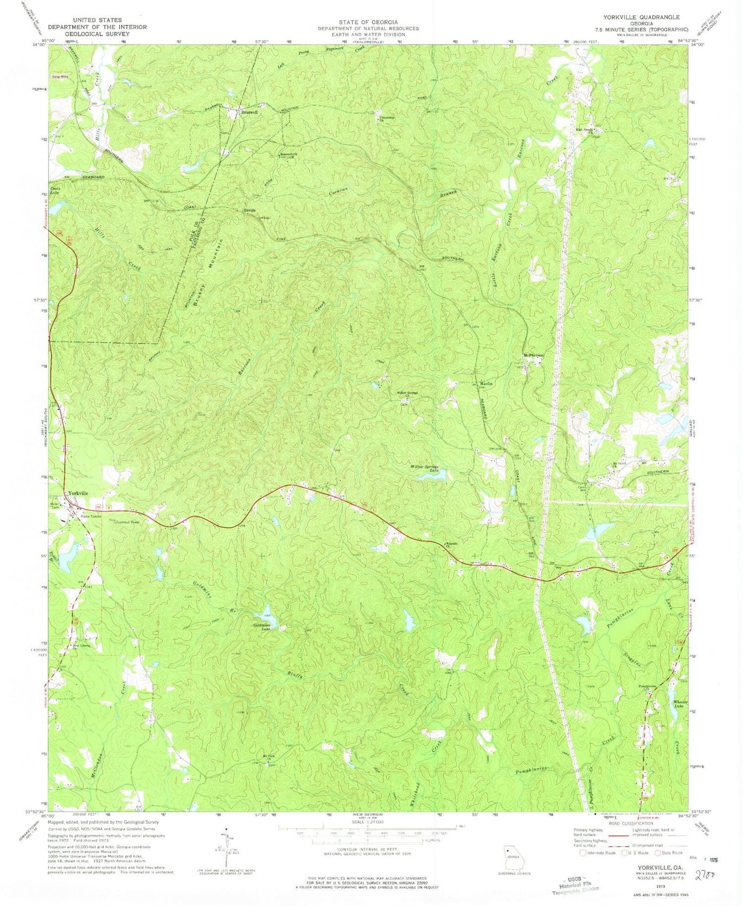
Classic USGS Yorkville Georgia 7.5'x7.5' Topo Map
Couldn't load pickup availability
Historical USGS topographic quad map of Yorkville in the state of Georgia. Typical map scale is 1:24,000, but may vary for certain years, if available. Print size: 24" x 27"
This quadrangle is in the following counties: Paulding, Polk.
The map contains contour lines, roads, rivers, towns, and lakes. Printed on high-quality waterproof paper with UV fade-resistant inks, and shipped rolled.
Contains the following named places: Bluffy Creek, Cochran Branch, Goldmine Branch, Goldmine Lake, Lane Creek, Little Pumpkinvine Creek, Little Raccoon Creek, Mount View Church, Mount Olivet Church, Scoggins Creek, Wheeler Lake, Whitehead Creek, Willow Springs Church, Willow Springs Lake, Hanlin, McPherson, Braswell, Brushy Mountain, Divide, Yorkville, Archibald Holland Bridge, Gann Cemetery, McPherson Baptist Church, Yorkville Elementary School, Pumpkinvine Creek Structure Number Eight Dam, Jones Lake, Pumpkinvine Creek Structure Number 10 Dam, Flint Lake, Gore Lake Dam, Gore Lake, Jones Lake Dam, Jones Lake, Wheeler Lake Dam, Pumpkinvine Creek Structure Number 11 Dam, Womack Lake, Upper Coots Lake Dam, Upper Coots Lake, Willow Springs Lake Dam, Gore Lake Dam, Blair Lake Dam, Blair Lake, Finney Dam, Finney Lake, Beatty Switch, Friendship Cemetery, Old High Shoals Baptist Church Cemetery, Little Creek Farms, High Shoals Baptist Church Cemetery, Rock Springs, Scoggins Ridge, Willow Springs Cemetery, Yorkville Cemetery, Yorkville United Methodist Church, Baxter Prospect, Yorkville Mine, Braswell Church, Friendship Church, High Shoals Church, New Liberty Church, Pumpkinvine Church, Wayside Church, Pumpkin, Remus, Yorkville Division, Town of Braswell, Paulding Northwest Atlanta Airport, Poole Elementary School, Braswell Police Department, Mount Olivet Church Cemetery


