
MyTopo
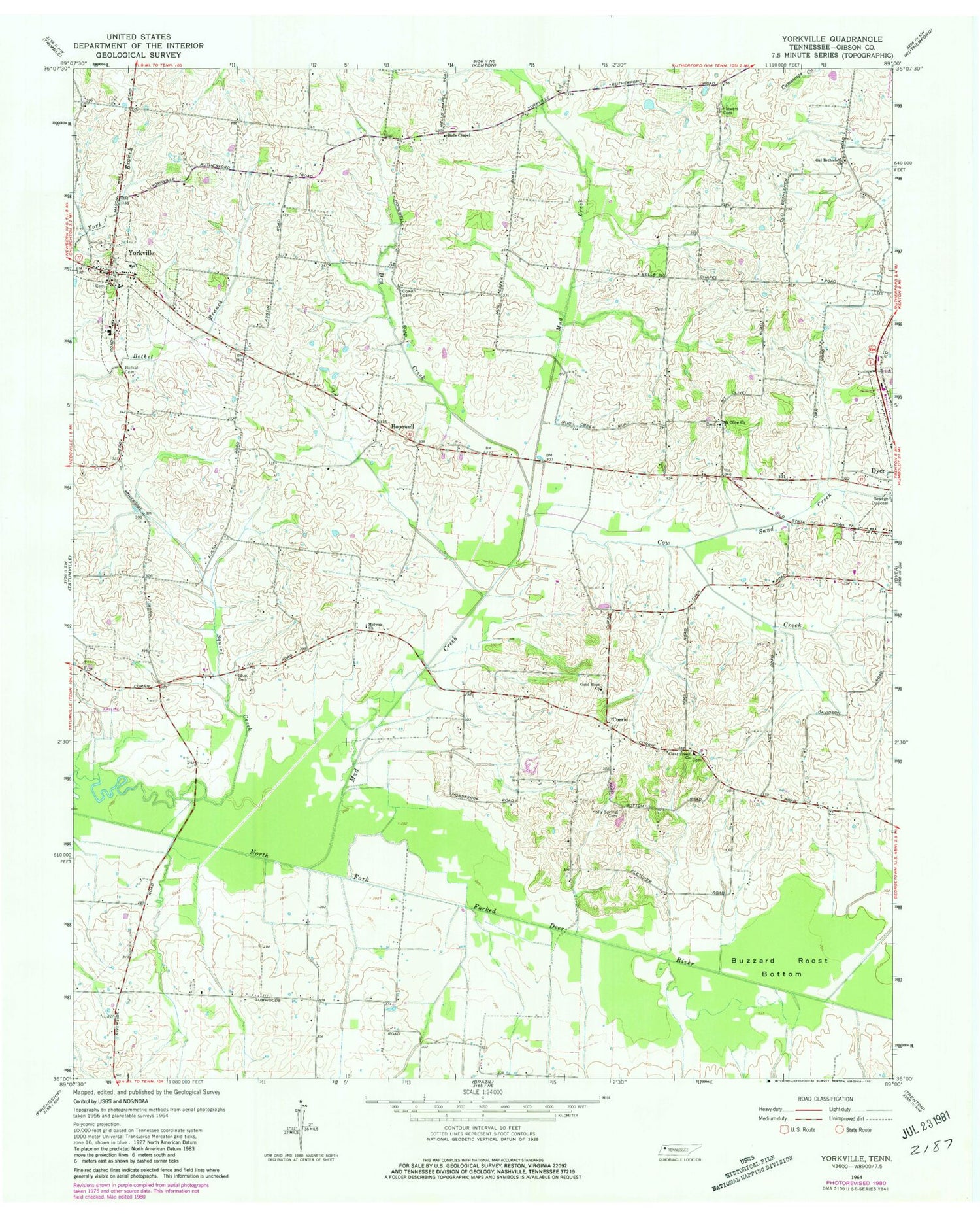
Classic USGS Yorkville Tennessee 7.5'x7.5' Topo Map
Couldn't load pickup availability
Historical USGS topographic quad map of Yorkville in the state of Tennessee. Map scale may vary for some years, but is generally around 1:24,000. Print size is approximately 24" x 27"
This quadrangle is in the following counties: Gibson.
The map contains contour lines, roads, rivers, towns, and lakes. Printed on high-quality waterproof paper with UV fade-resistant inks, and shipped rolled.
Contains the following named places: Bells Chapel, Bells Chapel Cemetery, Bells Chapel School, Bethel Baptist Church, Bethel Cemetery, Buzzard Roost Bottom, City of Yorkville, Clear Creek Cemetery, Clear Creek Church, Commissioner District 16, Cow Creek, Cowan Cemetery, Currie, District 21, District 8, Dry Creek, Duck Hill Church, Dyer Industrial Park, Flowers Cemetery, Flowers Chapel, Good Hope Cemetery, Good Hope Church, Hogue Cemetery, Holly Spring Cemetery, Hooten, Hopewell, Hopewell Methodist Episcopal Church South, Hopewell School, Midway Church, Mount Carmel Cumberland Presbyterian Church, Mount Olive Cemetery, Mount Olive Church, Mud Creek, Newell, Old Bethlehem Church, Riverside, Sand Creek, Union Academy, Yorkville, Yorkville Cemetery, Yorkville Church of Christ, Yorkville Cumberland Presbyterian Church, Yorkville Cumberland Presbyterian Church Cemetery, Yorkville Division, Yorkville Elementary School, Yorkville Fire Department, Yorkville High School, Yorkville Post Office, ZIP Code: 38330


