MyTopo
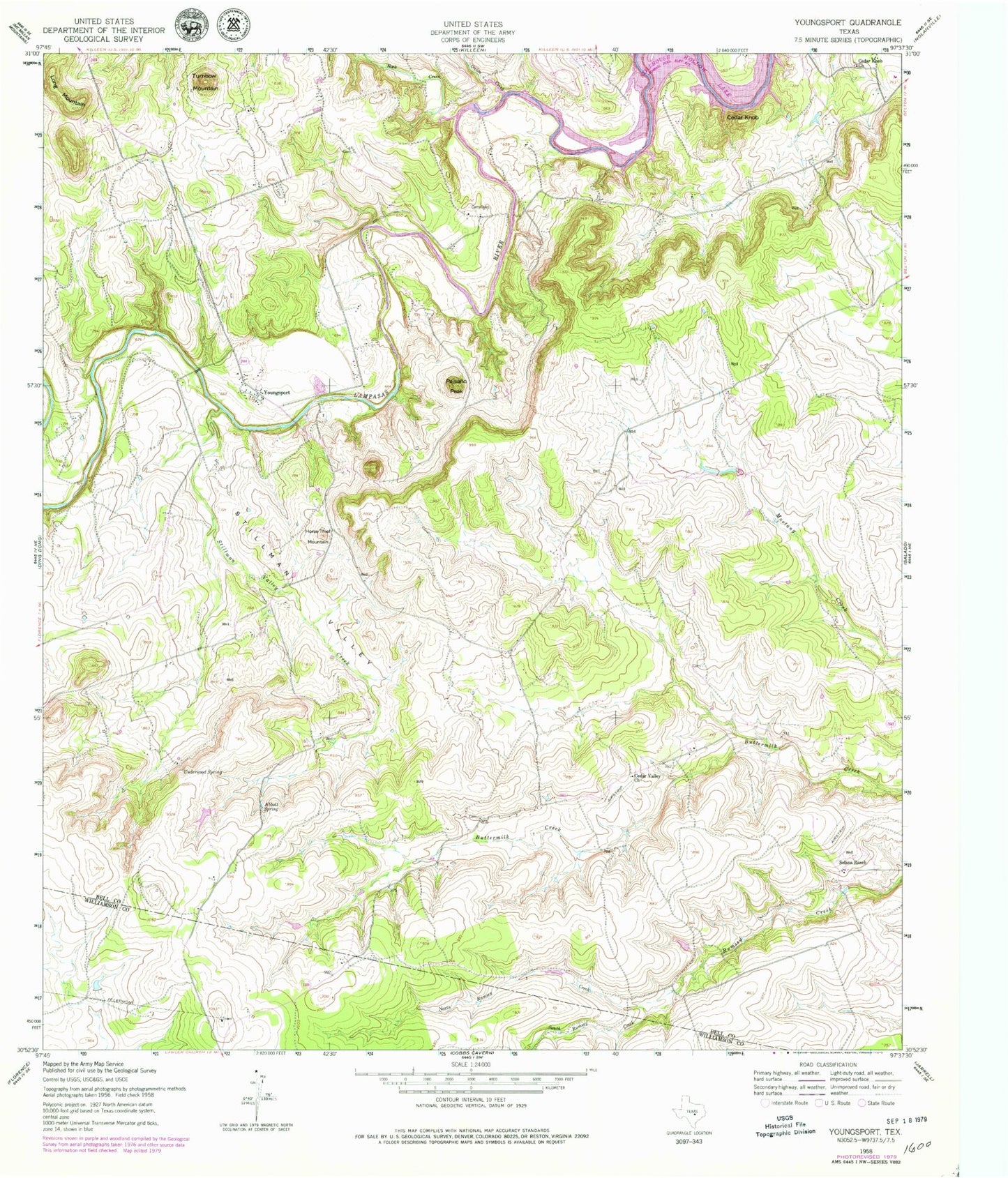
Classic USGS Youngsport Texas 7.5'x7.5' Topo Map
Couldn't load pickup availability
Historical USGS topographic quad map of Youngsport in the state of Texas. Map scale may vary for some years, but is generally around 1:24,000. Print size is approximately 24" x 27"
This quadrangle is in the following counties: Bell, Williamson.
The map contains contour lines, roads, rivers, towns, and lakes. Printed on high-quality waterproof paper with UV fade-resistant inks, and shipped rolled.
Contains the following named places: Abbott Spring, Cedar Knob, Cedar Knob Church, Cedar Valley, Cedar Valley Church, Headquarters Springs, Horse Thief Mountain, KNCT-FM (Killeen), KNCT-TV (Belton), KPLE-FM (Temple), Long Mountain, North Rumsey Creek, Onion Creek, Paisano Peak, Rock Creek, Solana Ranch, South Rumsey Creek, Stillman Valley, Stillman Valley Creek, Turnbow Mountain, Underwood Spring, Warwick Springs, Youngsport