MyTopo
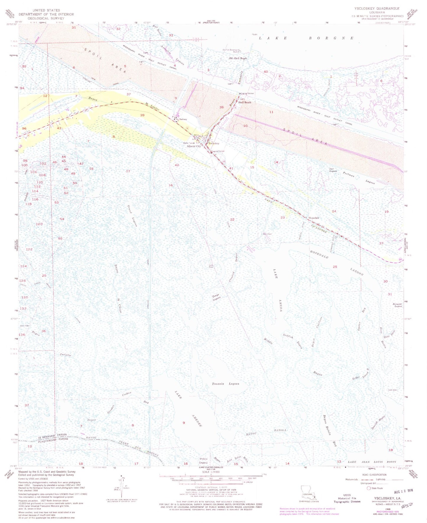
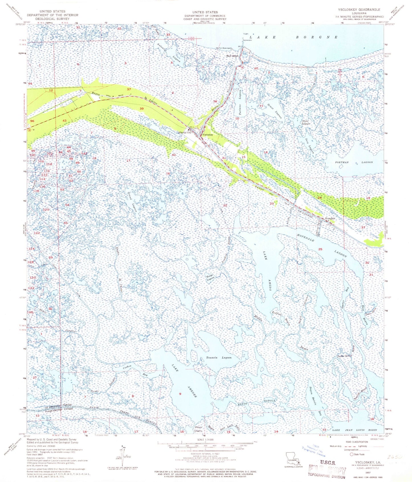
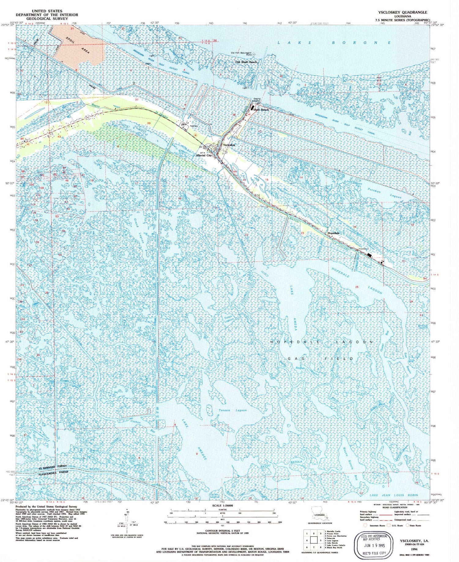
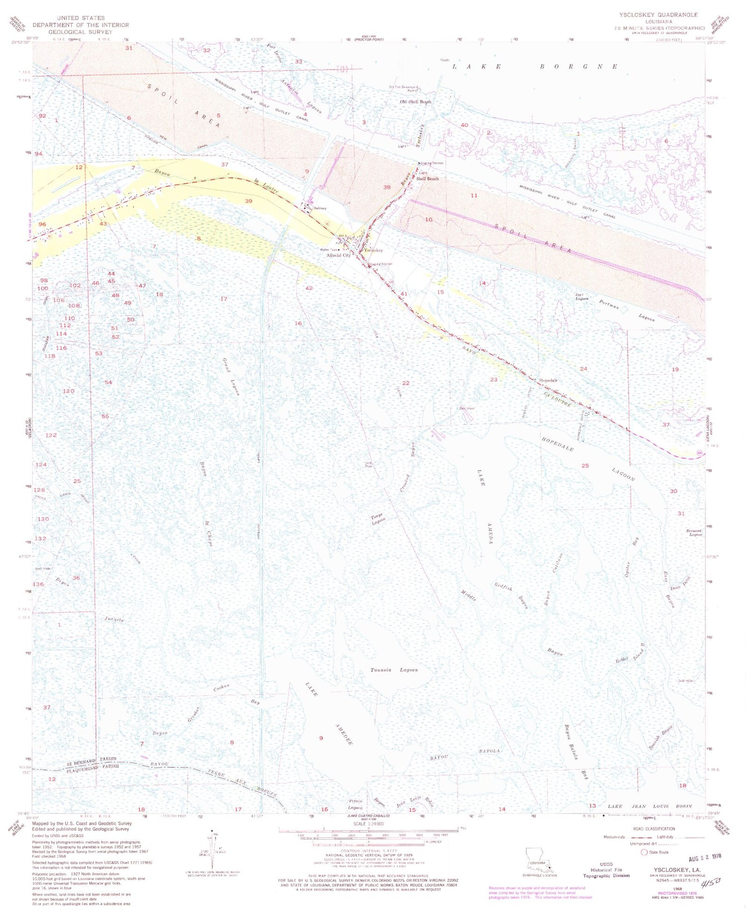
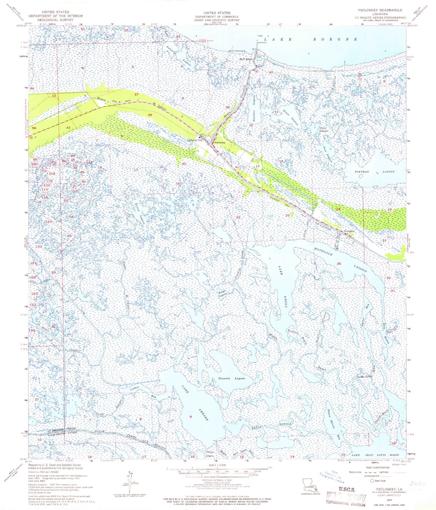
Classic USGS Yscloskey Louisiana 7.5'x7.5' Topo Map
Couldn't load pickup availability
Historical USGS topographic quad map of Yscloskey in the state of Louisiana. Map scale may vary for some years, but is generally around 1:24,000. Print size is approximately 24" x 27"
This quadrangle is in the following counties: Plaquemines, St. Bernard.
The map contains contour lines, roads, rivers, towns, and lakes. Printed on high-quality waterproof paper with UV fade-resistant inks, and shipped rolled.
Contains the following named places: Alluvial City, Antonios Lagoon, Bakers Ditch, Bayou Batola, Bayou Batola Bay, Bayou Catilano, Bayou Grosbec, Bayou Juanita, Bayou la Chape, Bayou Yscloskey, Cochon Bay, Crooked Bayou, Douluts Canal, Dows Ditch, East Bayou, Grand Lagoon, Grass Lagoon, Hopedale, Hopedale Canal, Hopedale Lagoon, Inez Lagoon, Lake Ameda, Middle Bayou, Nicks Lagoon, Old Shell Beach, Oyster Bay, Portman Lagoon, Rabbit Island Bayou, Redfish Bayou, Reggio Canal, Schooner Canal, Shell Beach, Spanish Bayou, Tanasia Lagoon, Tonys Lagoon, Turiano Lagoon, Yscloskey, ZIP Code: 70085