MyTopo
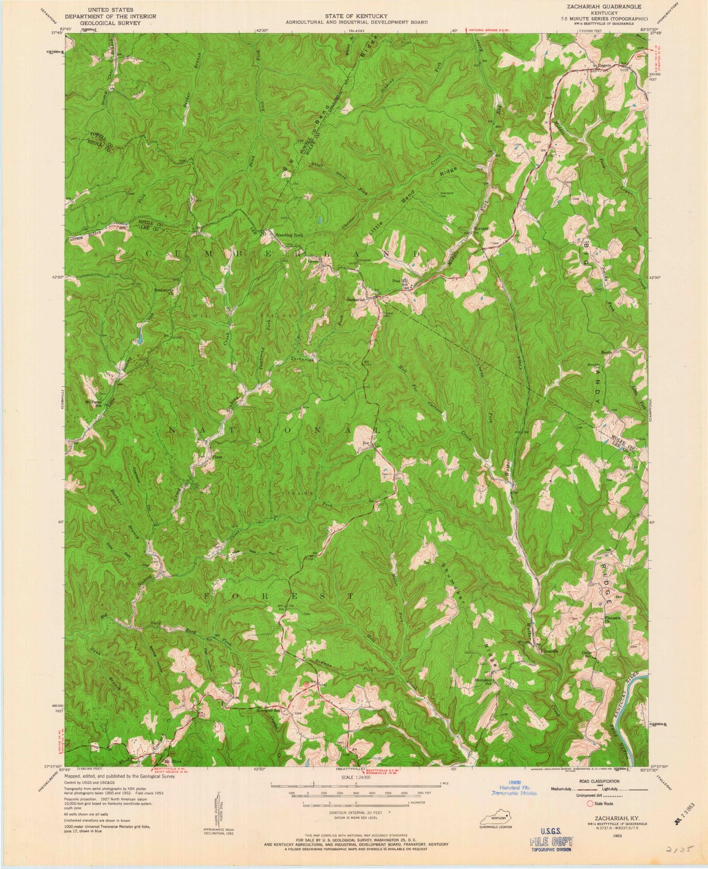
Classic USGS Zachariah Kentucky 7.5'x7.5' Topo Map
Couldn't load pickup availability
Historical USGS topographic quad map of Zachariah in the state of Kentucky. Typical map scale is 1:24,000, but may vary for certain years, if available. Print size: 24" x 27"
This quadrangle is in the following counties: Estill, Lee, Powell, Wolfe.
The map contains contour lines, roads, rivers, towns, and lakes. Printed on high-quality waterproof paper with UV fade-resistant inks, and shipped rolled.
Contains the following named places: Bald Rock Fork, Beech Stand Fork, Bethlehem Church, Big Andy Ridge, Big Bend Ridge, Boonesboro Fork, Booth, Bowman Fork, Buckner Branch, Caves Fork, Chester Creek, Coalbank Hollow, Cold Oak Hollow, Cowan Fork, Crow Drive Creek, Fincastle, Fincastle Church, Fixer, Huff Cave Branch, Hauk Branch, Hell for Certain Creek, Hog Gap Hollow, Hopewell Church, Leeco, Little Bend Ridge, Miller Fork, Moreland Hollow, Mount Paran School, Rogers, Shumaker Ridge, Sinking Fork, Spring Hollow, Standing Rock, Thacker Cemetery, Torrent, Townsend Cemetery, Townsend Fork, Whisman Cemetery, Zachariah, Zachariah Fork, Zoe, Flat Hollow, Beattyville Division, Rogers Elementary School, Booth Post Office (historical), El Park (historical), Naomi Baptist Church, Rogers Baptist Church, Rogers Post Office, Torrent Church of God, Torrent Creek, Torrent Post Office (historical), Zachariah Post Office (historical), Peddler Creek, Barker Branch (historical), Harris (historical), Tri - Community Fire Department, Zoe Post Office, Hopewell Church Cemetery