MyTopo
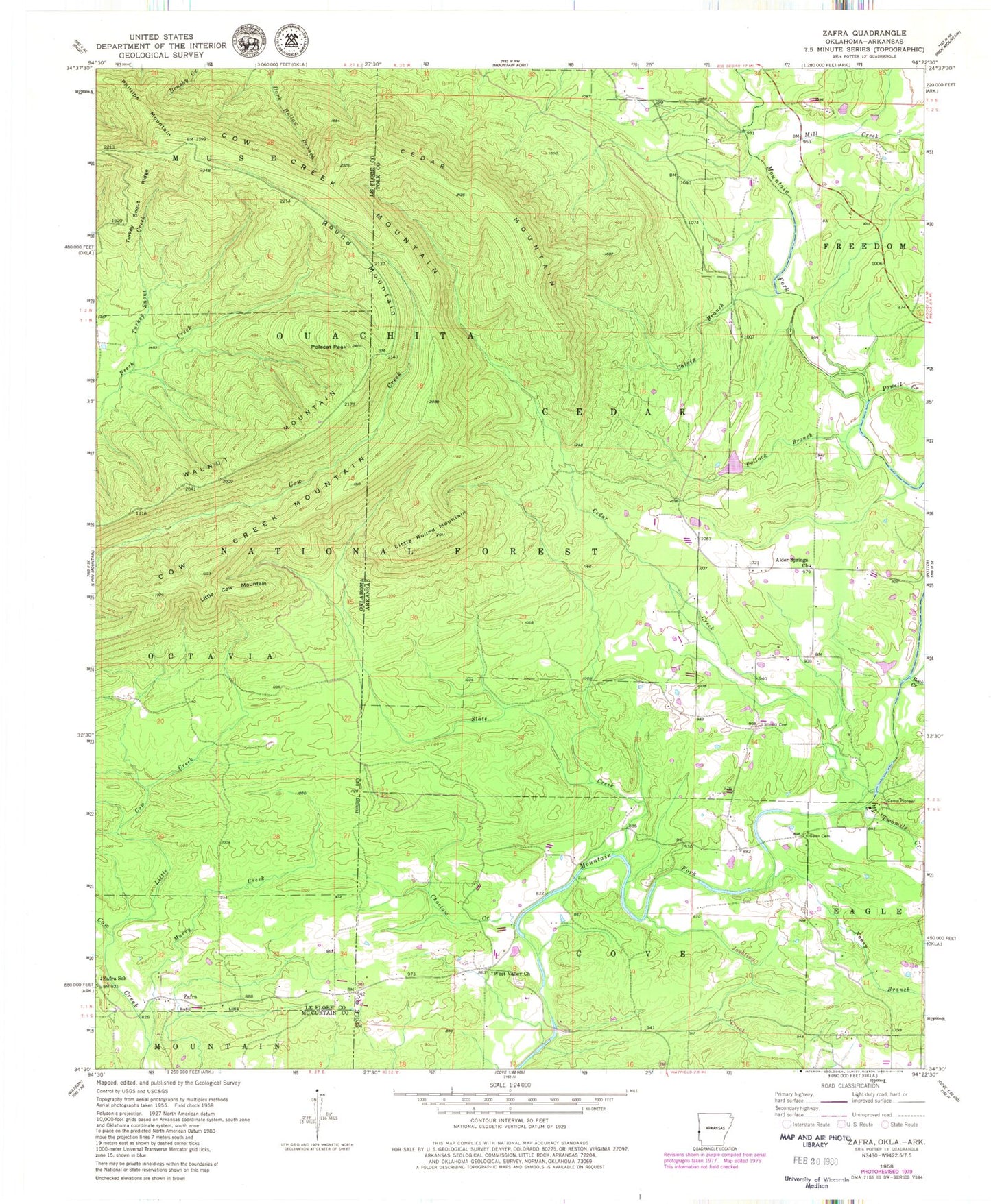
Classic USGS Zafra Oklahoma 7.5'x7.5' Topo Map
Couldn't load pickup availability
Historical USGS topographic quad map of Zafra in the states of Oklahoma, Arkansas. Map scale may vary for some years, but is generally around 1:24,000. Print size is approximately 24" x 27"
This quadrangle is in the following counties: Le Flore, McCurtain, Polk.
The map contains contour lines, roads, rivers, towns, and lakes. Printed on high-quality waterproof paper with UV fade-resistant inks, and shipped rolled.
Contains the following named places: Alder Springs Church, Calvin Branch, Camp Pioneer, Cedar Creek, Cedar Mountain, Choctaw Creek, Cow Creek Mountain, Gann Cemetery, Ivey Lake, Ivey Lake Dam, Joshling Creek, Little Cow Creek, Little Cow Mountain, Little Round Mountain, Mill Creek, Mountain Fork Bridge, Murry Creek, Nancy Branch, Phillips Mountain, Polecat Peak, Pollock Branch, Potter Fire Department Substation, Powell Creek, Queen Creek, Rock Creek, Round Mountain, Slate Creek, Stinett Cemetery, Township of Cedar, Turkey Snout Creek, Turkey Snout Ridge, Twomile Creek, Walnut Mountain, West Valley, West Valley Church, Zafra, Zafra School