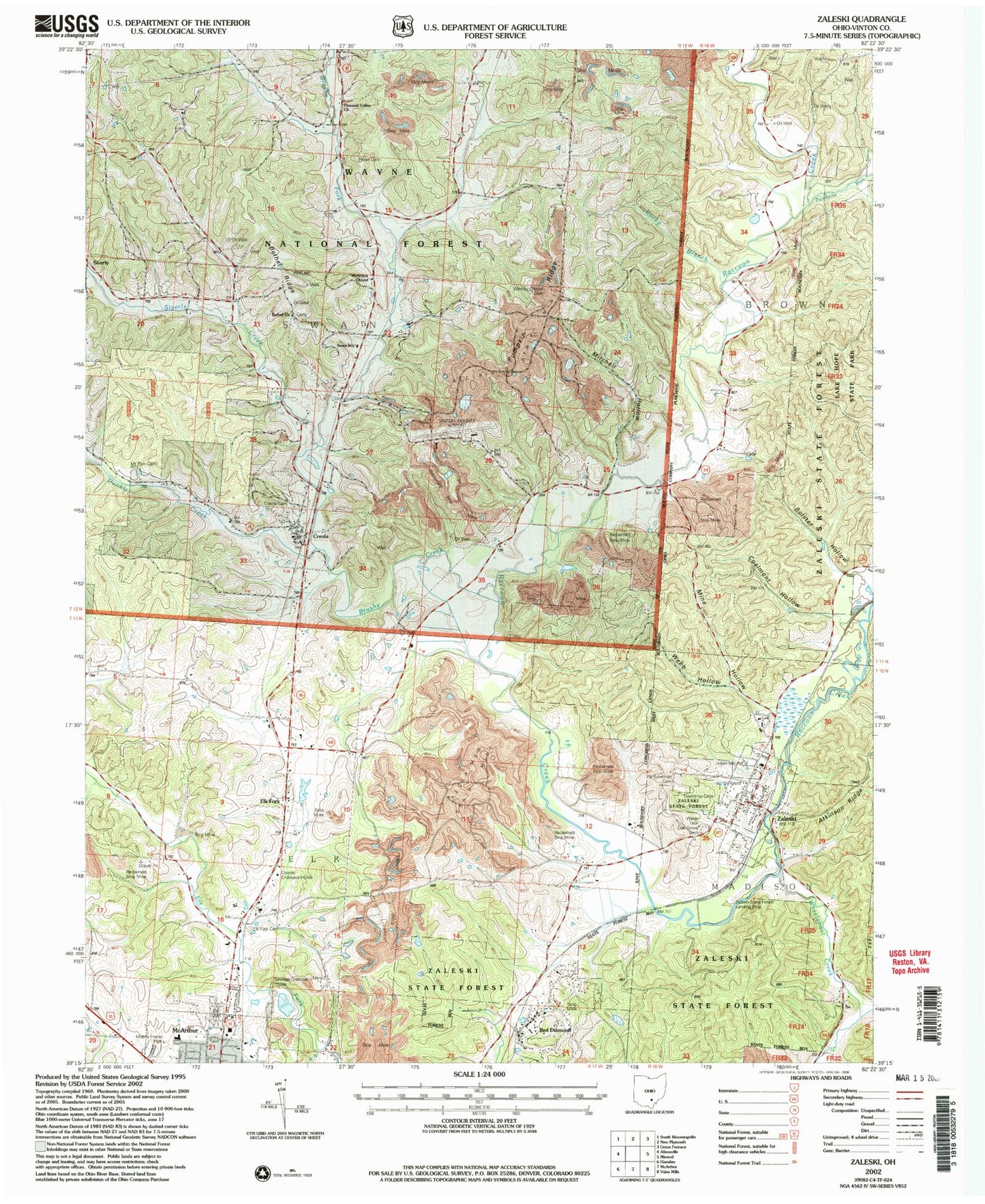
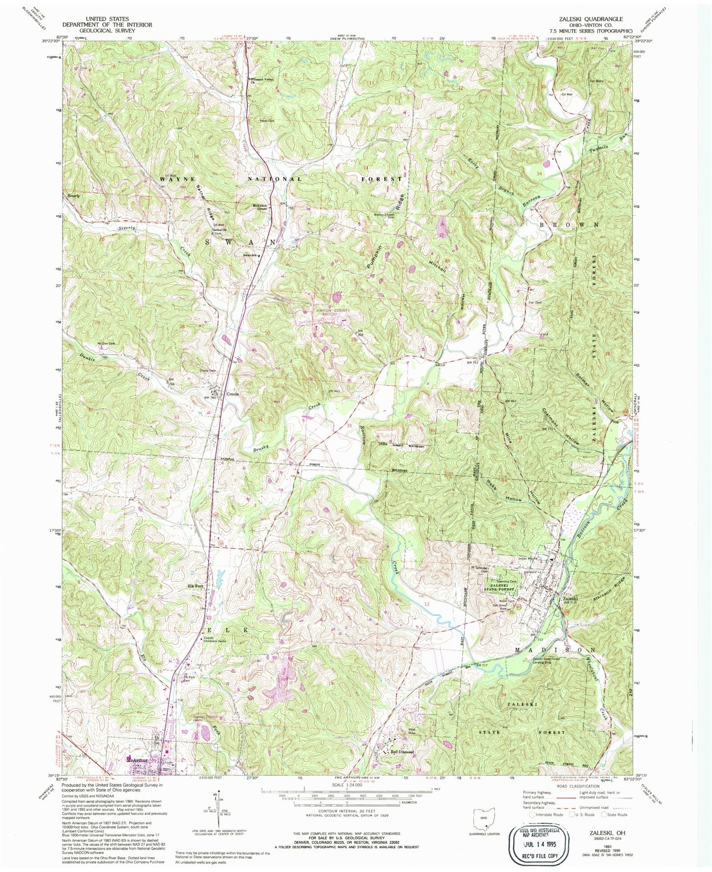
MyTopo
Classic USGS Zaleski Ohio 7.5'x7.5' Topo Map
Couldn't load pickup availability
Historical USGS topographic quad map of Zaleski in the state of Ohio. Typical map scale is 1:24,000, but may vary for certain years, if available. Print size: 24" x 27"
This quadrangle is in the following counties: Vinton.
The map contains contour lines, roads, rivers, towns, and lakes. Printed on high-quality waterproof paper with UV fade-resistant inks, and shipped rolled.
Contains the following named places: Cox Bridge, Zaleski Elementary School, The Pinnacle, Ural (historical), Vinton County, Bethel Church, Bethel Ridge, Bolster Hollow, Brushy Creek, Brushy Fork, Coalmont Hollow, Creola, Creola Cemetery, Dunkle Creek, Elk Cemetery, Elk Fork, Elk Fork Cemetery, Fee Cemetery, McArthur Chapel, Mine Hollow, Mount Zion Cemetery, Oak Grove Cemetery, Pleasant Valley Church, Pumpkin Ridge, Red Diamond, Rocky Branch, Saint Sylvester Cemetery, Siverly, Siverly Creek, Swan School, Twomile Run, Webb Hollow, Wesley Chapel Cemetery, Wheelabout Creek, Zaleski, Zaleski State Forest, Zaleski State Forest Landing Strip (historical), Vinton County Childrens Home, Prose Cemetery, Mitchell Hollow, Vinton County Airport, Township of Elk, Township of Madison, Township of Swan, Church of the Nazarene, Bethel Cemetery, Village of Zaleski, Zaleski Volunteer Fire Department, Vinton County Emergency Medical Services, Zaleski Post Office, Coyote Creek