MyTopo
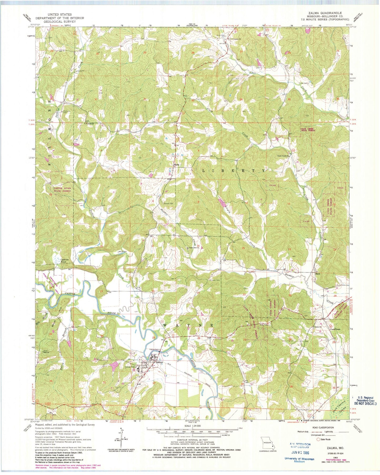
Classic USGS Zalma Missouri 7.5'x7.5' Topo Map
Couldn't load pickup availability
Historical USGS topographic quad map of Zalma in the state of Missouri. Map scale may vary for some years, but is generally around 1:24,000. Print size is approximately 24" x 27"
This quadrangle is in the following counties: Bollinger.
The map contains contour lines, roads, rivers, towns, and lakes. Printed on high-quality waterproof paper with UV fade-resistant inks, and shipped rolled.
Contains the following named places: Antioch Church, Balch Church, Barks Lake, Barks Lake Dam, Cane Creek Cemetery, Cane Creek School, Castor Bridge, Club Creek State Forest, Clubb Creek, Clubb Creek Church, Clubb Creek School, Crites Cemetery, Cypress Pond, Eaker School, Eakers Cemetery, Greenwood School, Hable Dam, Hahn, Hall Church, Hall School, James School, Ladd Chapel, Ladd School, Mitz Branch, Myers School, Patterson Cemetery, Patterson School, Perkins Creek, Point Pleasant Church, Sank, Sank State Wildlife Area, Sherman Lake Dam, Shoal Hill, Speer Cemetery, Sweetgum Public Access Area, Talley Branch, Taylor Bayless Dam, Union Hill Church, Village of Zalma, Virgin Creek, Virgin Creek Lake, White Cemetery, Wonder Lake - Field Visit 1979, Zalma, Zalma Census Designated Place, Zalma Rural Volunteer Fire Department