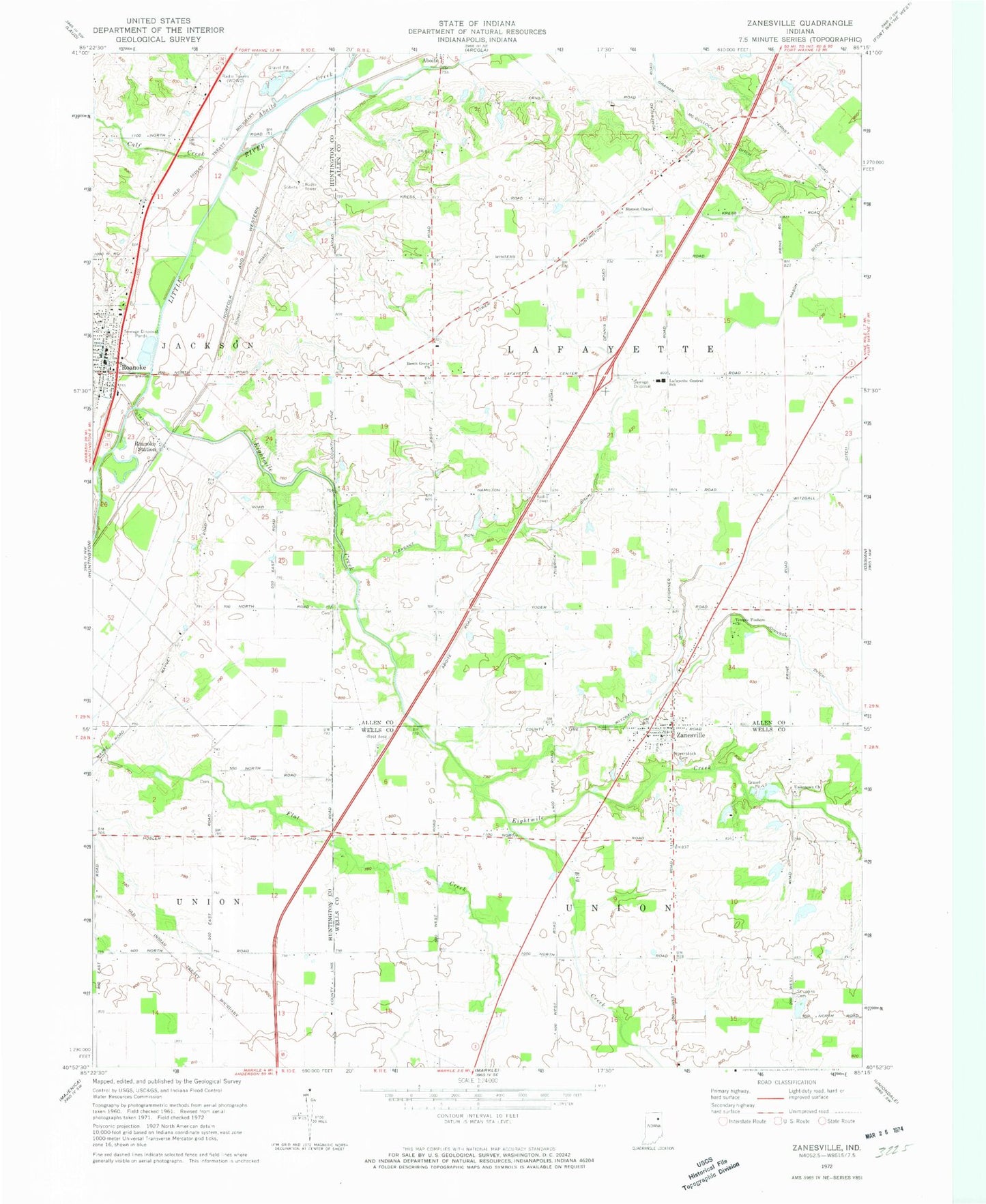
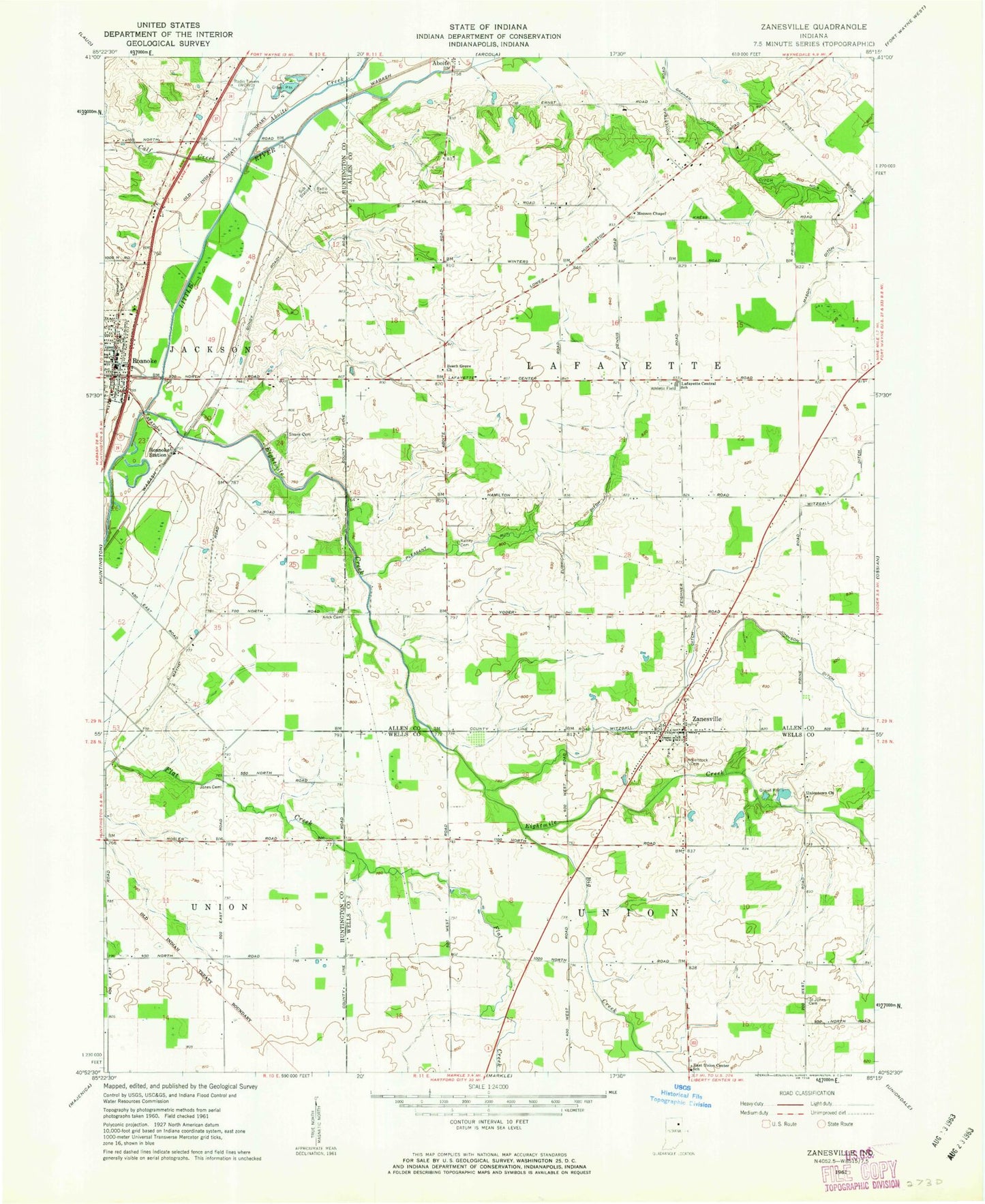
MyTopo
Classic USGS Zanesville Indiana 7.5'x7.5' Topo Map
Couldn't load pickup availability
Historical USGS topographic quad map of Zanesville in the state of Indiana. Map scale may vary for some years, but is generally around 1:24,000. Print size is approximately 24" x 27"
This quadrangle is in the following counties: Allen, Huntington, Wells.
The map contains contour lines, roads, rivers, towns, and lakes. Printed on high-quality waterproof paper with UV fade-resistant inks, and shipped rolled.
Contains the following named places: Aboite Creek, Beech Grove Church, Big Creek, Calf Creek, Cow Creek, Eightmile Creek, Fisher Farm Airport, Graham McCulloch Ditch Number Four, Hoverstock Cemetery, Lafayette Central School, Mason Ditch, McPherren Ditch, Monson Chapel, Parkview Hospital Emergency Medical Services, Pleasant Run Ditch, Roanoke, Roanoke Police Department, Roanoke Post Office, Roanoke Station, Roanoke Volunteer Fire Department, Saint Johns Cemetery, Temple Timbers Church, Town of Zanesville, Township of Lafayette, Uniontown Church, Witzgall Ditch, WOWD-AM (Fort Wayne), Zanesville, Zanesville Post Office, ZIP Codes: 46783, 46799