MyTopo
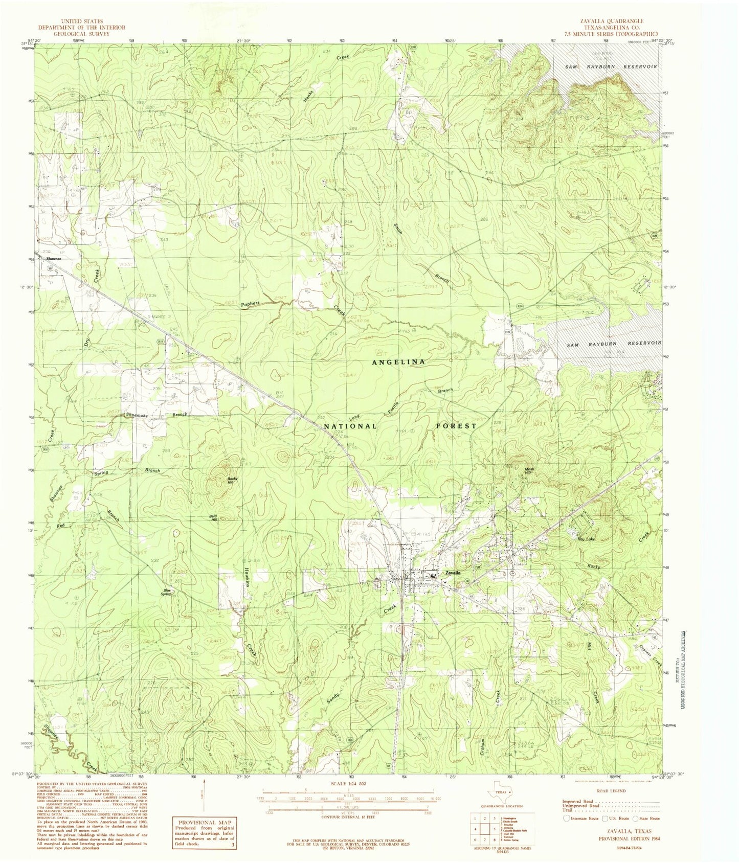
Classic USGS Zavalla Texas 7.5'x7.5' Topo Map
Couldn't load pickup availability
Historical USGS topographic quad map of Zavalla in the state of Texas. Map scale may vary for some years, but is generally around 1:24,000. Print size is approximately 24" x 27"
This quadrangle is in the following counties: Angelina.
The map contains contour lines, roads, rivers, towns, and lakes. Printed on high-quality waterproof paper with UV fade-resistant inks, and shipped rolled.
Contains the following named places: Bald Hill, Blue Spring, Boynton, City of Zavalla, Dry Creek, Hawkins Creek, Long Prairie Branch, McNeil Cemetery, McNiel Cemetery, Monterey, Moss Hill, Ozias Cemetery, Poland Cemetery, Polano Cemetery, Ray Lake, Ray Lake Dam, Rocky Hill, San Augustine Constable's Office Precinct 4, Shawnee, Shoemake Branch, Smith Branch, Spring Branch, Townsend Cemetery, Zavalla, Zavalla Forest Service Facility, Zavalla Police Department, Zavalla Post Office, Zavalla Volunteer Fire Department, ZIP Code: 75980