MyTopo
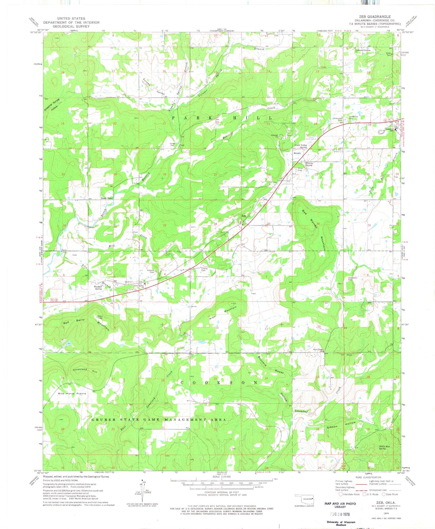
Classic USGS Zeb Oklahoma 7.5'x7.5' Topo Map
Couldn't load pickup availability
Historical USGS topographic quad map of Zeb in the state of Oklahoma. Map scale may vary for some years, but is generally around 1:24,000. Print size is approximately 24" x 27"
This quadrangle is in the following counties: Cherokee.
The map contains contour lines, roads, rivers, towns, and lakes. Printed on high-quality waterproof paper with UV fade-resistant inks, and shipped rolled.
Contains the following named places: Berch Hole, Black Valley Spring, Bob Warren Mountain, Bobtail Creek, Buzzard Roost Hollow, Chambers Cemetery, Crescent Valley Church, Crossland Hill, Eureka Spring Branch, Eureka Valley, Fire Branch, Gibson Hollow, Greenleaf Cemetery, Greenleaf Church, Gulager Spring Branch, Hendricks Cemetery, Holland Cemetery, Jones Cemetery, Lowrey Cemetery, Manard, Metory, Metory Spring, Mill Creek, Pentecostal Holiness Church, Price Cemetery, Red Berry Mountain, Rider Mountain, Sequoyah High School, South Cherokee Division, Steeley Cemetery, Stone Chapel School, White Man Spring, Wild Horse Prairie, Woodall, Woodall Census Designated Place, Woodall Fire Department Station 1, Woodall Fire Department Station 2, Woodall Public Schools, Woodall Spring, Zeb, Zeb Census Designated Place