MyTopo
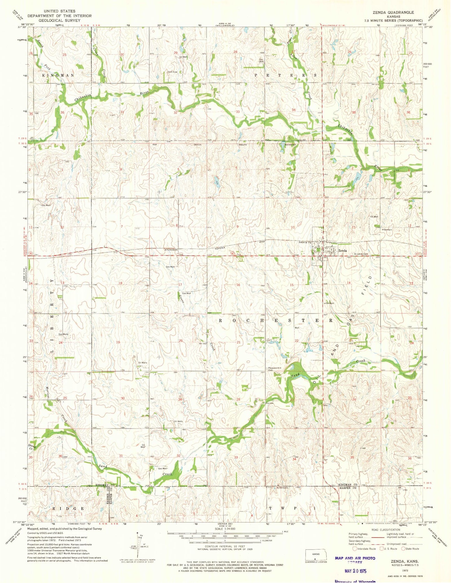
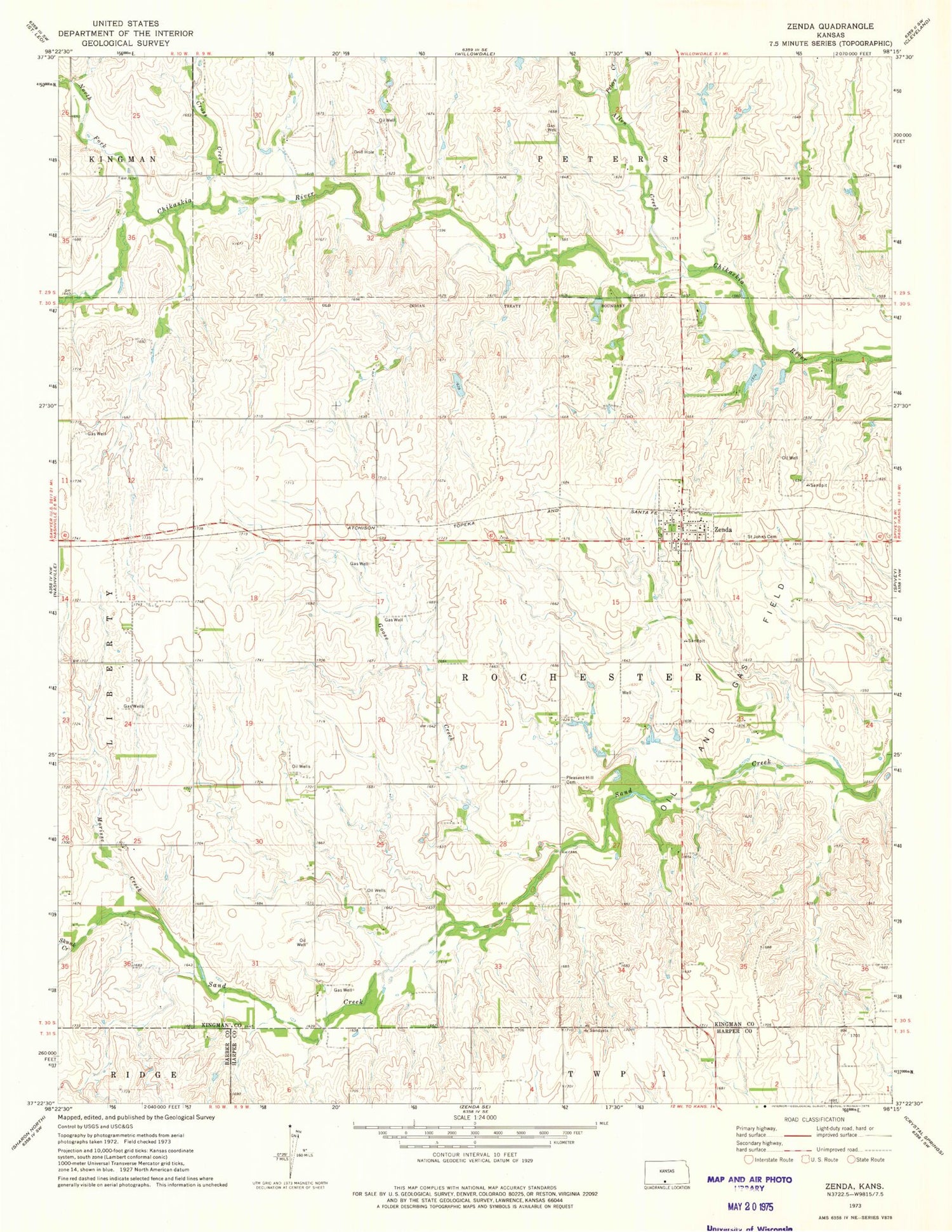
Classic USGS Zenda Kansas 7.5'x7.5' Topo Map
Couldn't load pickup availability
Historical USGS topographic quad map of Zenda in the state of Kansas. Map scale may vary for some years, but is generally around 1:24,000. Print size is approximately 24" x 27"
This quadrangle is in the following counties: Barber, Harper, Kingman.
The map contains contour lines, roads, rivers, towns, and lakes. Printed on high-quality waterproof paper with UV fade-resistant inks, and shipped rolled.
Contains the following named places: Allen Creek, Bross School, City of Zenda, Cross Creek, Goose Creek, Happy Hollow School, Kemp Creek, New Rochester, North Fork Chikaskia River, Peters Creek, Pleasant Hill Cemetery, Saint John's Catholic Church, Saint Johns Cemetery, Skunk Creek, Spring Creek School, Sunny View School, Township of Rochester, Westport, Zenda, Zenda Elementary School, Zenda Post Office, Zenda Public Library, Zenda Rural Fire Department, Zenda United Methodist Church, Zenda Wastewater Plant, ZIP Code: 67159