MyTopo
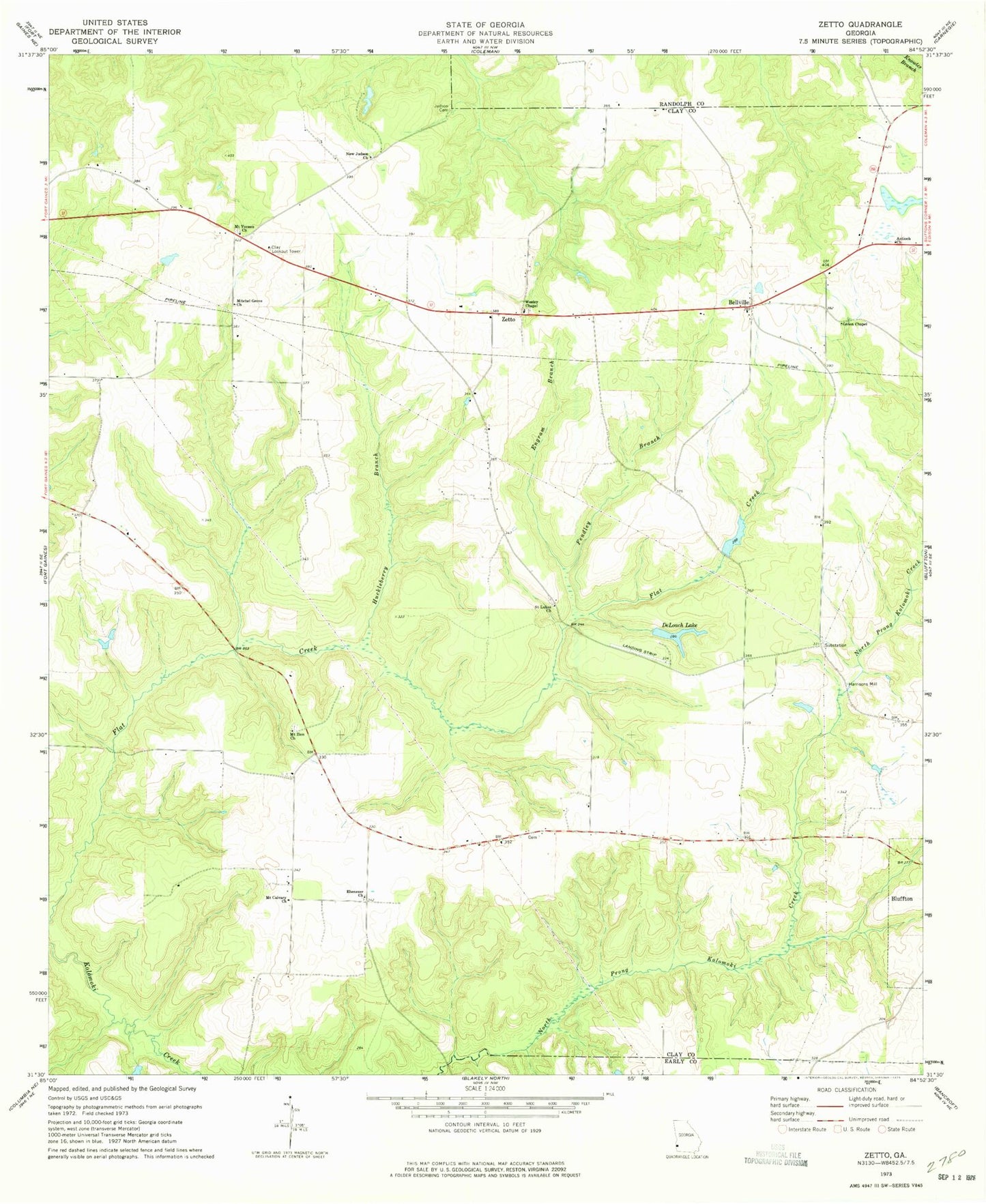
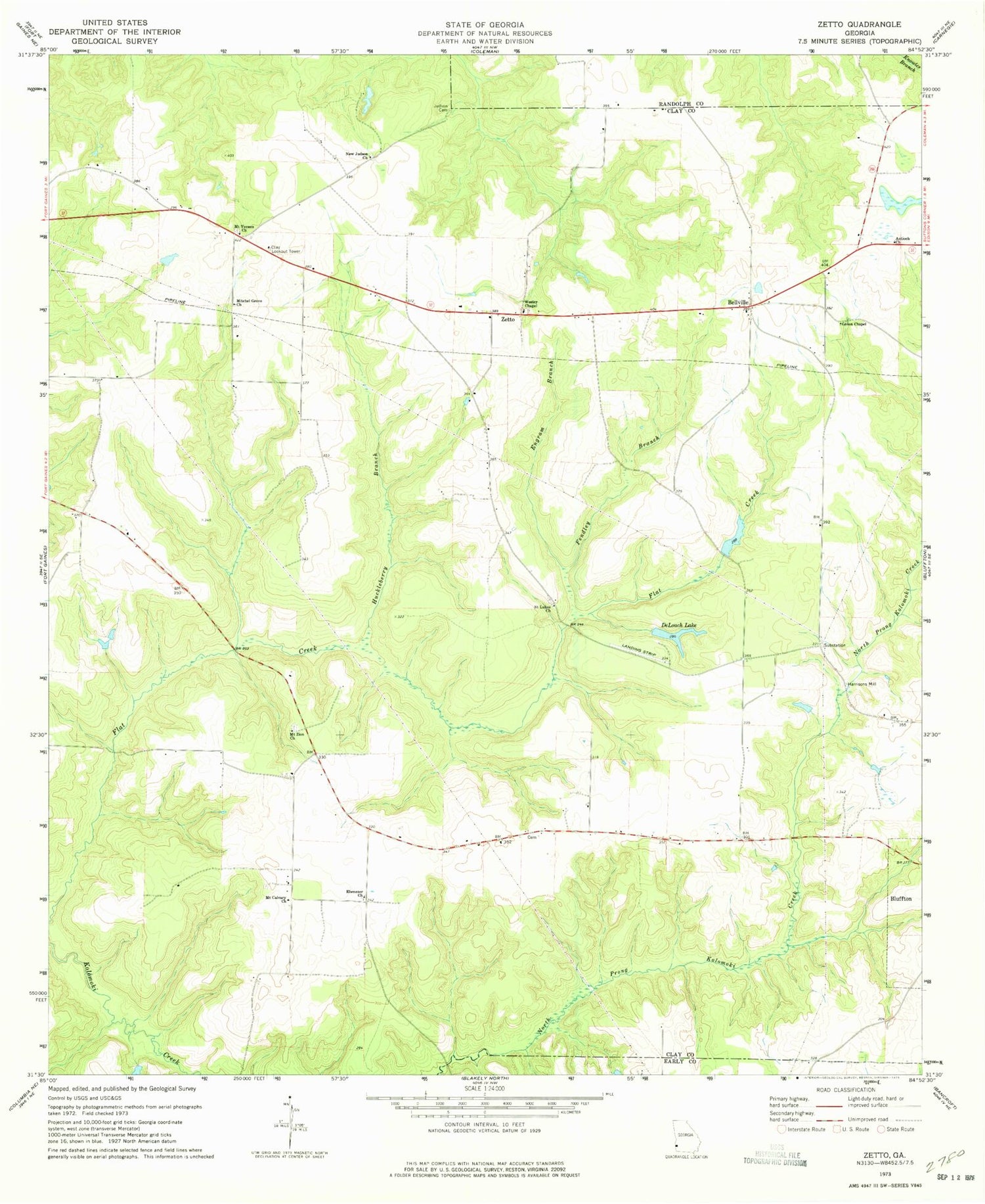
Classic USGS Zetto Georgia 7.5'x7.5' Topo Map
Couldn't load pickup availability
Historical USGS topographic quad map of Zetto in the state of Georgia. Map scale may vary for some years, but is generally around 1:24,000. Print size is approximately 24" x 27"
This quadrangle is in the following counties: Clay, Early, Randolph.
The map contains contour lines, roads, rivers, towns, and lakes. Printed on high-quality waterproof paper with UV fade-resistant inks, and shipped rolled.
Contains the following named places: Antioch Church, Bellville, Bluffton Division, Bryant - Neves Cemetery, Clay Lookout Tower, DeLoach Lake, Deloach Lake Dam, Ebenezer Church, Engram Branch, Fendley Branch, Fendley Lake, Fendley Lake Dam, Green Chapel, Harrisons Mill, Huckleberry Branch, Judson Cemetery, Mckemie Lake, Mckemie Lake Dam, Mckemie Lake North Dam, Mckenie Lake North, Mitchel Grove Church, Mount Calvary Church, Mount Vernon Church, Mount Vernon Church Cemetery, Mount Zion Cemetery, Mount Zion Church, New Judson Church, New Judson Church Cemetery, Saint Lukes Church, Wesley Chapel, Wesley Church Cemetery, Zetto, ZIP Code: 39851