MyTopo
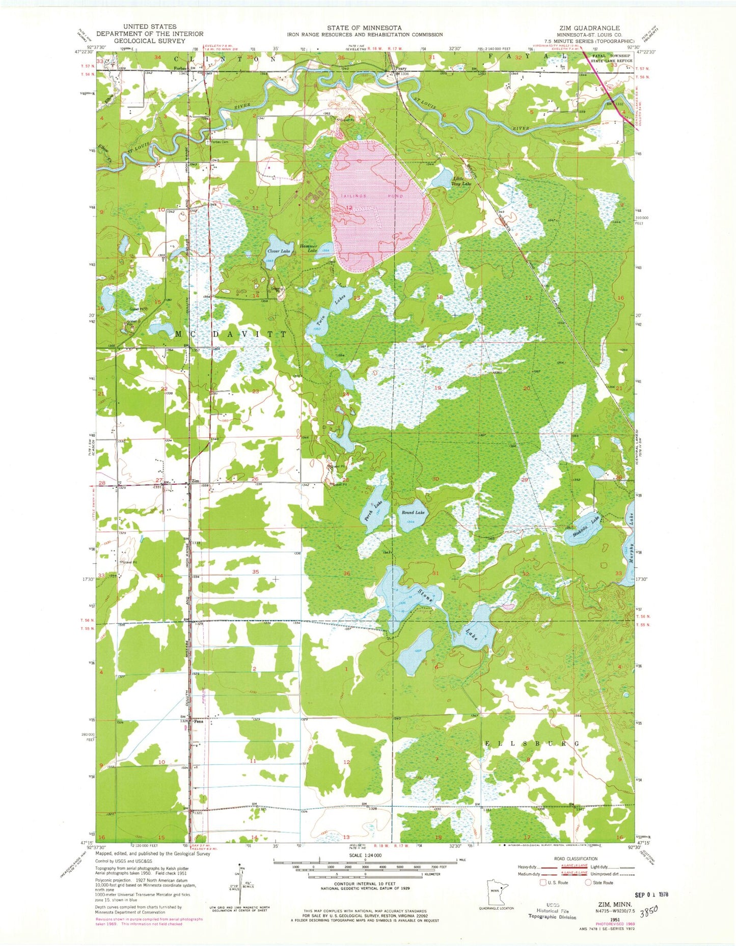
Classic USGS Zim Minnesota 7.5'x7.5' Topo Map
Couldn't load pickup availability
Historical USGS topographic quad map of Zim in the state of Minnesota. Map scale may vary for some years, but is generally around 1:24,000. Print size is approximately 24" x 27"
This quadrangle is in the following counties: St. Louis.
The map contains contour lines, roads, rivers, towns, and lakes. Printed on high-quality waterproof paper with UV fade-resistant inks, and shipped rolled.
Contains the following named places: Clover Lake, Elbow Creek, Eveleth Taconite Tailings Basin, Eveleth Taconite Tailings Dam, Fens, Forbes, Forbes Cemetery, Forbes Post Office, Forbes Station, Hammer Lake, Hiekkila Lake, Lion Springs Wayside Park, Little Tony Lake, Long Lake Creek, Peary, Perch Lake, Round Lake, Saint Louis River Dam, Stone Lake, Township of McDavitt, Twin Lakes, Zim, Zim Post Office, Zim Station