MyTopo
Classic USGS Zionville Tennessee 7.5'x7.5' Topo Map
Couldn't load pickup availability
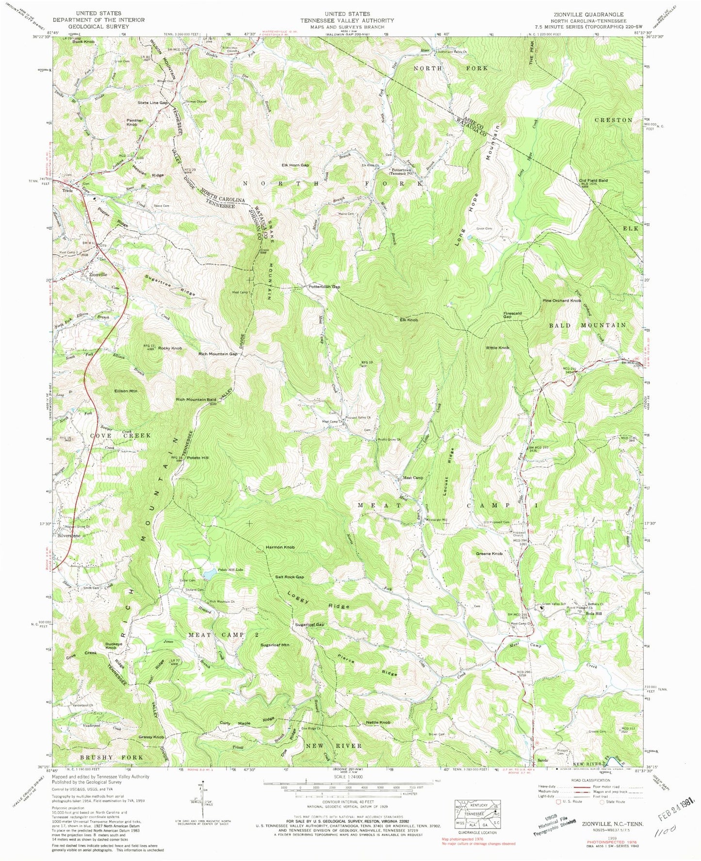
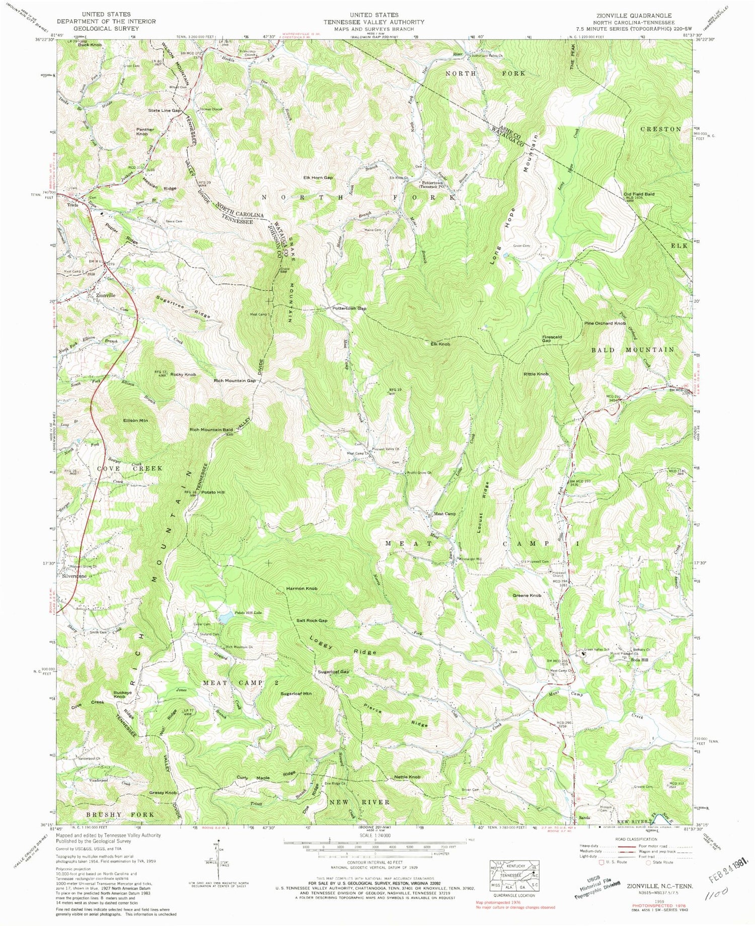
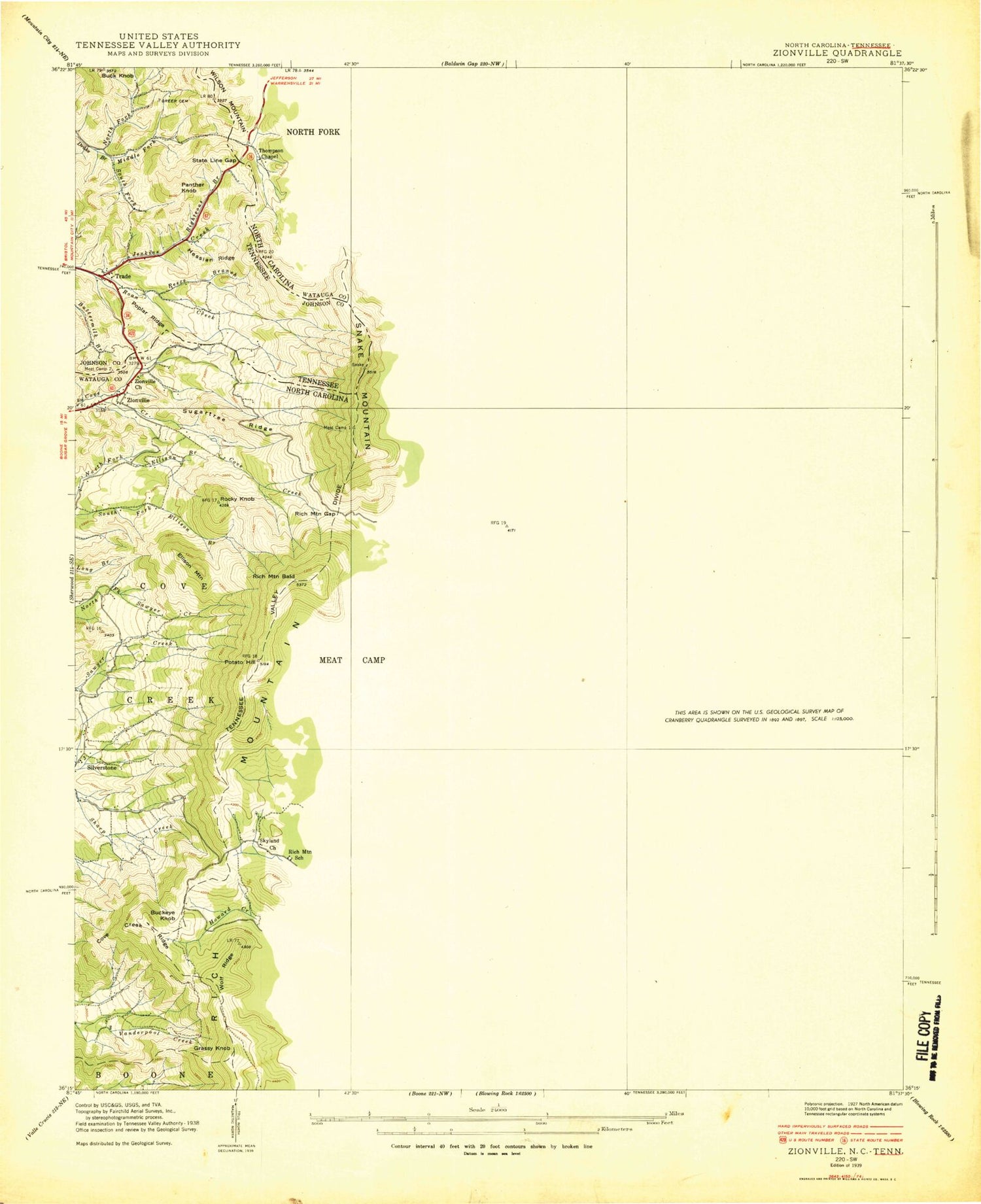
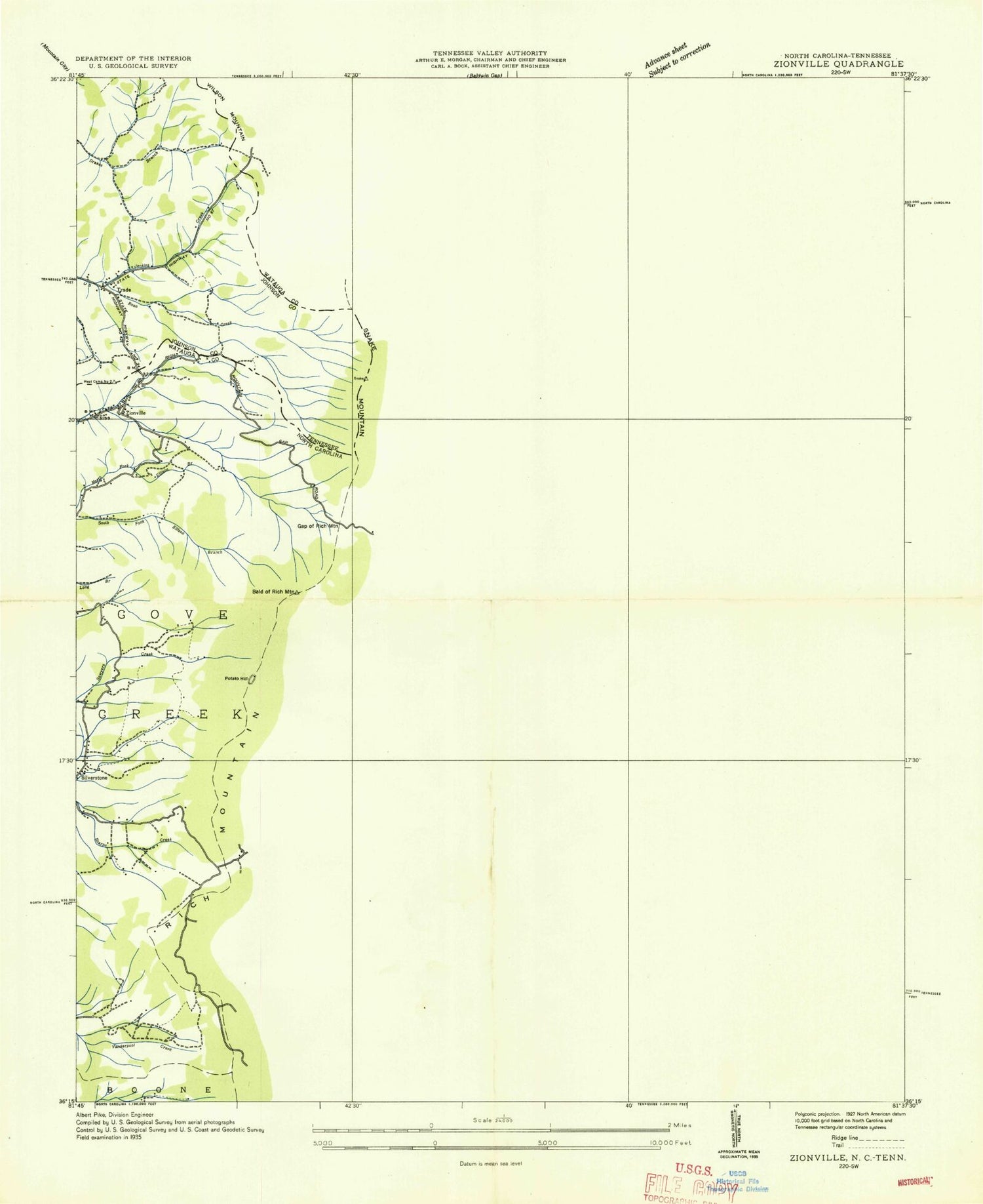
Historical USGS topographic quad map of Zionville in the states of Tennessee, North Carolina. Typical map scale is 1:24,000, but may vary for certain years, if available. Print size: 24" x 27"
This quadrangle is in the following counties: Ashe, Johnson, Watauga.
The map contains contour lines, roads, rivers, towns, and lakes. Printed on high-quality waterproof paper with UV fade-resistant inks, and shipped rolled.
Contains the following named places: South Fork Drake Branch, Trade, Buck Knob, Greer Cemetery, Hessian Ridge, Jenkins Creek, Middle Fork Drake Branch, North Fork Drake Branch, Panther Knob, Poplar Ridge, Reece Branch, Reece Family Cemetery, Trade Elementary School, Trade Post Office, Bethany Church, Brown Cemetery, Cove Creek Ridge, Culler Cemetery, Curly Mapel Ridge, Doe Branch, Doe Ridge Baptist Church, Elk Horn Gap, Elk Knob Baptist Church, Friendship Methodist Church, Greene Cemetery, Greer Cemetery, Hodges Cemetery, Hopewell Methodist Church, Jones Branch, Little Creek, Locust Ridge, Loggy Ridge, Maine Branch, Maine Cemetery, Meat Camp Baptist Church, Meat Camp Church, Mine Branch, Mount Pleasant Lutheran Church, Norris Fork, Old Field Bald, Old Hopewell Cemetery, Pierce Ridge, Pleasant Grove Baptist Church, Pleasant Valley Methodist Church, Pottertown Gap, Proffit Grove Baptist Church, Rich Mountain Baptist Church, Rocky Knob, Rush Branch, Salt Rock Gap, Skyland Cemetery, Smith Cemetery, Snyder Branch, South Branch North Fork New River, State Line Gap, Sugarloaf Gap, Sugartree Ridge, Sutherland Valley Church, Thomas Chapel, Vanderpool Church, Wilson Cemetery, Winebarger Mill, Wolf Ridge, Cobb Creek, Rich Mountain Bald, Rich Mountain Gap, Rittle Fork, McBrides Mill (historical), Norris (historical), Firescald Gap, Trivett Branch, Buckeye Knob, Elk Knob, Ellison Mountain, Grassy Knob, Greene Knob, Harmon Knob, Long Hope Mountain, Meat Camp, Nettle Knob, Pine Orchard Knob, Potato Hill Lake, Pottertown, Rich Mountain, Rittle Knob, Sands, Snake Mountain, Soda Hill, Sugarloaf Mountain, Zionville, Green Valley Elementary School, Township of Meat Camp, Township of North Fork, Mount Zion Church (historical), Pottertown School (historical), Rich Mountain School (historical), Thomas School (historical), Winebarger School (historical), Zionville Baptist Church, Elk Knob State Natural Area, Meat Camp Fire Department, Zionville Post Office, Potato Hill, South Fork Drake Branch, Trade, Buck Knob, Greer Cemetery, Hessian Ridge, Jenkins Creek, Middle Fork Drake Branch, North Fork Drake Branch, Panther Knob, Poplar Ridge, Reece Branch, Reece Family Cemetery, Trade Elementary School, Trade Post Office, Bethany Church, Brown Cemetery, Cove Creek Ridge, Culler Cemetery, Curly Mapel Ridge, Doe Branch, Doe Ridge Baptist Church, Elk Horn Gap, Elk Knob Baptist Church, Friendship Methodist Church, Greene Cemetery, Greer Cemetery, Hodges Cemetery, Hopewell Methodist Church, Jones Branch, Little Creek, Locust Ridge, Loggy Ridge, Maine Branch, Maine Cemetery, Meat Camp Baptist Church, Meat Camp Church, Mine Branch, Mount Pleasant Lutheran Church, Norris Fork, Old Field Bald, Old Hopewell Cemetery, Pierce Ridge, Pleasant Grove Baptist Church, Pleasant Valley Methodist Church, Pottertown Gap, Proffit Grove Baptist Church, Rich Mountain Baptist Church, Rocky Knob, Rush Branch, Salt Rock Gap, Skyland Cemetery, Smith Cemetery, Snyder Branch, South Branch North Fork New River, State Line Gap, Sugarloaf Gap, Sugartree Ridge, Sutherland Valley Church, Thomas Chapel, Vanderpool Church, Wilson Cemetery, Winebarger Mill, Wolf Ridge, Cobb Creek, Rich Mountain Bald, Rich Mountain Gap, Rittle Fork, McBrides Mill (historical), Norris (historical), Firescald Gap, Trivett Branch, Buckeye Knob, Elk Knob, Ellison Mountain, Grassy Knob, Greene Knob, Harmon Knob, Long Hope Mountain, Meat Camp, Nettle Knob, Pine Orchard Knob, Potato Hill Lake, Pottertown, Rich Mountain, Rittle Knob, Sands, Snake Mountain, Soda Hill, Sugarloaf Mountain, Zionville, Green Valley Elementary School, Township of Meat Camp, Township of North Fork, Mount Zion Church (historical), Pottertown School (historical), Rich Mountain School (historical), Thomas School (historical), Winebarger School (historical), Zionville Baptist Church, Elk Knob State Natural Area, Meat Camp Fire Department, Zionville Post Office, Potato Hill