MyTopo
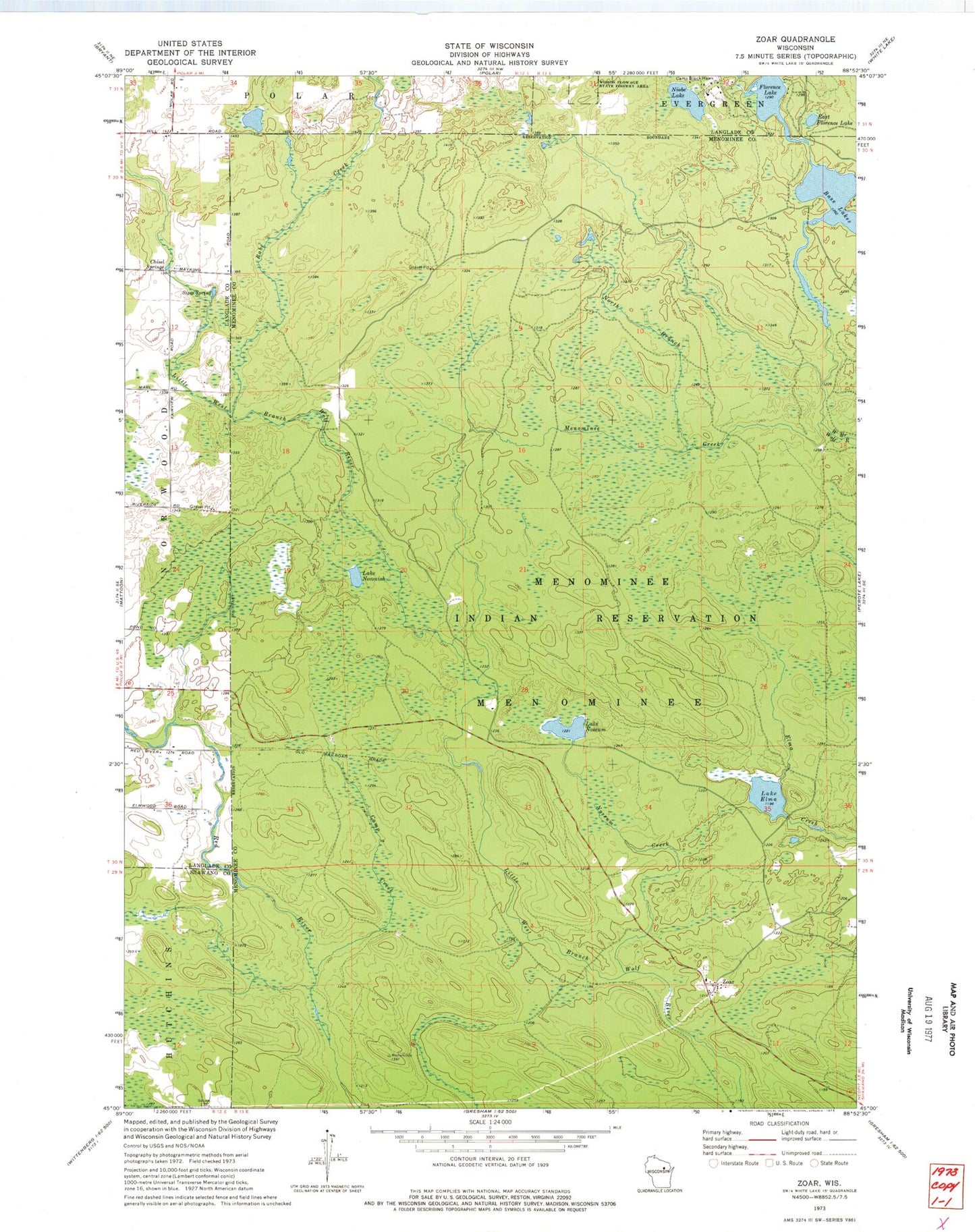
Classic USGS Zoar Wisconsin 7.5'x7.5' Topo Map
Couldn't load pickup availability
Historical USGS topographic quad map of Zoar in the state of Wisconsin. Map scale may vary for some years, but is generally around 1:24,000. Print size is approximately 24" x 27"
This quadrangle is in the following counties: Langlade, Menominee, Shawano.
The map contains contour lines, roads, rivers, towns, and lakes. Printed on high-quality waterproof paper with UV fade-resistant inks, and shipped rolled.
Contains the following named places: Bass Lakes, Camp Black Hawk, Camp Creek, Chisel Springs, Deer Creek, East Florence Lake, Florence Lake, Lake Dam, Lake Elma, Lake Neconish, Lake Noseum, Menominee Creek, Niobe Lake, North Branch Menominee Creek, Noseum Creek, Rabe Creek, Red River Camp, Red Springs, Sipes Creek, Sipes Spring, Upper Reservoir, Zoar, Zoar Census Designated Place