MyTopo
Classic USGS Zolfo Springs Florida 7.5'x7.5' Topo Map
Couldn't load pickup availability
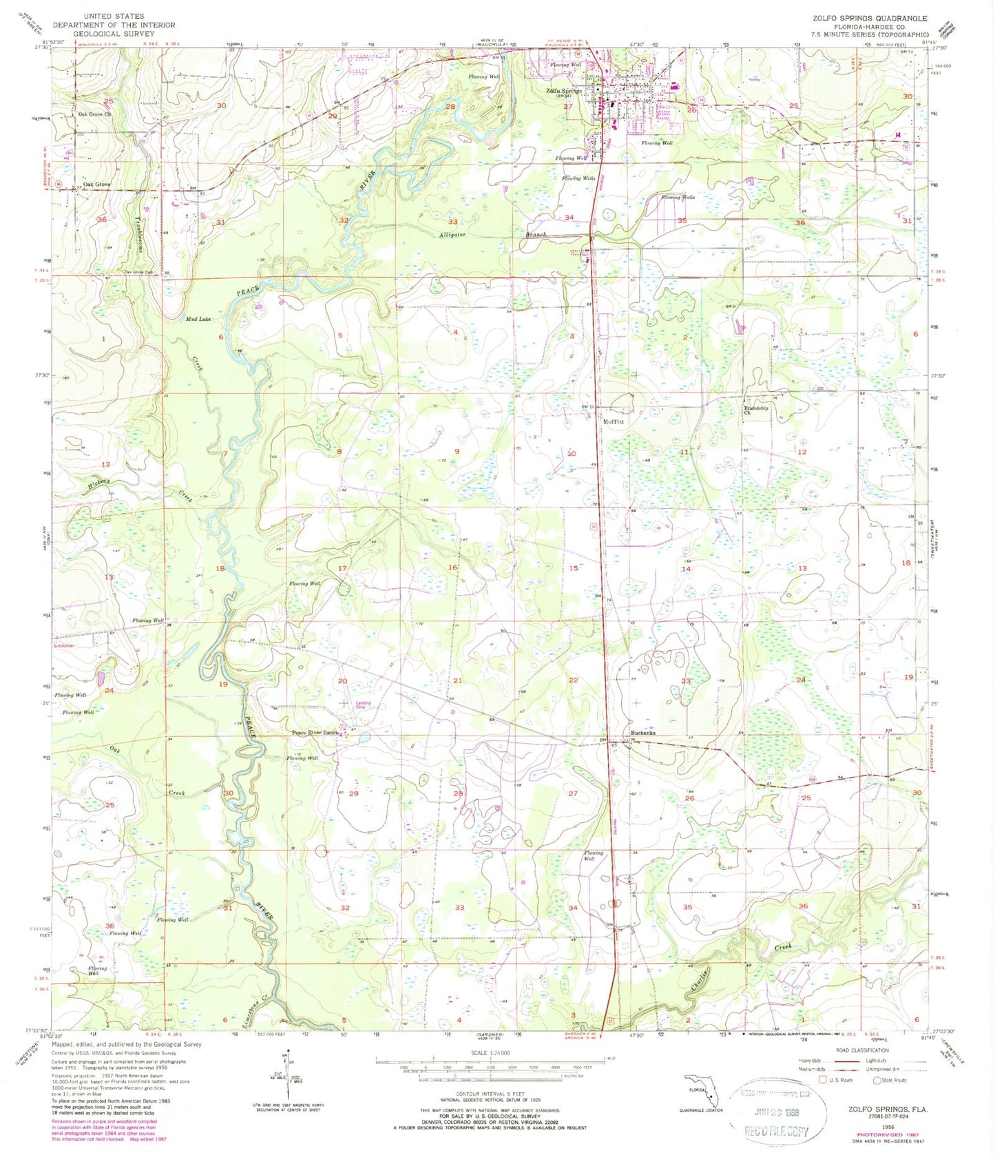
Historical USGS topographic quad map of Zolfo Springs in the state of Florida. Typical map scale is 1:24,000, but may vary for certain years, if available. Print size: 24" x 27"
This quadrangle is in the following counties: Hardee.
The map contains contour lines, roads, rivers, towns, and lakes. Printed on high-quality waterproof paper with UV fade-resistant inks, and shipped rolled.
Contains the following named places: Alligator Branch, Friendship Church, Hickory Creek, Limestone Creek, Mud Lake, Oak Creek, Oak Grove, Oak Grove Cemetery, Oak Grove Church, Peace River Ranch, Troublesome Creek, Zolfo Springs, Buchanan, Moffitt, Hardee County, Zolfo Springs Elementary School, Griffins Peace River Ranch Airport, Hardee County Fire Rescue Department Station 2, Zolfo Springs Police Department, Town of Zolfo Springs, Wekiva Golf Club, Sunshine Trailer Park, Wyndmoor Community Golf Course, Johnson Trailer Park, The Oasis at Zolfo Springs Mobile Home Park, Crossroads Community Church, First Baptist Church of Zolfo Springs, Hardee County Spanish United Methodist Church, Cantu Apiairies, Zolfo Springs Post Office