MyTopo
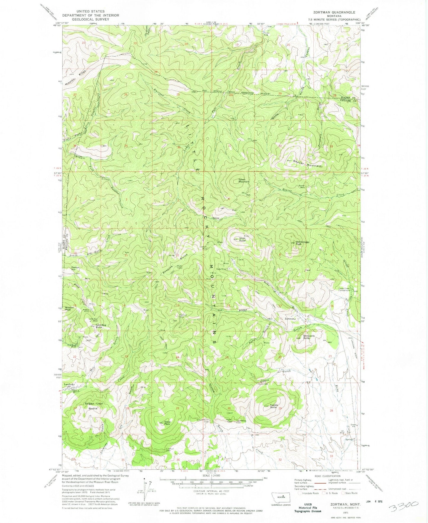
Classic USGS Zortman Montana 7.5'x7.5' Topo Map
Couldn't load pickup availability
Historical USGS topographic quad map of Zortman in the state of Montana. Typical map scale is 1:24,000, but may vary for certain years, if available. Print size: 24" x 27"
This quadrangle is in the following counties: Blaine, Phillips.
The map contains contour lines, roads, rivers, towns, and lakes. Printed on high-quality waterproof paper with UV fade-resistant inks, and shipped rolled.
Contains the following named places: Alder Gulch, Antoine Butte, August Mine, Beaver Mine, Beaver Mountain, Camp Creek Campground, Damon Hill, Emerson Creek, Gold Bug Butte, Gold Bug Mine, Goslin Gulch, Green Mountain, Hawkeye Mine, Landusky, Linda K Mine, Little Ben Mine, Middle Fork Little Peoples Creek, Mill Gulch, Mission Peak, Old Scraggy Peak, Pony Gulch, Porphyry Gulch, Ruby Gulch, Ruby Mine, Saddle Butte, Shell Butte, Silver Peak, Sugar Loaf Butte, Whitcomb Butte, Zortman, King Creek Tailings, Antoine Butte Mine, Damon Hill Mine, Ruby Gulch Tailings, Lucky Maud Number 2 Mine, Alder Gulch Mine, Alder Gulch Number 4 Mine, Alder Gulch Number 5 Mine, Upper Alder Gulch Mine, Pony Gulch Mine, Hawkeye Mine, Lucky Maud Mine, Dry Gulch Mine, Beaver Mine, Lodge Pole Limestone Mine, Hawkeye Millsite, Lower Hawkeye Mine, Antoine Butte Number 2 Mine, 26N25E20BBCC01 Spring, 26N25E20ABD_01 Well, Zortman Cemetery, Grace Chapel, Saint Joseph Church, Ruby Gulch School (historical), Little Ben School (historical), Zortman School, Landusky School, Landusky Post Office (historical), Ragtown (historical), Bowdoin (historical), Beaver Creek (historical), Zortman Post Office, Whitcomb (historical), Whitcomb Post Office (historical), Phillips County Fire Company Zortman Station, Zortman Census Designated Place, Zortman Airport, Landusky Census Designated Place