MyTopo
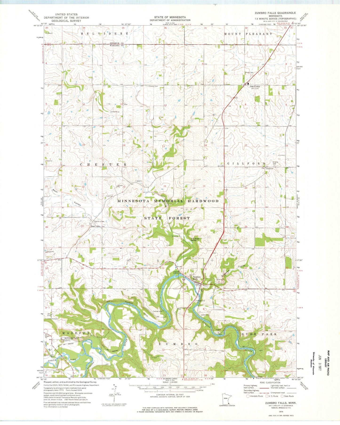
Classic USGS Zumbro Falls Minnesota 7.5'x7.5' Topo Map
Couldn't load pickup availability
Historical USGS topographic quad map of Zumbro Falls in the state of Minnesota. Map scale may vary for some years, but is generally around 1:24,000. Print size is approximately 24" x 27"
This quadrangle is in the following counties: Goodhue, Wabasha.
The map contains contour lines, roads, rivers, towns, and lakes. Printed on high-quality waterproof paper with UV fade-resistant inks, and shipped rolled.
Contains the following named places: Bear Valley, Bear Valley Cemetery, Bear Valley Post Office, Black Cemetery, Bluff Valley Campgrounds, Buckman Coulee, Chester Cemetery, City of Zumbro Falls, Cold Brook Spring, Cold Creek, English Cemetery, Lincoln Church, Mazeppa State Wildlife Management Area, North Fork Zumbro River, Oak Center, Oak Center Post Office, Saint John's Bear Valley Lutheran Church, Saint John's Lutheran Cemetery, Structure S-16A Dam, Township of Chester, Trinity Lutheran Cemetery, Trout Brook, Zumbro Community Church, Zumbro Falls, Zumbro Falls City Hall, Zumbro Falls Fire Department, Zumbro Falls Golf Club, Zumbro Falls Post Office, Zumbro Parkway Bridge, ZIP Code: 55991