MyTopo
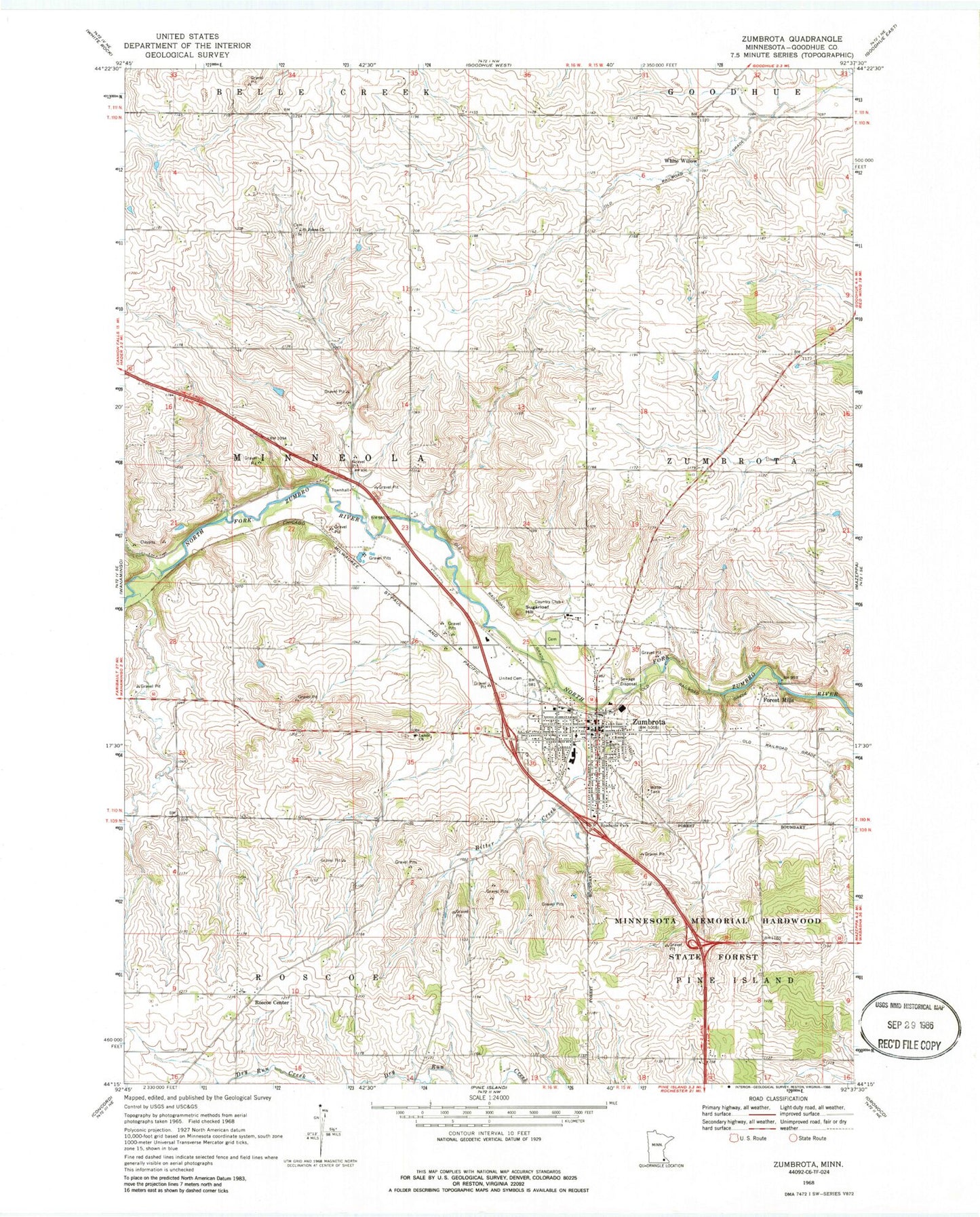
Classic USGS Zumbrota Minnesota 7.5'x7.5' Topo Map
Couldn't load pickup availability
Historical USGS topographic quad map of Zumbrota in the state of Minnesota. Map scale may vary for some years, but is generally around 1:24,000. Print size is approximately 24" x 27"
This quadrangle is in the following counties: Goodhue.
The map contains contour lines, roads, rivers, towns, and lakes. Printed on high-quality waterproof paper with UV fade-resistant inks, and shipped rolled.
Contains the following named places: Bitter Creek, Christ Lutheran Church, City of Zumbrota, Congregational Church, Covered Bridge, Erredge Group Detention Dam, Fairview Zumbrota Clinic, Forest Mills, Forest Mills Post Office, German Lutheran Cemetery, Joseph Frederich Dam, Land Norwegian Lutheran Cemetery, Lands Church, Lower 7 Group Structure Number 1 Dam, Lower 7 Group Structure Number 2 Dam, Minneola Township Pool Site 3 Dam, Our Saviour's Lutheran Church, Roscoe Center, Roscoe Center Post Office, Saint John's Cemetery, Saint Johns Church, Saint Paul's Catholic Church, Stordahl Norwegian Lutheran Cemetery, Sugarloaf Hill, Synod Cemetery, Thomforde Group Structure Number 1 Dam, Thomforde-Rockne Number 1 Dam, Thomforde-Rockne Number 2 Dam, Township of Minneola, United Cemetery, United Redeemer Lutheran Church, Wesleyan Church, White Willow, Whitewillow Post Office, Zumbrota, Zumbrota Cemetery, Zumbrota City Hall, Zumbrota Elementary School, Zumbrota Fire Department, Zumbrota Historical Marker, Zumbrota Hospital, Zumbrota Mazeppa High School, Zumbrota Nursing Home, Zumbrota Police Department, Zumbrota Post Office, Zumbrota Public Library, Zumbrota Wayside Park, ZIP Code: 55992