MyTopo
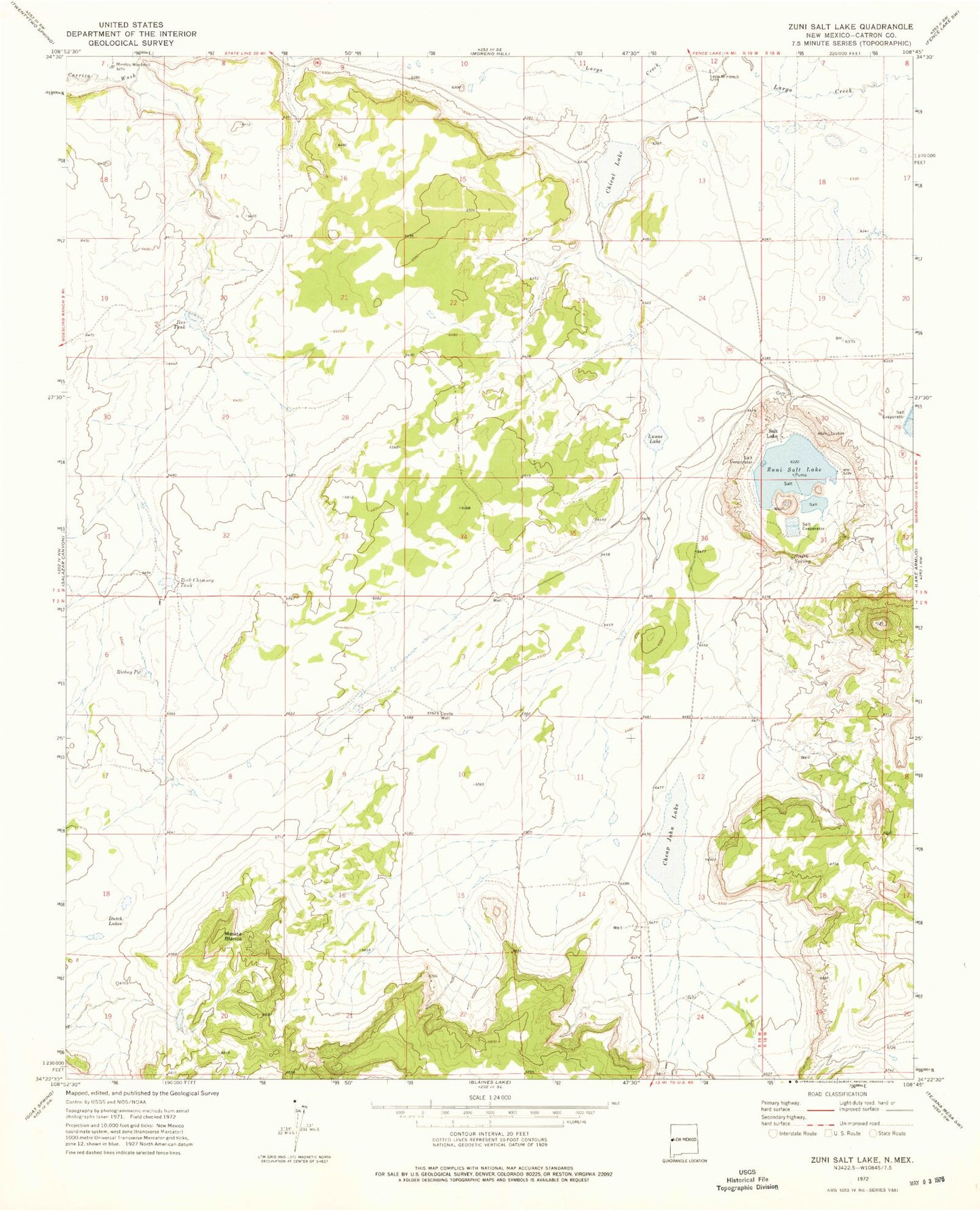
Classic USGS Zuni Salt Lake New Mexico 7.5'x7.5' Topo Map
Couldn't load pickup availability
Historical USGS topographic quad map of Zuni Salt Lake in the state of New Mexico. Map scale may vary for some years, but is generally around 1:24,000. Print size is approximately 24" x 27"
This quadrangle is in the following counties: Catron.
The map contains contour lines, roads, rivers, towns, and lakes. Printed on high-quality waterproof paper with UV fade-resistant inks, and shipped rolled.
Contains the following named places: Ahayu:t an Yalanne, Cheap John Lake, Chical Lake, Cottonwood Canyon, Davila Well, Dutch Lakes, Ikes Tank, Layton Number 3 Water Well, Layton Number 4 Water Well, Leon Windmill, Lunas Lake, Mesita Blanca, Mesita Blanca Wilderness Study Area, Mireles Windmill, Richey Pit, Rock Chimney Tank, Salt Lake, Salt Lake Post Office, Zuni Salt Lake, Zuni Salt Lake Mine