MyTopo
Idaho GMU 56 Map
Couldn't load pickup availability
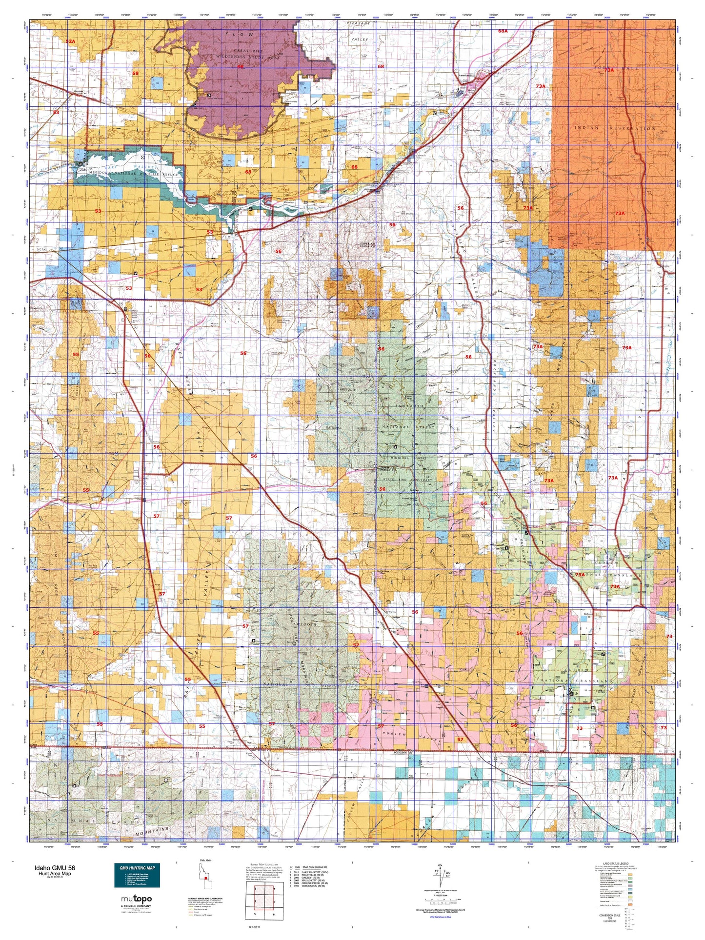
Hunting unit map of Idaho Game Management Unit 56 with topographic lines and unit boundaries. This topo map features UTM / MGRS and Latitude/Longitude grids, plus public land ownership. It comes folded on waterproof paper. Be fully prepared for your hunt with a MyTopo GMU map!.
This map contains the following named places: 83211,83243,83271,83323,83342,Albion Division,American Falls,American Falls Dam,American Falls Hatchery,Badger Peak,Bally Mountains,Bannock Canal,Bannock Peak,Barkdull Ranch,Barnes Creek,Beaver Island,Bench Ditch,Big Canyon,Big Siphon Wasteway,Birch Creek,Bird Island,Black Pine,Black Pine Cone,Black Pine Mountains,Black Pine Peak,Blind Spring Creek,Bonanza Bar,Bonanza Lake,Borah,Bowen Canyon,Bridge,Brigham Point,Broken Circle Ranch,Buck Peak,Buist,Burnt Basin,Calder Creek,Campbell Ranch,Cassia Creek,Cedar Creek,Cedar Creek Peak,Cedar Knoll,Cedar Ridge,Cedarhill,City of American Falls,City of Malta,City of Rockland,Clear Creek,Coe Creek,Cold Creek,Cold Water Camp,Colson Basin,Compressor Station Bench,Conant,Cotterel,Cotterel Mountains,Cottonwood Creek,Curlew Campground,Curlew Junction,Curlew National Grassland,Deep Creek Mountains,Deep Creek Peak,DeWoff,E 10.5 Lateral,E 3.0 Lateral,E 4.6 Lateral,E 7.1 Lateral,Eagle Point,Eagle Rock,Eagletail Rock,East Canal,East Fork Rock Creek,East Fork Sunbeam Creek,Eyrie Peak,Fall Creek,Fenstermaker Ranch,Flat Ridge,Fort Hall Division,Garden Ranch,Gifford Spring Wildlife Habitat Area,Goat Island,Grandine Ranger Station,Gunnell Guard Station,Hansen Ranch,Hartley Peak,Hawley,Hazel Pine Mine,Heglar,Holbrook,Holbrook Division,Holt Creek,Horse Butte,Horse Butte Wildlife Habitat Area,Hudspeth Cutoff Historical Marker,Hunt Party Historical Site,Idahome,Idahome Waterfowl Wildlife Habitat Areas,Idahome Wildlife Habitat Area,Indian Fork,Janies Nipples,Jensen Ranch,Jones Creek,Juniper,Kelso,Keogh,Keogh Creek,Lake Fork,Lake Fork Recreation Site,Lake Walcott,Lambert Ranch,Lamb-Weston Dam,Lateral R,Lateral S,Lazy F C Ranch,Little Creek,Little Table Mountain,Little Warm Creek,Lone Rock,Lookout Mountain,Lower West Ditch,Main East Canal,Main West Canal,Malta,Malta Wildlife Habitat Area North,Malta Wildlife Habitat Area South,Marys Mine Access Area,Massacre Rocks,Massacre Rocks Rest Area,Massacre Rocks State Park,Meadow Brook Creek,Meadow Creek,Minidoka Dam,Minidoka Forest State Bird Sanctuary,Minidoka National Wildlife Refuge,Mollys Nipple,Moonshine Peak,Morgans Waterhole,Naf,Neeley,Nelson,Nibbs Creek,North Chapin Mountain,North Fork Sublett Creek,Onemile Creek,Paps Mountain,Park View Shopping Center,Parks Creek,Pevo Ditch,Pine Creek,Pine Creek Reservoir,Pinnacle,Porcupine Creek,Porter Creek,Power County,Power County Fairgrounds,Quaking Asp Mountain,Quigley,Raft River,Rattlesnake Butte,Rattlesnake Creek,Red Rock Mountain,Register Rock,Register Rock State Picnic Ground,Rehn Ranch,Rice Creek,Right Fork Onemile Creek,Right Fork Starlight Creek,Rock Creek,Rockland,Rockland Division,Rose Ranch,Round Mountain,Round Mountain Creek,Roy,Roy Summit,Ruth Mine,Saddle Horse Basin,Salyer Cow Camp,Sawmill Creek,School Lateral,Seagull Bay,Sheep Creek,Sheep Mountain,Shirley Creek,Sikes Act Wildlife Habitat Area,Silver Hills Mine,Six-Mile Ranch,Sixmile Reservoir,Smith Springs,Snowville,South Chapin Mountain,South Fork Rock Creek,South Fork Sublett Creek,Spring Creek,Squaw Creek,Standrod,Starlight Creek,Station Fork,Stone,Stone Hills,Stone Reservoir,Strevell,Sublett,Sublett Creek,Sublett Dam,Sublett Forest Service Station,Sublett Range,Sublett Recreation Site,Sublett Reservoir,Sublett Reservoir Access Area,Sunbeam Creek,Sweeten Reservoir,Table Mountain,Tallman Mine,Tipton,Town of Snowville,Tule Island,U S Ditch,Upper Stump Canyon Reservoir,US Ditch,Van Camp Creek,W 1.7 Lateral,W 4.2 Lateral,Wapi,War Eagle Peak,Warm Creek,Warm Springs Creek,Webb Brothers Wildlife Habitat Area,West Canal,West Fork Sunbeam Creek,Western Home Ranch,Wheatgrass Bench,White Quartz Mountain,Yale Wildlife Habitat Area East,Yale Wildlife Habitat Area West


