MyTopo
Idaho GMU 6 Map
Couldn't load pickup availability
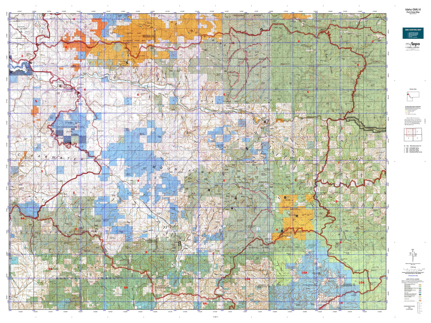
Hunting unit map of Idaho Game Management Unit 6 with topographic lines and unit boundaries. This topo map features UTM / MGRS and Latitude/Longitude grids, plus public land ownership. It comes folded on waterproof paper. Be fully prepared for your hunt with a MyTopo GMU map!.
This map contains the following named places: Abes Knob,Adams Creek,Agatha Creek,Al Vanderpool Picnic Area,Alder Creek,Ally Point,Ames Creek,Annis Creek,Anthony Creek,Anthony Peak,Avery Ranger Station,Baby Grand Mountain,Bald Mountain,Beals Butte,Beaver Creek,Beaver Mountain,Bechtel Butte,Bells Lake,Benewah County,Big Creek Cabin,Big Creek Campground,Billy Goat Hill,Blue Heaven Cabin,Bogus Point,Breezy Point,Bussel Peak,Calder,Calder Point,Calder Work Center,Camelback Mountain,Cameron Hill,Camp Forty,Camp Forty-Four,Camp Grizzly,Camp Three,Cardwell,Carpenter Mountain,Castle Rock,CCC Campground,Cedar Butte,Cedar Creek Campground,Cedar Grove,Cedar Lake,Cedar Mountain,Chat'u'washa'lqs Bluff,City of Saint Maries,Clarkia,Clarkia Peak,Clarkia Work Center,Coddington Peak,Cornwall Point,Coyote Butte,Crater Lake,Crater Peak,Crow Lake,Crystal Lake,Crystal Peak,Dago Creek,Daugherty Hill,Daveggio Knob,Dennis Knob,Donkey Recreation Site,Drive Point,Dunn Peak,East Elk Peak,Elsie Peak,Emerald Butte,Emerald Creek,Emerald Creek Campground,Emerald Creek Garnet Area,Emida,Emida Peak,Erlmo,Ethelton,Evergreen Mountain,Fernwood,Ferrel,Fish Lake,Fishhook Peak,Fitzgerald Peak,Flash Peak,Flat Creek,Flatiron Knobs,Flemming Point,Floodwood Camp,Floodwood State Forest,Flynn Butte,Foolhen Mountain,Freezeout Camp,Giant White Pine Recreation Site,Gibson Point,Goat Mountain,Goose Heaven Lake,Grandfather Mountain,Grandmother Mountain,Grange Park,Grassy Mountain,Green Mountain,Haunted Cabin,Herrick,Hill 36,Hnmlmulsh Grove,Hobo Botanical Area,Hobo Cedar Grove,Hobo Hill,Hollywood,Homestead Hump,Honey Jones Peak,Horsecamp,Hoyt,Hoyt Mountain,Huckleberry Flat Campground,Huckleberry Mountain,Hunters Peak,Jacksons Knob,Jims Spur,Keeler,Kings Peak,Laird Park,Lemonade Peak,Lemonade Peak Lookout,Lick Creek Point,Lindstrom Peak,Little Bald Mountain,Little Lost Lake,Little North Fork Campground,Little Sand Mountain,Long Hike Peak,Long Hike Rock,Lookout Mountain,Lost Lake,Lotus,Malamute Point,Marble Creek,Marble Creek Campground,Marble Mountain,Marcus Cook Peak,Marks Butte,Mashburn,Mastodon Mountain,Maternity Hill,Meadowhurst,Merry Creek Access Area,Milltown,Mix Cabin,Moon Peak,Muellers Camp,Mullen Trail Park Historical Monument,Nakarna Mountain,North South Ski Bowl,Omega,O'Neill Hill,Outlaw Point,Pearson Peak,Peterson Point,Pettis Peak,Pinchot Butte,Pocono,Pocono Hill,Pokey Creek,Porrett Lake,Preston Knob,Prince Peak,Prospect Mountain,Ramsdell,Reeds Baldy,Renfrew,Renfro Peak,Riverdale,Rochat Peak,Rocky Run Point,Round Top,Roundtop Guard Station,Roundtop Mountain,Roundtop Work Center,Rover,Saint Joe,Saint Joe Baldy,Saint Joe National Forest,Saint Joe Wild and Scenic River,Saint Maries,Saint Maries Country Club,Saint Maries Division,Saint Maries Peak,Saint Maries Ranger Station,Saint Maries River Access,Saint Maries River Access Area,Saint Maries Wildlife Management Area,Sand Mountain,Santa,Santa Peak,Shadowy Saint Joe Campground,Sharp Top,Shay Hill,Sheep Butte,Sherwin,Sherwin Point,Sherwin Station,Shoshone County,Slate Creek Cabin,Slate Creek Recreation Site,Slate Peak,Sly Meadows,Soldier Creek,Soloa Peak,Spooky Butte,Stanley Ranch,Stocking Meadow Lookout,Stony Butte,Storm Mountain,Sunset Mountain,Swan Lake,Swan Peak,Telephone Booth Hill,Theriault Lake,Three Tree Butte,Tram Creek,Trego Point,Trout Point,Ts'e'ltm Rock,Turtle Lake,Twodot Peak,Tyson Creek Station,Tyson Peak,Upper Fishook Research Natural Area,Urquhart Lake,Wayland,West Elk Peak,West Emerald,White Rock,Widow Mountain,Willow Peak,Wilson Creek,Wilson Mountain,Windy Peak


