MyTopo
Idaho GMU 60A Map
Couldn't load pickup availability
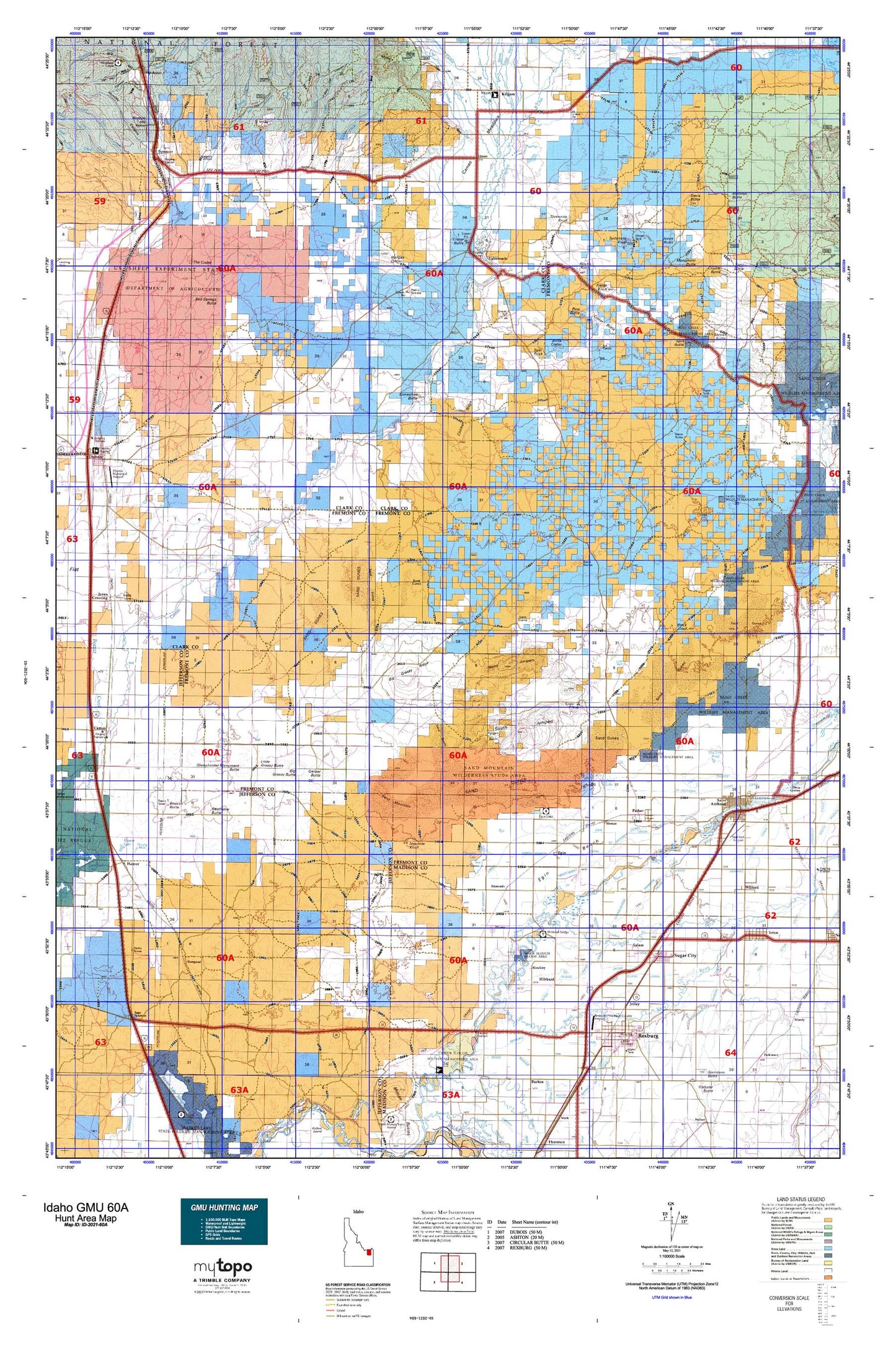
Hunting unit map of Idaho Game Management Unit 60A with topographic lines and unit boundaries. This topo map features UTM / MGRS and Latitude/Longitude grids, plus public land ownership. It comes folded on waterproof paper. Be fully prepared for your hunt with a MyTopo GMU map!.
This map contains the following named places: 83445,83448,Adams Elementary School,Aspen Butte,Austin,Beacon Butte,Beacon Hill,Bear Cat Canyon,Beaver Dick Cemetery,Bed Springs Butte,Bedstead Corner,Big Grassy Butte,Big Grassy Ridge,Big Island,Birdseye Butte,Bishop Burn Well,Black Knoll,Blacks Knoll,Blacks Well Number 2,Butte Crater,Camas Meadows,Central Elementary School,Chicken Ridge,China Point,Ching Creek,Cinder Butte,City of Parker,City of Rexburg,City of Saint Anthony,City of Spencer,City of Sugar City,City of Teton,Clements Spori Ditch,Consolidated Farmers Canal,Corral Creek,Crab Creek,Crater Butte,Crooked Creek,Crystal Butte,Davis Butte,Davis Lake,Davis Lake Number One,Davis Lake Number Three,Davis Lake Number Two,Dry Creek,East Camas Creek,East Clark Division,East Fork Rattlesnake Creek,East Threemile Creek,Edmonds,Egin,Egin Bench,Egin Canal,Egin Lakes,Eighteenmile,Farmers Friend Canal,Fogg Butte,Fogg Butte Well,Fort Henry Historic Monument,Freize Knoll,Fremont County EMS Saint Anthony Unit,Fremont County Sherrif Department,Gardner Lake,Gerber Butte,Hansen Basin,Hart,Hawgood,Heman,Hibbard,Hibbard Elementary School,Hinckley,Historic Monument Site of First Ferry,Hunting Well,Huntley Canyon,Idaho Industrial Training School,Idmon,Island Ward Canal,Jacoby Ranch,Jenkins Will,Jolley,Jones Butte,Judd Well,Juniper Buttes,Kennedy Elementary School,Kershaw Intermediate School,Kilgore,Kilgore Cemetery,KRXK-AM (Rexburg),Lincoln Elementary School,Little Ching Creek,Little Grassy Butte,Little Grassy Ridge,Little Island,Little Warm Creek,Mackerts Pond,Madison County Sheriff's Office,Madison Fire Department Station 1,Madison High School,Madison Junior High School,Madison Memorial Hospital,Middle Threemile Creek,Millward Slough,Monument Butte,Moody Creek,Moody School,Morgan Crater,New Kilgore Cemetery,Ninemile Knoll,North Branch Independent Canal,North Branch Wilford Canal,North Fork Bridge,North Junipers,Old Beaver,Opal Mountain,Parker,Parker Cemetery,Parker Post Office,Parker-Egin Elementary School,Pincock Byington Canal,Pincock Garner Ditch,Pine Butte,Pioneer Ditch,Plano,Plano Cemetery,Pyke,Quayles Lake,Rattlesnake Creek,Raumaker Butte,Rexburg,Rexburg Canal,Rexburg Cemetery,Rexburg Police Department,Rexburg Post Office,Rexburg-Madison County Airport,Ricks College,Rigby Hospital,Riverview Cemetery,Sage Junction,Saint Anthony,Saint Anthony and Independent Canal,Saint Anthony Canal,Saint Anthony Division,Saint Anthony Police Department,Saint Anthony Post Office,Saint Anthony Union Canal,Salem,Salem Canal,Salem Union Canal,Sand Mountain,Sandy Butte Well,Satellite Center Preschool,Saw Creek,Service Butte,Sheepherder Monument Butte,Shotgun Well,Snowshoe Butte,South Branch Wilford Canal,South Fremont High School,South Fremont Junior High School,South Fremont Rural Fire Station,South Junipers,South Teton River,Spencer,Split Butte,Split Rock,Spring Creek,Stanford Field,Stewart Ditch,Sugar - Salem High School,Sugar City,Sugar City Cemetery,Sugar City Division,Sugar City Post Office,Sugar-Salem Junior High School,Sweat Springs,Teton,Teton Canal,Teton Cemetery,Teton Island Canal,Teton Post Office,Teton River,Teton School,The Crater,Thomas Draw,Threemile Creek,Threemile Knoll,Threemile Reservoir,Twin Groves Canal,Twitchells Knoll,United States Sheep Experiment Station,Warm Creek,Warm Slough,Warm Slough Access Area,Washington Elementary School,West Butte,West Camas Creek,West Fork Rattlesnake Creek,West Threemile Creek,Westfield Branch Canal,Wilford,Woodmansee Johnson Canal


