MyTopo
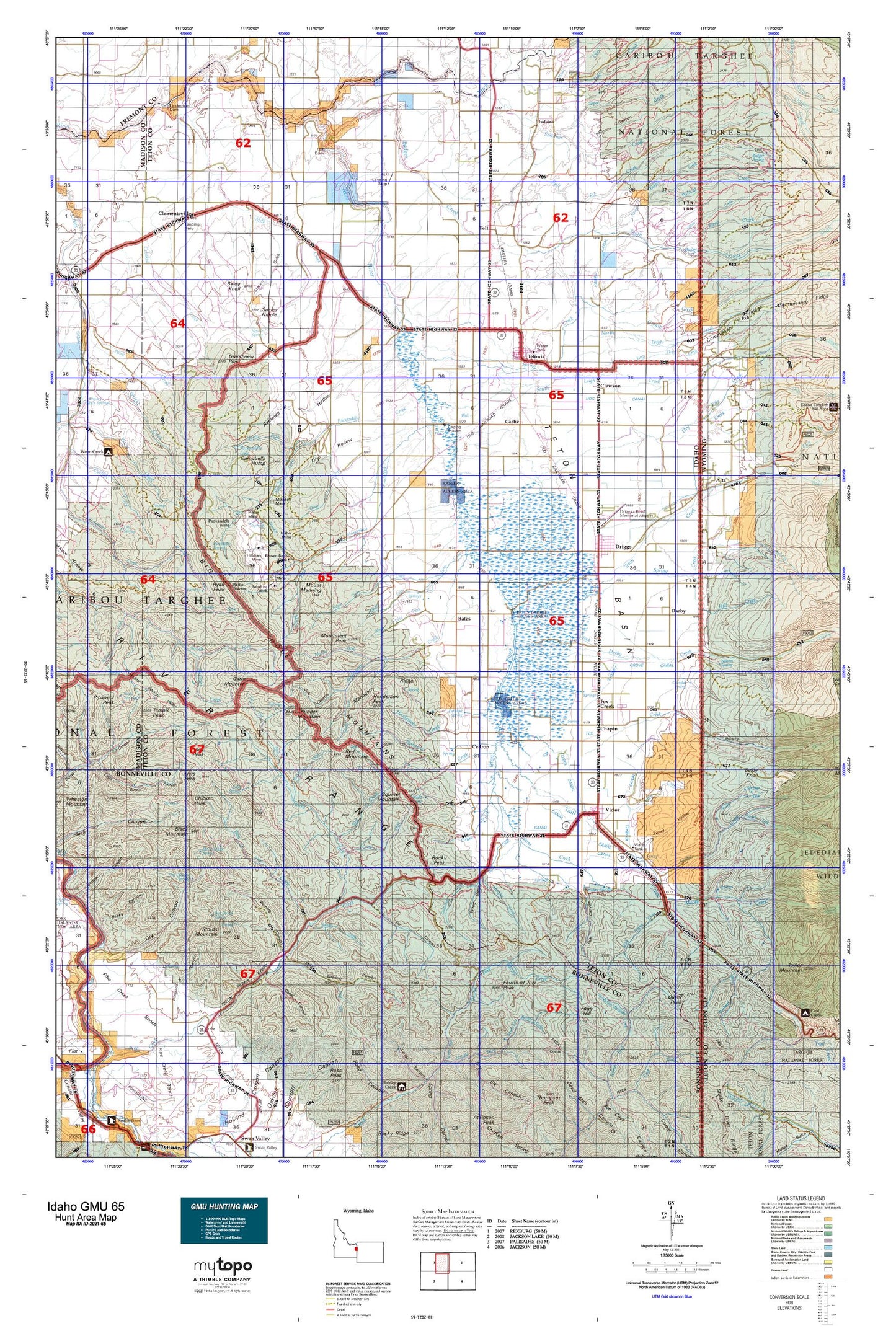
Idaho GMU 65 Map
Couldn't load pickup availability
Hunting unit map of Idaho Game Management Unit 65 with topographic lines and unit boundaries. This topo map features UTM / MGRS and Latitude/Longitude grids, plus public land ownership. It comes folded on waterproof paper. Be fully prepared for your hunt with a MyTopo GMU map!.
This map contains the following named places: 83422,83424,83452,83455,Allen Canyon,Allen Creek,Alligator Lake,Alta,Badger Creek,Badger Creek Access Area,Baldy Knoll,Bates,Bell Creek,Big Bend,Big Hole Mountains,Bitch Creek,Black Grove,Blacktail Creek,Blanchard Ridge,Blind Canyon,Blind Creek,Boquet Creek,Boquet Ridge,Brown Bear Creek,Brown Bear Mine,Bull Elk Creek,Burbank Creek,Burnt Canyon,Bustle Creek,Buttermilk Draw,Cache,Canal Canyon,Castle Lake,Castle Rock,Cave Canyon,Cedron,Center Basin,Center Canal,Chapin,Cherry Grove Canal,Chicken Creek,Chicken Peak,City of Driggs,City of Tetonia,City of Victor,Clawson,Clementsville,Coalmine Fork,Corral Creek,Coyote Canyon,Crystal Lake,Darby,Darby Creek,De Coster Trail,Deadwood Creek,DeCoster Trail,Diamond X Canyon,Dick Creek,Drake Creek,Driggs,Driggs Division,Dry Creek,Dry Fork,Dry Hollow,Dude Creek,Edison and Ricks Canal,Elbow Fork,Elk Flat Fork,Elliott Creek,Felt,Felt Dam,Fish Creek,Fleming Canyon,Flume Canyon,Fogg Hill,Foster Slough,Fourth of July Peak,Fox Creek,Fox Creek East Access Area,Fox Creek West Access Area,Game Creek,Garns Mountain,Gopher Canyon,Gopher Creek,Government Fork,Grand Teton Canal,Grandview Point,Grouse Creek,Grove Creek,Haden,Haden Canal,Henderson Creek,Henderson Peak,Hill Creek,Hillman Creek,Hillman Mine,Hog Canal,Holter Creek,Horse Creek,Horse Heaven,Horseshoe Creek,Hovermale Ridge,Humble Canal,Hungry Creek,Hunts Corral,Idaho Canyon,Idaho Mine,Idaho Ridge,Irene Creek,Johns Creek,Judkins,Juniper Creek,Kearsley Canal,Kiln Creek,Kilpack Canal,Kimball Canal,Liars Peak,Linderman Dam,Linderman Ranch,Little Dry Creek,Little Pine Creek,Lizard Lake,Long Ridge,Lookingglass Creek,Mahogany Creek,Mahogany Ridge,Middle Leigh Creek,Middle Twin Creek,Mike Harris Camnpground,Mike Harris Creek,Mike Spencer Canyon,Mikesell Canyon,Mikesell Mine,Milk Creek,Mine Canyon,Monument Peak,Moose Creek,Mount Manning,Mud Lake,Murphy Creek,Nickerson Bridge Access Area,No Cut Timber Creek,Nordell Canyon,North Badger Creek,North Fork Canyon Creek,North Fork Game Creek,North Fork Horseshoe Creek,North Fork Mahogany Creek,North Fork Packsaddle Creek,North Fork Pine Creek,North Fork Teton River,North Leigh Canal,North Leigh Creek,North Twin Creek,Oliver Peak,Packsaddle Basin,Packsaddle Creek,Packsaddle Lake,Packsaddle Mine,Paradise Creek,Patterson Creek,Patterson Ridge,Pine Basin Ski Area,Pine Creek Campground,Piney Peak,Pintar Mine,Poison Creek,Porcupine Creek,Pratt Canal,Rainbow Bend,Rainer Access Area,Rapid Creek,Red Creek,Red Mountain,Relay Ridge,Rock Creek,Rocky Peak,Rotten Bottom,Ryan Peak,Sam,Slocum Creek,Sorensen Creek,South Badger Creek,South Fork Canyon Creek,South Fork Game Creek,South Fork Hill Creek,South Fork Horseshoe Creek,South Fork Mahogany Creek,South Fork Packsaddle Creek,South Fork Patterson Creek,South Leigh Creek,South Twin Creek,Spencer Canal,Spring Creek,Spud Drive-In,Squirrel Mountain,Stateline Canyon,Station Creek,Steep Creek,Stouts Mountain,String Canal,Superior Creek,Superior Mine,Susies Nipple,Swanner Creek,Targhee National Forest,Temple Peak,Tepee Creek,Teton Basin,Teton County,Teton Creek,Teton Creek Access Area,Tetonia,Tetonia Division,The String,Three Forks,Thunder Mountain,Tonks Canal,Trail Creek,Trail Creek Campground,Twin Creek Ridge,Twin Forks,Two Forks,Victor,Victor Division,Walton Mine,Warm Creek,Weir,West Burbank Creek,West Pine Creek,West Pine Creek Girls Camp,Wildcat Creek,Wolf Creek,Woods Creek,Yellow Creek


