MyTopo
Idaho GMU 69 Map
Couldn't load pickup availability
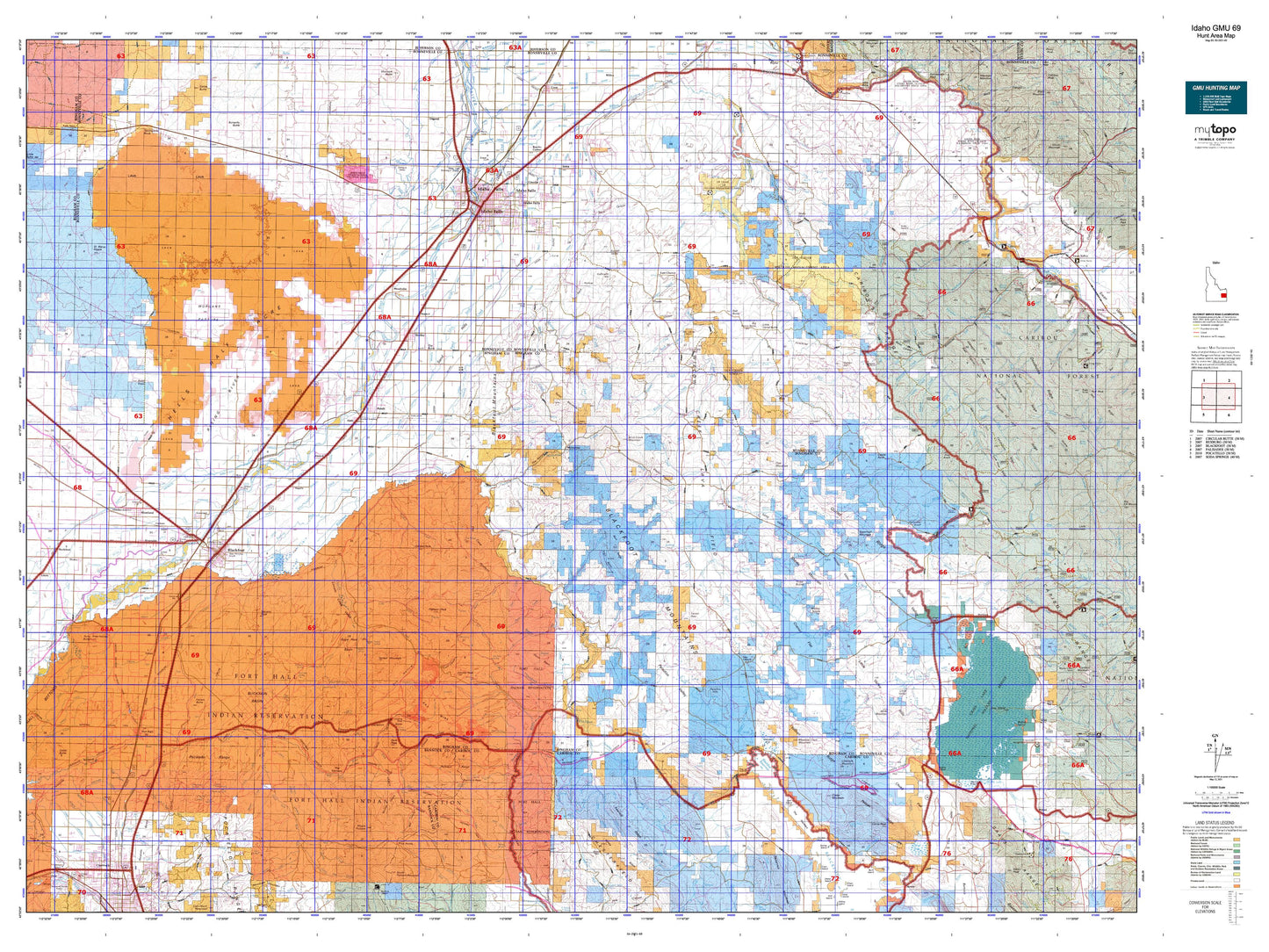
Hunting unit map of Idaho Game Management Unit 69 with topographic lines and unit boundaries. This topo map features UTM / MGRS and Latitude/Longitude grids, plus public land ownership. It comes folded on waterproof paper. Be fully prepared for your hunt with a MyTopo GMU map!.
This map contains the following named places: Aberdeen Junction,Aiken,Airport Park,Alridge,Alridge Division,Ammon,Anares Park,Antelope Creek Ranch,Association Corral,Austin Ranch,Badger Knoll,Baldy Knoll,Basalt,Bay Island,Beachs Corner,Bear Creek,Bear Island,Beaver Creek,Big Horse Butte,Big Jimmy Creek,Bingham County,Birch Creek,Birch Creek Mountain,Blackfoot,Blackfoot Division,Blacktail Creek,Blue Creek,Bone,Bonneville County,Brockman Guard Station,Brush Creek,Buck Creek,Buck Island,Buffalo Lodge,Butterfly Butte,Camp Peak,Canyon Creek,Capitol Avenue Green Belt,Castle Rock,Cattle Creek,Cedar Butte,Cedar Creek,Central Park,Chesterfield Cow Camp,Chicken Creek,Chicken Point,Christensen Ranch,Chubbuck,City of Ammon,City of Basalt,City of Blackfoot,City of Chubbuck,City of Firth,City of Idaho Falls,City of Iona,City of Shelley,Civitan Park,Clarkson,Cold Creek,Collins,Cormorant Island,Corral Creek,Cotton,Country Club Mall,Cox,Crane Creek,Crane Island,Cranes Flat,Crater Mountain,Crow Creek,Curley Park,Dalton Hill,Dare Peak,Deadman Creek,Deer Creek,Dehlin,Diggie Creek,Dry Fork,Eagle Lodge,Eastern State Fairgrounds,Elm Street Park,Equalizing Reservoir,Esquire Acres Park,Fall Creek Cow Camp,Fall Creek Ranger Station,Faulkner Ranch,Ferry Butte,Firth,Firth Division,Flag Knoll,Fort Hall,Fort Hall Division,Fort Hall Indian Agency,Fort Hall Number 2 Historic Site,Fort Hall Reservation,Galbraith Hill,Garden Creek,Garden Peak,Gay,Gem State Access Area,Gerrard,Gibson,Goshen,Goshen Junction,Grand Teton Mall,Grave Creek,Grave Creek Campground,Grays Creek Outlet Access Area,Grays Lake,Grizzly Creek,Groveland,Guyaz,Hackman,Hall Park Shopping Plaza,Hancock Ranch,Hansen Corral,Hells Half Acre,Henry Creek,Herman,Herman Ranger Station,Higham Peak,Highland Park,Homer Creek,Horse Camp,Horse Creek,Hyram Butte,Idaho Falls,Idaho Falls Division,Idaho Falls Municipal Power Plant,Idaho Falls West Division,Indian,Indian Creek,Iona,Jeff Cabin Creek,Jensen Grove Park,Jensens Lake,Jones Creek,Jumpoff Hill,Kimball,Last Chance,Limerock Mountain,Lincoln,Lincoln Peak,Little Horse Butte,Little Sand Creek,Little Valley Reservoir,Mareet Creek,McCowin Park,McDonaldville,Meadow Creek,Meadow Creek Mountain,Meteor Hole,Milo Dry Farm,Mitchell,Mollies Nipple,Moreland,Moreland Division,Morgan,Mount Baldy,Mount Putnam,Neil Ranch,Nettle Island,Northside Narrows Access Area,Orvin,Osgood,Ozone,Parleys Reservoir,Particular Knoll,Payne,Petersen Ranch,Peterson,Pine Mountain,Pinecrest Municipal Golf Course,Point Lookout,Poison Creek Boat Ramp,Poison Creek Island,Poitevin Park,Putnam Lodge,Rat Lake,Red Butte,Reed Ranch,Rhinehart Park,Ririe Reservoir,Rising River,Riverside,Riverton Access Area,Robbers Roost,Robison Reservoir,Rockford,Rollandet Park,Rose,Rouse,Russ Freeman Park,Sagehen Campground,Saint Leon Grange,Saint Marys Knoll,Sandy Downs Rodeo Grounds,Shamrock Park,Sheep Mountain,Shelley,Shelley Division,Shopko,Skelly Hill,Skyline Shopping Center,Snake River Ranger Station,South Falls Center,Split Island,Spring Island,Staffel Island,Stevens Peak,Stuart Park,Sugarloaf Mountain,Tautphaus Park,Taylor Mountain,Taylor Mountain Ski Area,Taylorville,Teton Plaza,Tex Creek Wildlife Management Area,The Butte,The Cove,The Narrows,The Saddle,Thomas,Three Buttes,Three Knolls,Trailton,Tyhee,Wapello,Westvaco,Wheeler Ranch,Willow Creek and Seventy Creek Access Areas,Wolverine,Woodville,Yandell Mountain,Ziegler Mountain


