MyTopo
Idaho GMU 9 Map
Couldn't load pickup availability
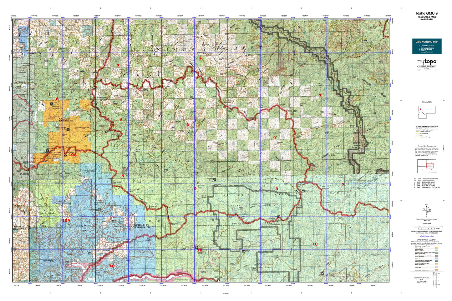
Hunting unit map of Idaho Game Management Unit 9 with topographic lines and unit boundaries. This topo map features UTM / MGRS and Latitude/Longitude grids, plus public land ownership. It comes folded on waterproof paper. Be fully prepared for your hunt with a MyTopo GMU map!.
This map contains the following named places: Aconite Creek,Adair Creek,Attention Peak,Avalanche Creek,Avery-Clarkia Division,Bad Bear Creek,Bad Bear Peak,Bad Luck Creek,Badger Creek,Badger Mountain,Barren Hill,Bathtub Creek,Bathtub Mountain,Bear Creek,Bear Skull,Bear Skull Creek,Beaver Peak,Big Talk Lake,Black Buttes,Black Creek,Blackdome Peak,Blue Heaven Cabin,Blue Lake,Bonehead Hill,Breezy Point,Brush Creek,Brush Hill,Buck Creek,Buck Point,Butte Creek,Buzzard Creek,Buzzard Roost,Cache Creek,Cairn Creek,Calipeen Creek,Camp Forty-Four,Canyon Creek,Canyon Peak,Caribou Creek,Cataract Creek,Cedar Creek,Chicadee Cabin,Cliff Creek,Cobbler Creek,Cobblers Knob,Collins Peak,Conrad Peak,CPTA Headquarters,Crag Lake,Crag Peak,Crater Lake,Crater Peak,Crescendo Creek,Crescendo Peak,Crimper Creek,Crow Lake,Culdesac Creek,Delaney Creek,Delate Creek,Devils Club Creek,Devils Lake,Devils Pulpit,Dip Creek,Dismal Lake,Dominion Point,Drift Creek,Dunce Creek,Duncecap Rock,Durham Creek,East Butte,East Fork Bluff Creek,East Fork Brush Creek,East Fork Fishhook Creek,East Fork Twin Creek,East Sister,East Sister Peak,Elk Prairie,Elmer Creek,Falls Creek,Fawn Lake,Finns Cabin,Fish Lake,Fishhook Peak,Flatiron Knobs,Floodwood Camp,Floodwood Creek,Floodwood State Forest,Forage Creek,Forage Mountain,Fortune Point,Freezeout Trail Lookout,Getaway Point,Gnat Lake,Gnat Point,Goat Creek,Goat Mountain,Granite Peak,Grassy Point,Greenie Creek,Grizzley Lake,Haunted Cabin,Heart Lake,Heart Peak,Heather Creek,Hemlock Spring Creek,Hero Lake,Hilo Creek,Hilo Peak,Honey Creek,Hoodoo Peak,Indian Dip,Isabella Creek,Isabella Point,Jacksons Knob,John Creek,Joker Peak,Jug Creek,Jug Rock,Junction Creek,Junction Peak,Jungle Creek,Landmark Peak,Larkins Creek,Larkins Lake,Larkins Peak,Lick Creek Point,Lightning Creek,Little Lost Lake,Little North Fork Campground,Long Hike Peak,Long Hike Rock,Lookout Mountain,Lost Lake,Lost Lake Creek,Lund Creek,Mallard Lake,Mallard Larkins Pioneer Park,Mallard Peak,Mammouth Springs Campground,Martin Creek,Martin Peak,Meadow Creek,Meadows Creek,Middle Creek,Middle Sister Peak,Miller Peak,Mink Creek,Minnesaka Creek,Mix Cabin,Montana Creek,Montana Peak,Montana Point,Moses Butte,Mosquito Peak,Mowich Creek,Mud Lake,Mulligan Creek,Mulligan Hump,N P Hill,North Butte,Northbound Creek,Northbound Lake,Noseeum Lake,O'Donnell Creek,Old Man Creek,Outlaw Creek,Outlaw Point,Papoose Creek,Papoose Mountain,Peggy Peak,Perry Creek,Pinchot Butte,Pinchot Creek,Pineapple Peak,Pitchfork Creek,Polar Creek,Pole Mountain,Red Raven Creek,Rocket Creek,Rocky Run,Rocky Run Point,Roundtop Guard Station,Roundtop Mountain,Roundtop Work Center,Rutledge Creek,Saint Joe National Forest,Sawtooth Creek,Sawtooth Peak,Shale Point,Shoepack Point,Siamese Creek,Ski Creek,Skyland Lake,Snow Peak,Snow Peak Wildlife Management Area,South Butte,Spotted Louis Creek,Spotted Louis Point,Spotwean Peak,Spud Creek,Stanton Creek,Steamboat Lake,Stocking Meadow Lookout,Stony Creek,Stubtoe Creek,Stubtoe Peak,Surveyors Peak,Surveyors Ridge Lookout,Tangle Creek,Thor Mountain,Timber Creek,Trail Creek,Trappers Cabin,Trimmed Tree Hill,Triple Creek,Tumbledown Creek,Twin Creek,Twin Creek Campground,Twin Lakes,Twin Spring Creek,Twodot Peak,Upper Fishook Research Natural Area,Walo Point,Wash Creek,Wasset Creek,Wasset Peak,Webfoot Creek,West Fork Bluff Creek,West Fork Cedar Creek,West Fork Fishhook Creek,West Fork Floodwood Creek,West Fork Montana Creek,West Fork Twin Creek,Whistling Peak,Widow Mountain


