MyTopo
Montana Antelope GMU 320 Map
Couldn't load pickup availability
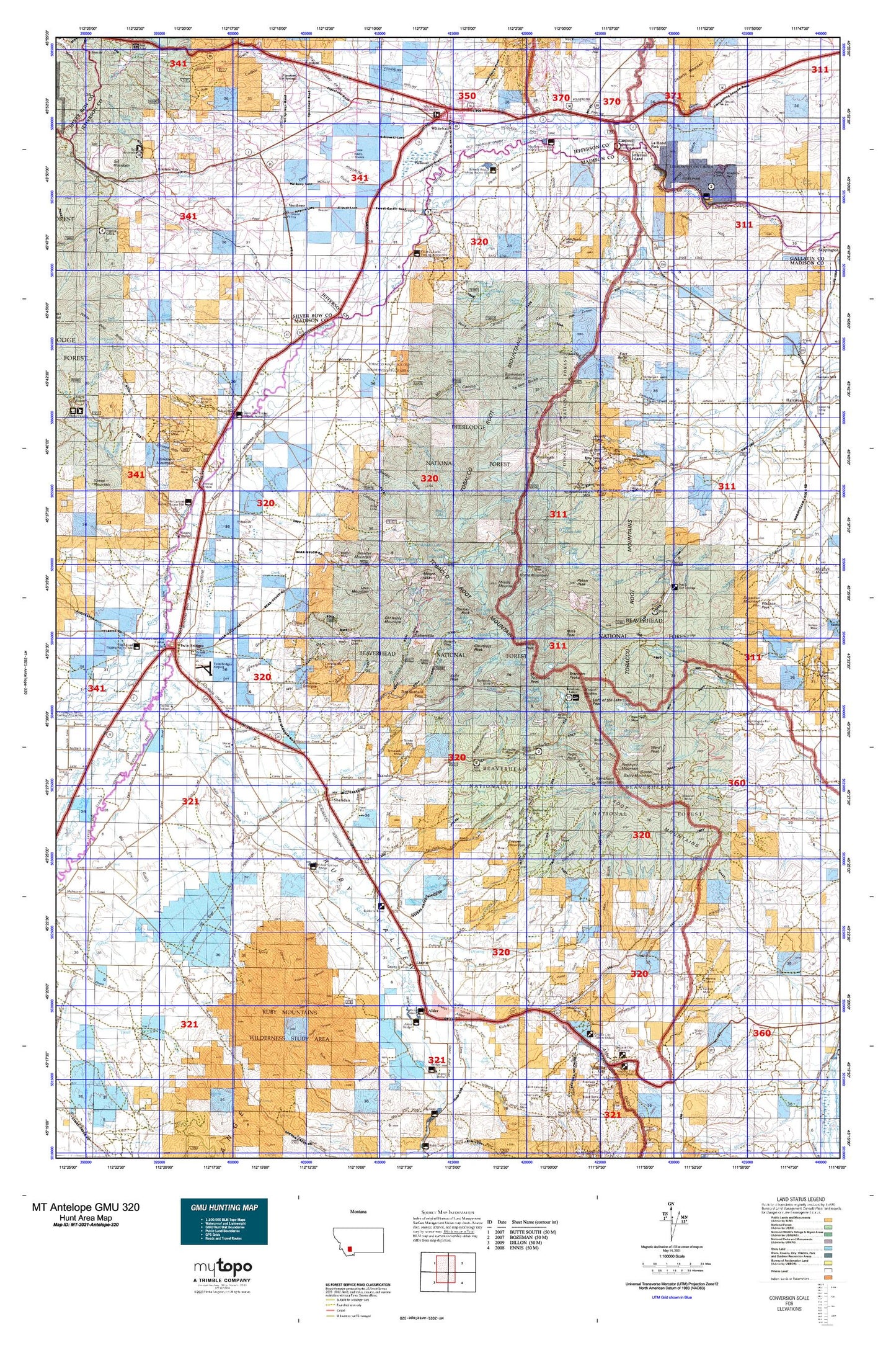
Hunting unit map of Montana Game Management Unit Antelope-320 with topographic lines and unit boundaries. This topo map features UTM / MGRS and Latitude/Longitude grids, plus public land ownership. It comes folded on waterproof paper. Be fully prepared for your hunt with a MyTopo GMU map!.
This map contains the following named places: A P A Mountain,Adobe,Adobetown Historical Marker,Albro Lake,Alcazar,Alder,Alder Gulch Creek,Alder KOA Kampground,Antelope Creek,Antimony Creek,Aurora Creek,Bagdad,Balanced Rock Campground,Bald Mountain,Bardsen,Barkell Hot Springs,Beall Creek,Beall Lake,Bear Gulch,Bell Lake,Belle Point,Beulrh Mine Camp,Big Dry Creek,Bismark,Bismark Reservoir,Bivens Gulch,Blackstone,Blossom Lake,Brandon,Branham Lakes,Branham Lakes Recreation Site,Branham Peaks,Brannan Lakes,Brenner Ranch,Brownback Mountain,Bulldog Mountain,Bungalow Group,Cactus Junction,California Ranch,Camp Creek Reservoir,Cardwell,Cardwell Bridge Fishing Access Site,Cataract Lake,Cave Mountain,Cavern,Cedric,Chicago Milwaukee and Saint Paul Crossing,Clark Ranch,Clear Creek,Cliff Lake,Cloudrest Peak,Colterville,Copper Mountain,Cottonwood Ranch,Crystal Lake,Curly Lake,Dead Mountain,Deep Lake,Dolomite Knob,Dry Lake,Dry Lake Mountains,Durham Reservoir,East Butte,Eau Clair,Father De Smet Historical Marker,Ferris Peak,Fish Creek,Gaffney,Globe Lake,Gneiss Lake,Gold Hill,Grace,Granite Lake,Granite Peak,Harrison Division,Hill Reservoir,Hollow Top Lake,Hollowtop Mountain,Horse Mountain,Indian Creek,Iron Rod,Ironrod Hills,Jackson Lake,Jefferson Island,Jefferson River Camp,Jefferson Valley Historical Marker,Jessen Park Tourist Area,Junction,Kid Lake,Kid Mountain,Kountz,Kountz Bridge Fishing Access Site,La Casa Trailer Park,La Hood Park,La Hood Park Campground,Lady of the Lake Peak,Lakeshore,Lakeshore Mountain,Lamb Ranch,Laurin,Lava Mountain,Left Fork Leonard Slough,Leggat Mountain,Leiterville,Leonard Slough,Lewis & Clark Caverns State Park,Lewis and Clark Caverns Campground,Lewis and Clark Expedition Campsite Historical Marker,Lime Spur,Limespur Fishing Access Site,Little Fish Creek,Little Granite Peak,London Hills,London Peak,Lonesome Peak,Long Mountain,Loomont,Lost Cabin Lake,Louise Lake,Lower Boulder Lake,Lower Branham Lake,Macaroni Lake,Madison County Fairgrounds,Mammoth,Manhead Mountain,Mason Lake,Mayflower,Mayflower Bridge Fishing Access Site,McCammeron,McKelvey Lake,Middle Mountain,Mill Creek Campground,Mill Gulch Station,Miller Reservoir,Mine Lake,Mine Peak,Montana State Highway Department Section House,Mount Bradley,Mount Jackson,Mount Jefferson,Mud Lake,Nelson Reservoir,Nevada City,Nevada City Historical Marker,Nineteen Mile,Noble Lake,Noble Peak,Nobleville,Non Pareil Park,Nonpariel Creek,Old Baldy Mountain,Oval Lake,Parrot Castle Fishing Access Site,Pedro Point,Piedmont,Pipestone,Pipestone Campground,Pipestone Hot Springs,Pogliano Ranch,Point of Rocks,Pony,Porphyry Mountain,Postlewaite Creek,Potosi,Potosi Campground,Potosi Hot Springs,Potosi Peak,Potosi Ranger Station,Queens Hill,Ramshorn Mountain,Renova,Rice Motel and Trailer Court,River Side Ranch,Robbers Roost,Robbers Roost Historical Marker,Rock Creek Lake,Rossiter Lake,Ruby,Sage,Sailor Lake,Sheridan,Sheridan City Park,Sheridan Division,Sheridan Trailer Court,Silver Bow Ranch,Silver Springs,Silver Star,Silver Star Fishing Access,Skihi Peak,Skytop Lake,Smelter Mountain,Smith Reservoir,South Baldy Mountain,South Meadow Creek Lake,South Meadow Creek Ranger Station,Spring Creek,Spring Park Creek,Springside Ranch,Spuhler Peak,Stardust Country Inn and RV Park,Stonewall,Stonewall Creek,Strawberry,Sugar Loaf Mountain,Summit Valley,Sunrise Lake,Sunrise Peak,Sureshot Lake,Thompson Peak,Thompson Reservoir,Tinsley,Town of Sheridan,Town of Twin Bridges,Town of Whitehall,Triangle Lake,Twin Bridges,Twin Bridges City Park,Twin Bridges City Park Rest Area,Twin Bridges Division,Twin Lakes,U-H Ranch,Upper Boulder Lake,Upper Branham Lake,Upper Mason Lake,Upper Sureshot Lake,Vendome,Wagon Wheel Ranch,Ward Peak,Waterloo,White Rock Ranch,White Tail Deer,Whitehall,Whitehall Creek RV Park,Woodward Ranch,Ziegler Reservoir


