MyTopo
Montana Antelope GMU 430 Map
Couldn't load pickup availability
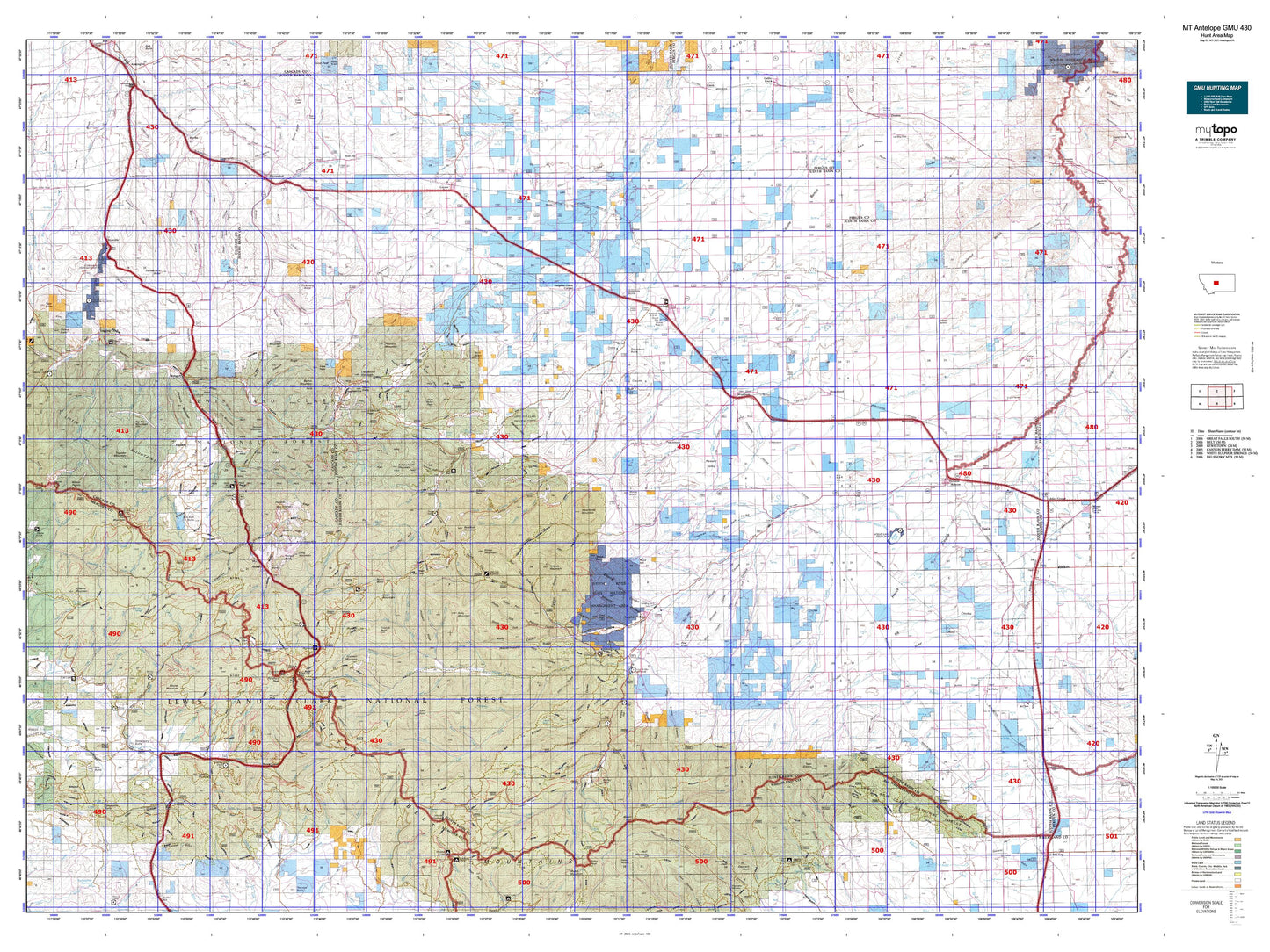
Hunting unit map of Montana Game Management Unit Antelope-430 with topographic lines and unit boundaries. This topo map features UTM / MGRS and Latitude/Longitude grids, plus public land ownership. It comes folded on waterproof paper. Be fully prepared for your hunt with a MyTopo GMU map!.
This map contains the following named places: A C M Company Spur,Ackley Lake,Ackley Lake Campground,Ackley Lake State Park,Adams Creek,Albright,Alkali Creek,Allan Creek,Anderson Peak,Antelope Butte,Antelope Creek,Appraisal Creek,Aspen Campground,Bandbox Mountain,Bangtail Creek,Barker,Barker Mountain,Barnaboo Creek,Bartleson Peak,Basin Creek,Belt Creek Ranger Station,Belt Park Butte,Benchland,Benton,Big Baldy Mountain,Big Deer Point,Big Horn Mountain,Black Butte,Blacktail Hills,Bluff Mountain,Blythe,Buffalo,Bull Roaring Creek,Burgys Spur,Burley Peak,Burris Cabin,Butcherknife Mountain,Cabin Mountain,Cameron,Camp Don Bosco,Camp Rotary,Centerville,City of Hobson,Clendenin Mountain,Cook Ranch,Cotton Trailer Court,Courtneys Creek,Coxcombe Butte,Coyote Creek,Coyote Peak,Crater Lake,Daisy Guard Station,Daisy Peak,DAV Park,Denton,Denton City Park,Dover,Dry Pole Campground,Dry Wolf Campground,Dry Wolf Ranger Station,Edith Nelson Trailer Court,Elephant Rock,Farmers Cooperative Elevator,Florence Mine,Forest Green,Fred M Ellis Memorial Campground,Galena,Gallatin Valley Milling Company Elevator,General Mills Incoporated Elevator,General Mills Incorporated Elevator,Geyser,Geyser Division,Geyser Elevator,Geyser Rest Area,Gibson Peak,Goodman,Granite Mountain,Green Mountain,Grendah Mountain,Hall Trailer Court,Hauck,Hay Canyon Campground,Heganer,Hidden Lake,Hobson,Hobson Division,Hobson Stop Trailer Court and RV Park,Holters Siding,Hoosac,Hoover,Hoover Mountain,Hughesville,Hunter Spring Guard Station,Hunters Camp,Indian Buttes,Indian Hill,Indian Hill Campground,Irene Peak,Iron Butte,Iron Mountain,J and M Trailer Court,Jellison Place,Jericho,Johannesburg,Judith Basin County,Judith Ranger Station,Judith River Game Range Headquarters,Judith River Historical Marker,Judith River State Wildlife Management Area,Jumping Creek Campground,Keegan Peak,Kelly Mountain,Kibbey,Kibby,King Hill Winter Sports Area,Kings Hill,Kings Hill Camp,Kings Hill Campground,Kings Hill Guard Station,Korell Cabin,Korells Dude Ranch,Lake Elva,Lamb Creek Campground,Leadville,Lehigh,Lewis and Clark National Forest,Lewis and Clark National Forest - Jefferson Division,Limestone Butte,Limestone Spar,Lion Creek Campground,Lions Club Park,Logging Creek,Lone Tree Creek,Long Mountain,Longs,Mann,Many Pines Campground,Marys Knoll,Meadow Creek,Merino,Michigan Settlement,Middle Fork Ranch,Mining Plays Second Fiddle Historical Marker,Mixes Baldy,Mizpah Peak,Moccasin,Monarch,Monarch Mountain,Monarch-Neihart Division,Montezuma,Moose Creek Campground,Moose Mountain,Mount High,Muddy Mountain,Neihart,Neihart Baldy,Neihart Reservoir,Neil Creek Ranch,Newlan Creek Guard Station,North Fork Courtneys Creek,Oka Butte,Old Geyser Creek,Old Yogo Town,Otter Mountain,Peterson Mountain,Philbrook,Pine Knob,Porphyry Peak,Porphyry Peak Lookout,Queen of the Hills Mine Spur,Rattlesnake Butte,Raynesford,Red Hill,Red Shed Lake,Reed Hill,Rhoda Lake,Riceville,Rocky Mountain Elevator,Russell Point,Saint Thomas Camp,Sand Point,Sapphire Village,Scholtztown,Servoss Mountain,Sheep Creek Campground,Sheep Mountain,Siegling,Silver Dyke,Skull Butte,Slide Rock Point,Smoky Mountain,South Fork Courtneys Creek,Spion Kop,Spring Branch,Spring Creek,Stanford,Stanford City Park,Stanford Division,Steamboat Butte,Steamerville,Stevens Butte,Strawberry Butte,Summit,Sun Mountain,Surprise Creek,Surprise Creek Colony,Taylor Mountain,Taylor Peak,Tenderfoot Creek Experimental Forest,Tepee Butte,The Devils Chair,Thunder Mountain,Tillinghast,Tobin,Tollgate,Tollgate Mountain,Town of Denton,Town of Neihart,Town of Stanford,Trask Ranch,Tucken Mountain,Twin Lakes,Twin Sisters,Tylers Spur,Utica,Western Lumber and Grain Company Elevator,Windham,Win-O-Ki Camp,Wolf Butte,Wolsey,Woodhurst Mountain,Yogo Crossing,Yogo Peak,Yules Spur,Yuleville


