MyTopo
Montana Antelope GMU 450 Map
Couldn't load pickup availability
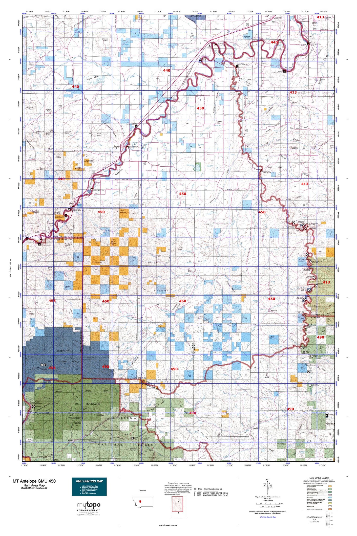
Hunting unit map of Montana Game Management Unit Antelope-450 with topographic lines and unit boundaries. This topo map features UTM / MGRS and Latitude/Longitude grids, plus public land ownership. It comes folded on waterproof paper. Be fully prepared for your hunt with a MyTopo GMU map!.
This map contains the following named places: 59421,59485,Adel,Adel Mountain,Allen Creek,Antelope Butte,Antelope Mountain,B K Ranch,Baldy,Bear Prairie,Beartooth Game Management Area,Big Bend,Big Bend Fishing Access Site,Bird Creek,Black Mountain,Blaine Creek,Boston Coulee,Brunots Rapids,Buckshot Island,Bunnell Creek,Burnt Gulch,Butte Creek,Cals Gulch,Camp Gulch,Candle Gulch,Candle Mountain,Cannon Lake,Cannonball Coulee,Cascade,Cascade Butte,Cascade Colony,Cascade County,Cascade County Waterfowl Production Area,Cascade Division,Cascade Reservoir,Cascade Stock Yards,Cascade Trailer Park,Castle Rock,Castner Coulee,Castner Falls,Cherry Coulee,Chestnut Valley,Chestnut Valley Canal,Chicken Coulee,Chisholm Mountain,Clark Creek,Coal Creek,Conway Ridge,Creek Corral,Crooked Creek,Dana Ranch,Dana-Cameron Ranch Dam,DeLacey Point,Dime Hill,Dodge,Dog Creek,Dry Fork,Dry Fork Fairhaven Number 1 Dam,Dry Fork Fairhaven Number 2 Dam,Dry Gulch Creek,Dunes Fishing Access Site,East Fork Government Creek,East Fork Hound Creek,East Fork Spring Creek,Elizabeth Reservoir,Elk Creek,Elk Ridge,Encampment Creek,Fair Haven Colony,Finigan Creek,Finigan Mountain,Fir Creek,Flat Creek,Flennikens Rapids,Flood,Fourteen Creek,Freeman Creek,Gallaher Dam,Gallaher Number 2 Dam,Garrison,Gates of the Mountains Wilderness,Geyser Creek,Gilman Gulch,Gilmore Siding,Gollaher Reservoir,Goodman Coulee,Gordon Ranch,Government Creek,Hardy,Hardy Bridge Fishing Access Site,Hardy Creek,Harris Creek,Harris Mountain,Herman Gulch,Hound Creek,Hound Creek Dam,Hound Creek Reservoir,Huff Creek,Hump Cabin,Hunters Creek,Iverson Hill,Johnson Butte,Keepout Gulch,Knapp Creek,Lepley Creek,Leveque Reservoir Dam,Lincoln,Little Bird Creek,Little Muddy Creek,Little Stickney Creek,Lone Pine Rapids,Lord Coulee,Lower Chestnut Valley,Lower Smith River Fishing Access Site,Martien,McKamey Dam,Mesaros Dam,Middle Creek,Middle Creek Camp,Middle Creek Lake,Middle Creek Lake Dam,Mill Coulee,Millegan,Mil-mil-teh Hill,Ming Coulee,Missouri Bird Dam,Missouri Inn Campground,Moors Mountain,Mountain Palace Fishing Access Site,Mowing Machine Coulee,Muddy Flats,Mullens Creek,Mullery Creek,Murphy Coulee,Nelson Island,Nelsons Gulch,North Branch Knapp Creek,North Fork Beaver Creek,North Fork Fir Creek,North Fork Freeman Creek,North Fork Sheep Creek,Novak Creek,One Creek,Palo Ranch,Pardais Coulee,Parsons Ranch,Pearce,Pelican Point Fishing Access Site,Pettapiece Badland,Pike Creek,Pine Coulee,Pine Island,Pine Island Rapids,Pole Creek,Porcupine Creek,Prewett Creek,Prewett Creek Fishing Access Site,Ray Carlson,Richardson Creek,Riverdale,Rocky Coulee,Rocky Gap,Rocky Gap Creek,Rocky Reef,Rocky Reef Reservoir,Saint Clair,Saint Johns Creek,Saint Peters Mission Historical Marker,Sawmill Creek,Schrammeck Lake,Seaton Ranch,Sheep Creek,Sheep Mountain,Shellrock Ridge,Sieben Ranch,Slip Gulch,Smith River,Soldier Creek,South Fork Freeman Creek,South Fork Sheep Creek,Spaniard Dam,Spanish Coulee,Splain Coulee,Spring Coulee,Spring Creek,Spring Creek Lake Dam,Spring Creek Reservoir,Spring Willow Coulee,Spun Dam,Square Butte,Staunton Ranch,Streeter Hill,Sulphur Gulch,Swede Bench,Tender Gulch,The Devils Kitchen,The Painted Rock,The Pinnacles,The Sawteeth,Thompson Ranch,Timber Hill,Tintinger Siding,Tintinger Slough,Too-nah-hin Creek,Too-nah-hin Hollow,Town of Cascade,Truly,Truly Bench,Truly Take-Out Fishing Access Site,Tunnel Number 1,Turtle Butte,Tyrell Camp,Tyrell Creek,Ulm,Ulm Bridge Fishing Access Site,Ulm Flats,Ulm Railroad Station,Upper Park,Wade Coulee,Webb Number 1 Dam,West Fork Flat Creek,West Fork Hound Creek,West Fork Middle Creek,Whitetail Creek,Whitetail Prairie,Wickiup Creek,Willow Creek,Willow Mountain,Wilson Butte,Wolf Point,Wooden Shoe Camp,Wooden Shoe Creek,Wosinek Flats,Yank Creek,Yucca Golf Club


