MyTopo
Montana Antelope GMU 513 Map
Couldn't load pickup availability
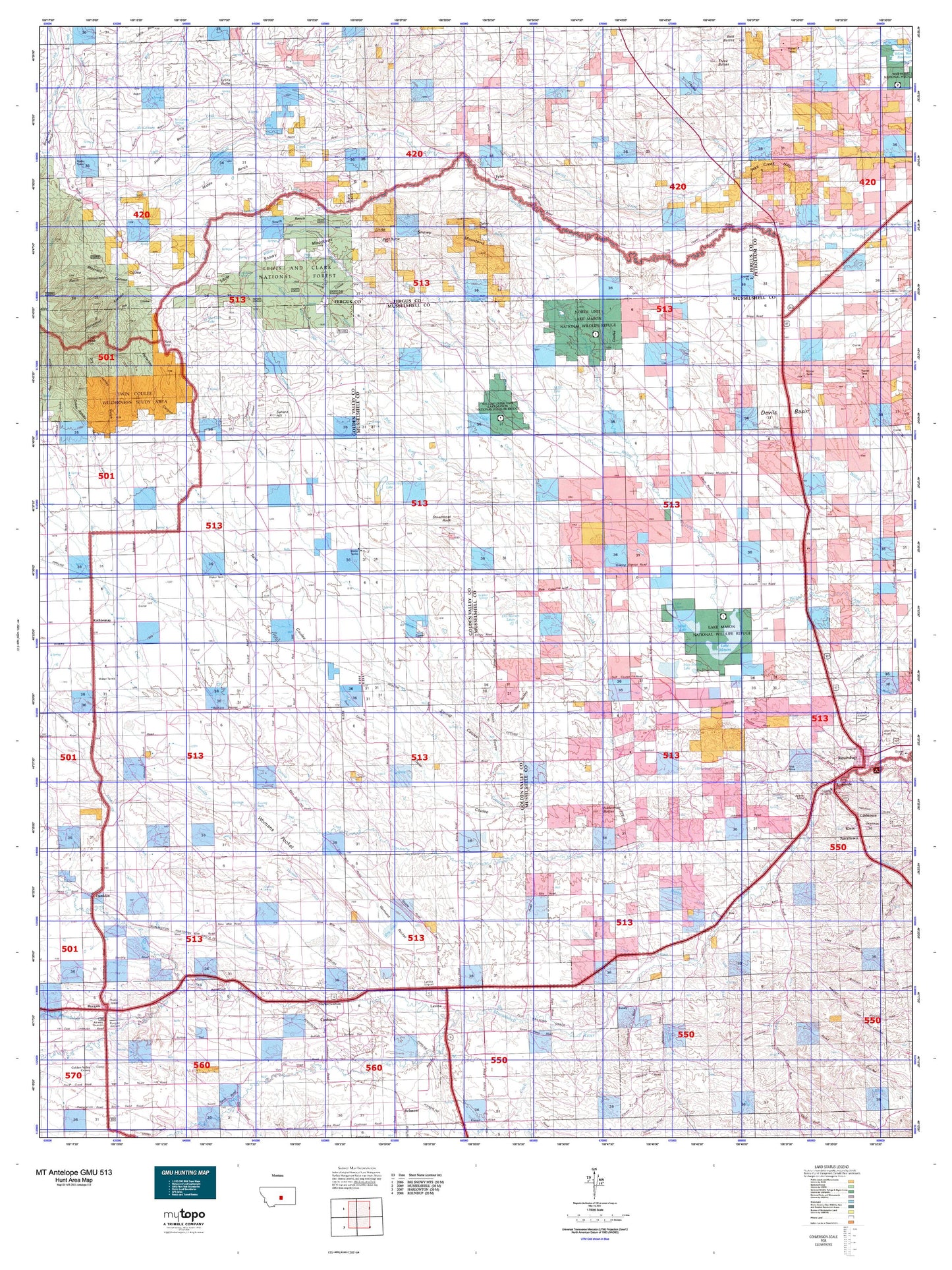
Hunting unit map of Montana Game Management Unit Antelope-513 with topographic lines and unit boundaries. This topo map features UTM / MGRS and Latitude/Longitude grids, plus public land ownership. It comes folded on waterproof paper. Be fully prepared for your hunt with a MyTopo GMU map!.
This map contains the following named places: 04N20E35DDAC01 Well,06N20E02DAAA01 Well,06N20E12BAD_01 Well,06N22E02AC__01 Well,06N22E02CACB01 Well,06N22E02DD__01 Well,06N22E11A___01 Well,06N23E01CBDB01 Well,06N23E02ACAD01 Well,06N23E02CBAA01 Well,06N23E18CCC_01 Well,06N24E04DDAB01 Well,06N24E06ADDD01 Well,06N24E08AABA01 Well,06N24E08C___01 Well,06N24E14CDDB01 Well,06N24E18DCCD01 Well,06N25E03BBBA01 Well,06N46E04DBCA01 Well,07N21E05BBC_01 Well,07N22E25B___01 Well,07N22E25BADA01 Well,07N22E27CA__01 Well,07N23E25BBCC01 Well,07N23E27DBDC01 Well,07N23E33AABA01 Well,07N24E02BCDA01 Well,07N24E04BBBC01 Well,07N24E13AACC01 Well,07N24E13BDAA01 Well,07N24E13BDDD01 Well,07N24E14ADDA01 Well,07N24E15BAA_01 Well,07N24E24DCCA01 Well,07N24E24DDDD01 Well,07N24E28ADBA01 Well,07N25E03DBBA01 Well,07N25E06ADDD01 Well,07N25E15CCDC01 Well,07N25E16BDCD01 Well,07N25E19DDDA01 Well,07N25E27ADDC01 Well,07N25E27BACA01 Well,08N21E29AAD_01 Well,08N21E30BBD_01 Well,08N21E35DCC_01 Well,08N23E12DBC_01 Well,08N23E21CDCA01 Well,08N23E23CCCC01 Well,08N23E30D___01 Well,08N23E32C___01 Well,08N24E02C___01 Well,08N24E15ACCC01 Well,08N24E15CCBB01 Well,08N24E17ADD_01 Well,08N24E17ADDB01 Well,08N24E19ACDD01 Well,08N24E20ACBA01 Well,08N24E33BB__01 Well,08N25E06BBAD01 Well,08N25E10ACDB01 Well,08N25E10ACDB02 Well,08N25E14CCBB01 Well,08N25E15BDCC01 Well,08N25E15BDDB01 Well,08N25E15DDDA01 Well,08N25E20BBAD01 Well,08N25E22DABB01 Well,08N25E22DACA01 Well,08N25E22DADA01 Well,08N25E22DADA02 Well,08N25E23BBDC01 Well,08N25E32ABBD01 Well,08N30E22ACCD01 Well,09N21E24C___01 Well,09N21E27B___01 Well,09N22E27CAAC01 Well,09N23E32BADC01 Well,09N23E33DDAB01 Well,09N25E21B___01 Well,09N25E28ADD_01 Well,09N25E32ADAC01 Well,09N25E32CCCD01 Well,12N22E13DDDD01 Spring,16 Ranch Airport,18N23E12CBC_01 Well,59046,59441,Alaska Bench,Alkali Creek,Ashbridge Spring,Ashley Coulee,Babbit Dam,Bald Butte,Battrick,Big Coulee Creek,Big Spring,Buck Creek,Bundy,Burgoyne Siding,Cameron Creek,Camp Three Census Designated Place,Careless Creek,Cat Creek,Cottonwood Creek,Cow Country Historical Marker,Currant Creek,Cushman,D Bartlett Number 2 Dam,Daley Gap,Darrel,Dean Creek,Des Moines Lakes,Devils Hole Lake,Dry Creek,Dry Lake,Durfee Creek,Durfee Gap,East Fork Dean Creek,Egge Ditch,Elso,Emory,Ernie Number 1 Dam,Fish Creek,Fivemile Coulee,Fivemile Creek,Fratt,George Rath Number 2 Dam,George Rath Number 3 Dam,Gerdts Dam,Glennie Ditch,Golden Valley County,Goulding Creek,Gyp Basin,Half Moon Creek,Halfbreed Creek,Hammer Number 1 Dam,Harper Coulee,Hay Coulee,Holt Creek,Horsethief Canyon,Horsethief Creek,Hughes Junior Number 1 Dam,Joe Toe Dam,Johnson Mine,Jones Creek,Keene Mine,Kinnick Coulee,Lake Mason,Lake Mason National Wildlife Refuge,Lake Mason National Wildlife Refuge Dam,Lake Thom,Lamberts Bench,Lamott Coulee,Lavina,Lavina Airport,Lavina Cemetery,Lavina City Park,Lavina Division,Lavina Water Users Association Ditch,Little Snowy Mountains,Lyons Butte,May Martin Lake,Maynard Coulee,Maynard Creek,McCartney Creek,McCartney Springs,McLean Lake,Merrills Springs Creek,Middle Bench,Miller Lake,Minerva Creek,Muppet Dam,N Bar Ranch,N Bar Ranch Airport,Naderman Buttes,Naderman Dam,Naderman Ditch,Nies Mine,Ninemile Creek,Ninemile Spring,North Fork Flatwillow Creek,North Fork Pole Creek,North Horsethief Canyon,Paint Rock Number 1 Dam,Painted Robe Creek,Patterson Canyon,Pender Coulee,Pike Creek Hills,Pine Grove Cemetery,Pole Creek,Pony Dam,Posey Spring,Potter Creek,Ray Creek,Red Hill,Resurrection Cemetery,Riverside,Road Coulee,Rock Springs,Roundup Division,Sahara,Sahara Hill,Sjandy Coulee,Slayton,Slayton Junction,Smith Coulee,Snowy Mountain Dam,South Bench,South Fork Flatwillow Creek,South Fork Pole Creek,Spring Coulee,Spring Creek,Spring Creek Irrigation Dam,Square Deal Mine,Stag Run,Stanley Creek,Steamboat Rock,Stella Dam,Stonehouse Canyon,Sulfur Springs,Talbot Lake,Three Buttes,Timber Buttes,Town of Lavina,Twin Coulee,Tyler,Tyler Cemetery,Vebar,Warr,West Roundup,Wheaton,Whoop-Up Creek,Womans Pocket,Zimmerman Dam Number 1


