MyTopo
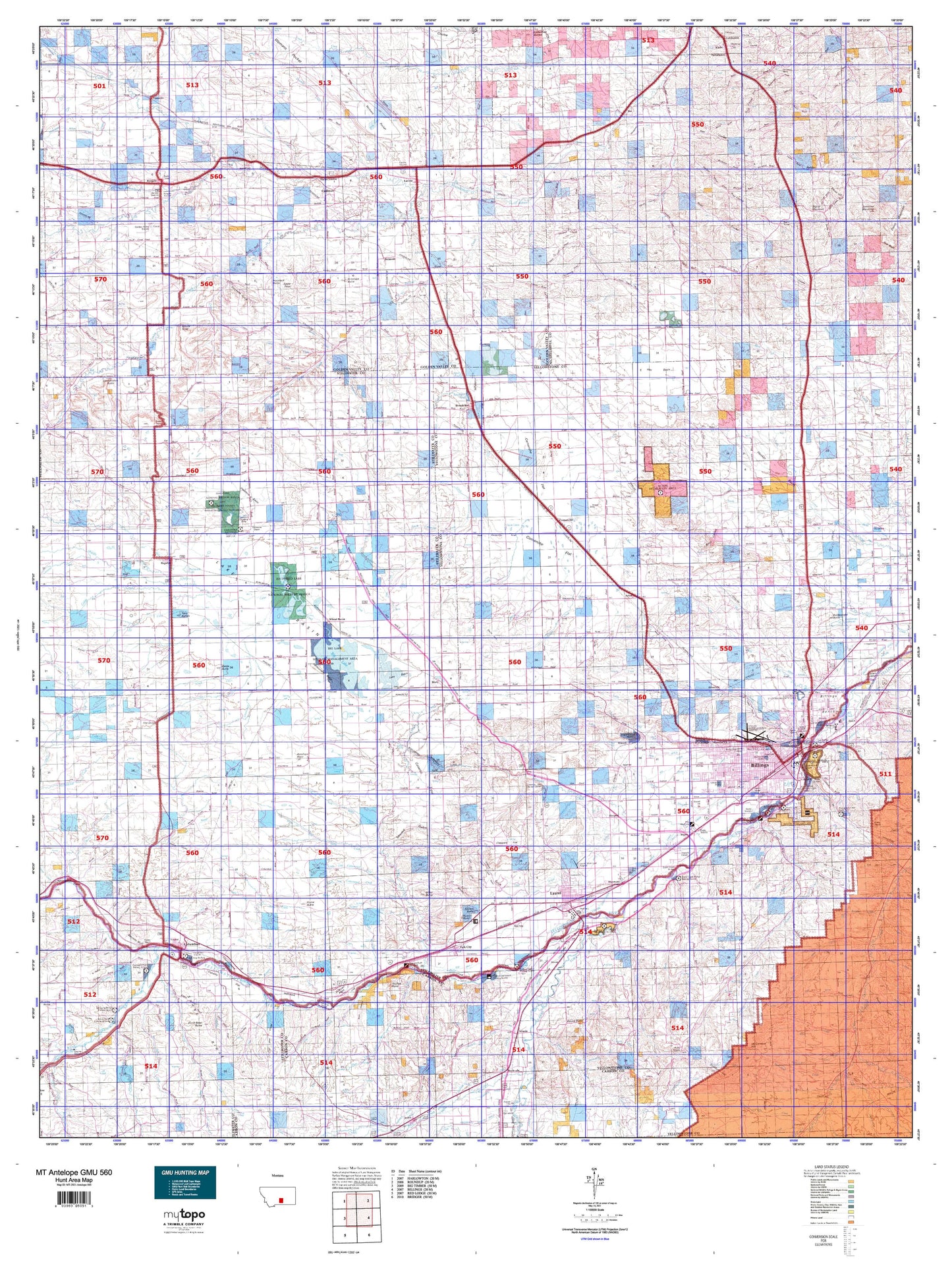
Montana Antelope GMU 560 Map
Couldn't load pickup availability
Hunting unit map of Montana Game Management Unit Antelope-560 with topographic lines and unit boundaries. This topo map features UTM / MGRS and Latitude/Longitude grids, plus public land ownership. It comes folded on waterproof paper. Be fully prepared for your hunt with a MyTopo GMU map!.
This map contains the following named places: Acton,Alkali Creek,Alkali Pond,Allen Creek,Antelope Butte,Antelope Point,Ballard Ranch,Baseline,Basin Creek,Battle Butte,Bearpaw Creek,Bellion Creek,Belmont,Big Coulee Creek,Big Lake,Billings,Billings Division,Billings Heights,Billings Racetrack,Bitter Creek,Blue Creek,Broadview,Broadview Pond,Broadview Pond Fishing Access Site,Brown Creek,Buffalo Mirage Fishing Access Site,Bundy,Burgoyne Siding,Busteed Hill,Cabin Gulch Creek,Cameron Park,Canyon Creek,Carr Trailer Court,Cedar Creek,Cherry Island,City of Billings,City of Laurel,Coal Mine Coulee,Cobb Field,Cole Creek,Columbus,Columbus Historical Marker,Columbus Rest Area,Comanche,Comanche Creek,Coombs,Cottonwood Creek,Cove Creek,Cow Creek,Cushman,Dallmann Lake,Davis Creek,Daylis Stadium,Dean Creek,Deer Creek,Difficulty Creek,Dirt Creek,Dry Creek,Dry Lake,Duck Creek,Dusty Creek,East Bridge Fishing Access Site,East Fork Dean Creek,East Fork Duck Creek,East Keyser Creek,Eastlake Pond/Big Lake Waterfowl Management Area,Elso,Farewell Creek,Farmers Elevator,Farralltown,Firemans Point Fishing Access Site,Fish Creek,Fivemile Creek,Fortney Ranch,Franklin,Fratt,Golden Valley Colony,Golden Valley County,Golden Valley County Waterfowl Production Area,Gorham Park,Goulding Creek,Granite Peak Park,Grass Lake National Wildlife Refuge,Greenwood Creek,Gurney Creek,H and H Trailer Court,Hailstone Lake,Hailstone National Wildlife Refuge,Halfbreed Lake,Harris Hill,Harvest State Cooperatives Elevator,Haystack Butte,Heiken Ranch,Hendey,Hensley Creek,Hesper,Hickson Ranch,Hilands Golf Club,Hogans Slough,Homestead Island Fishing Access Site,Hop Creek,Horse Butte,Horse Creek,Hunter Lake,Huntley Creek,Itch-Kep-Pe Park,Itch-Kep-Pe Park Campground,Joe Hill Creek,Josephine Park,Keyser Creek,Klein Division,Lake Elmo,Lane Ranch,Laurel,Laurel Division,Laurel Stockyards,Lavina,Lavina City Park,Lazy K T Ranch,Lindemulder Hill,Line Creek,Little Basin Creek,Little Cove Creek,Lost Creek,Love Hill,Luckey Homestead,Mackey Ranch,Mason,McCormick Hill,MetraPark,Middle Creek,Miller Butte,Mills Creek,Misko,Mitchell Y-P Ranch,Molt,Mossmain,Mount Sinai,Mountain View Colony,Musselshell County Waterfowl Production Area,Newman Creek,Ninemile Creek,Ninemile Hill,North Fork Alkali Creek,North Fork Canyon Creek,North Fork Cottonwood Creek,North Fork Crooked Creek,North Fork Fivemile Creek,North Park,North Stillwater Division,Northwest Yellowstone Division,Painted Robe,Painted Robe Creek,Park Avenue Park,Park City,Park City Division,Park City Historical Marker,Pershing Hill,Pictograph Cave State Park,Pioneer Park,Place Where the White Horse Went Down Historical Marker,Popelka Ranch,Porter Coulee,Rapelje,Rapelje Grain Company Elevator,Rapids,Rattlesnake Butte,Rehder Creek,Republic,Rimrock,Riverside Park Boat Ramp,Rock Creek,Rock Springs,Rocky Mountain College Park,Rocky Mountain Elevator,Rose Park,Ross Homestead,Round Butte,Rye Grass Creek,Ryegate,Ryegate City Park,Schaffs RV Court,Schroder Ranch,Schultz Ranch,Seventynine,Shane Creek,Shed Gulch Creek,Shorey,Signal Mountain,Silesia,Slayton,Slayton Junction,South Comanche Creek,South Fork Alkali Creek,South Fork Canyon Creek,South Fork Cottonwood Creek,South Fork Crooked Creek,South Fork Valley Creek,South Hills Fishing Access Site,South Park,Spring Creek,Spurling,Square Butte,Stanley Creek,Stewart Ranch,Stillwater County Fairgrounds,Stillwater Golf Course,Struck Creek,Swamp Creek,Thirty Mile,Thirtymile Ranch,Thompson Park,Tilden Creek,Toll Creek,Toms Creek,Town of Broadview,Town of Columbus,Town of Lavina,Town of Ryegate,Tucker Creek,Tutt Creek,Twin Buttes,Twin Lakes,Twin Pines Ranch,Vale Creek Ranch,Valley Creek,Valley Vista Trailer Park,Vebar,Wash Bowl Butte,Westover Island,Wheat Basin,Wimsett Point,Wyman Creek,Yegen,Youngs Point


