MyTopo
Montana Deer/Elk GMU 123 Map
Couldn't load pickup availability
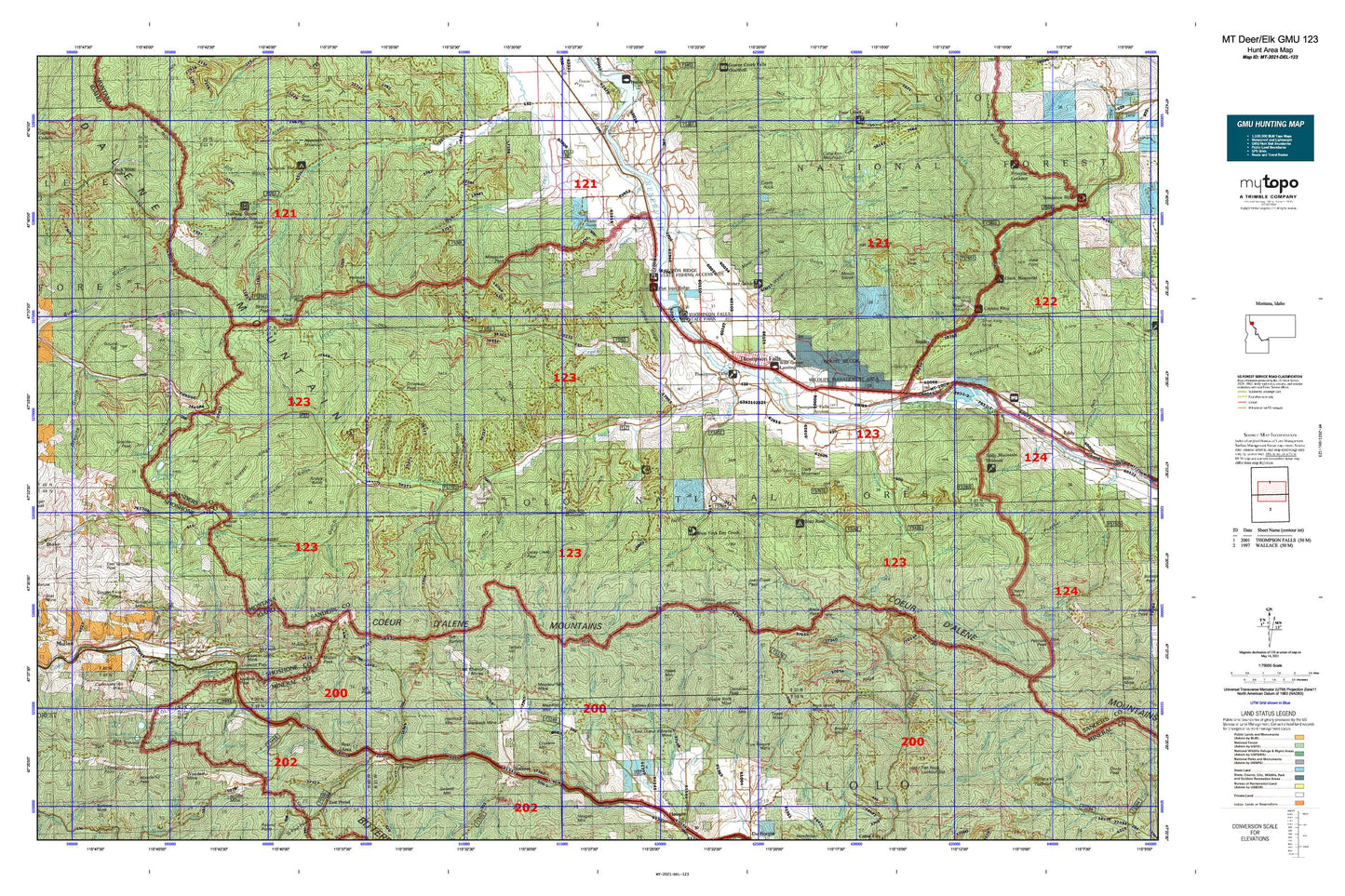
Hunting unit map of Montana Game Management Unit DEL-123 with topographic lines and unit boundaries. This topo map features UTM / MGRS and Latitude/Longitude grids, plus public land ownership. It comes folded on waterproof paper. Be fully prepared for your hunt with a MyTopo GMU map!.
This map contains the following named places: 59830,59867,59873,83846,Andys Knob,Antimony Creek,Arrowhead Lake,Ashley Creek,Ashleys Settlement,Beaver Lake,Beaver Peak,Belknap,Big Spruce Creek,Birdland Bay RV Resort,Black Traveler Mine,Blossom Lakes,Borax,Borax Creek,Boston Colby Mine,Breen Creek,Brimstone Creek,Brooks Mountain,Brownman,Bryan Mine,Bryson,Bug Creek,Bullion,Burke Summit,Cameron Creek,Cameron Peak,Camp Creek,Carbonate,Casper Creek,Castle Rock,Cat Creek,Cherry Creek,Chipmunk Creek,Chippy Creek,City of Thompson Falls,Clark Mountain,Clear Creek,Clear Peak,Columbus Creek,Copper Lake,Copper Rock Mine,Crow Creek,Cruzane Mountain,Cub Creek,Cube Iron Mountain,Daisy Creek,Deer Lake,Demont Creek,Denna Mora Campground,Denna Mora Creek,Dixie Creek,Dixie Peak,Dominion Creek,Dons Mountain,Dorsey,Dragin Creek,Driveway Peak,Dry Creek,Duckhead Lake,Duthie,East Coeur D'Alene Mine,East Fork Cherry Creek,East Fork Crow Creek,East Fork Dry Creek,East Fork Packer Creek,East Fork Willow Creek,East Grouse Peak,Elk Point,Emma Peak,Emma Peak Pack Trail,Evans Lake,Flat Rock Lookout Station,Flatiron Ridge Fishing Access Site,Flatiron Ridge Recreation Site,Ford Hill,Frog Lake,Goat Creek,Goat Lakes,Goat Mountain,Gold Rush Campground,Granite Peak,Grass Lake,Graves Creek,Haines Point,Halfway House Historical Site,Halfway House Historical SIte,Hanaker Creek,Hartman,Haun Creek,Hawk Mountain,Helwick Peak,Hemlock Mine,Hemlock Mountain,Hilda Creek,Hill Seven,Holacaust Historical Marker,Honeymoon Lake,Inland Mine,Iron Daisy Mine,Jack Pine Flats Campground,Jack Waite Forks,Joan Creek,Johns Mountain,Kildee,Knowles Lake,Knox Creek,Larson,Last Chance Creek,Last Chance Mines,Lavell,Lindroos Hill Recreation Site,Little North Fork South Fork Coeur d'Alene River,Liver Peak,Lone Lake,Lookout,Lookout Pass Ski Area,Lost Branch,Lower Glidden Lake,Lower Stevens Lake,Lucky Luke Mine,Lynx Creek,Maple Peak,Marmot,Meadow Mountain,Meadow Mountain Mine,Meadow Mountain Mines,Mephisto Creek,Middle Fork Savanac Creek,Miller Park,Mineral Mountain Creek,Montana City,Montana Mine,Mosquito Creek,Mosquito Peak,Mount Bushnell,Mount Silcox,Mountain House Historic Site,Mullan Division,Mullan Hatchery,Mullan Road Historical Marker,North Fork Clear Creek,Northup Creek,Packer Creek,Pear Lake,Petes Point,Pinehurst,Polleys Spur,Pottsville,Prospect Creek,Rainy Creek,Randolph Creek,Rattlesnake Creek,Revett Lake,Riverfront RV Park and Cabins,Rock Creek Vista,Rock Island Mine,Round Top,Round Top Mountain,Runt Mountain,Safety Spur,Saint Regis Lake,Saleesh House,Saltese,Saltese Consolidated Mine,Saltese Rest Area,Saw Creek,Shannonville,Shoshone Park,Shoshone Park Recreation Area,Sildex/Amazon-Dixie Mine,Sildix,Silent Creek,Silver Cable Mine,Silver Creek,Skeeter Creek,Slidex Mine,Snider,Snowshoe Creek,Snowstorm Peak,Sohon,South Branch Big Beaver Creek,South Fork Wilkes Creek,Spokane Creek,Sqaylth-kwum Creek,Steamboat Island,Stevens Peak,Sullivan,Summit Creek,Table Top Mountain,Taft,Taft Peak,Taft Summit,Tammany,Tarbox Hill,Tarbox Mine,Tarbox-Mineral King Mine,Texas Mine,The Rock Hill,Thompson Falls,Thompson Falls Campground,Thompson Falls Dam Point of Interest,Thompson Falls Golf Club,Thompson Falls Historical Marker,Thompson Falls Reservoir,Thompson Falls State Park Campground,Thompson Falls State Recreation Area,Thompson Point,Thompson River,Thompson River Spur,Thorne Creek,Trapper Cabin Creek,Tributary Creek,True Fissure Mine,Twentyfour Mile Creek,Twentythree Mile Creek,United States Forest Service Fire Station,Upper Fork Clear Creek,Upper Glidden Lake,Upper Saint Regis Lake,Upper Stevens Lake,Valentine Mine,Wabash Mine,West Fork Crow Creek,West Fork Dry Creek,West Fork Packer Creek,West Fork Timber Creek,West Fork Willow Creek,Wilkes Creek,Willow Creek,Wonderful Peak,Woodlin


