MyTopo
Montana Deer/Elk GMU 261 Map
Couldn't load pickup availability
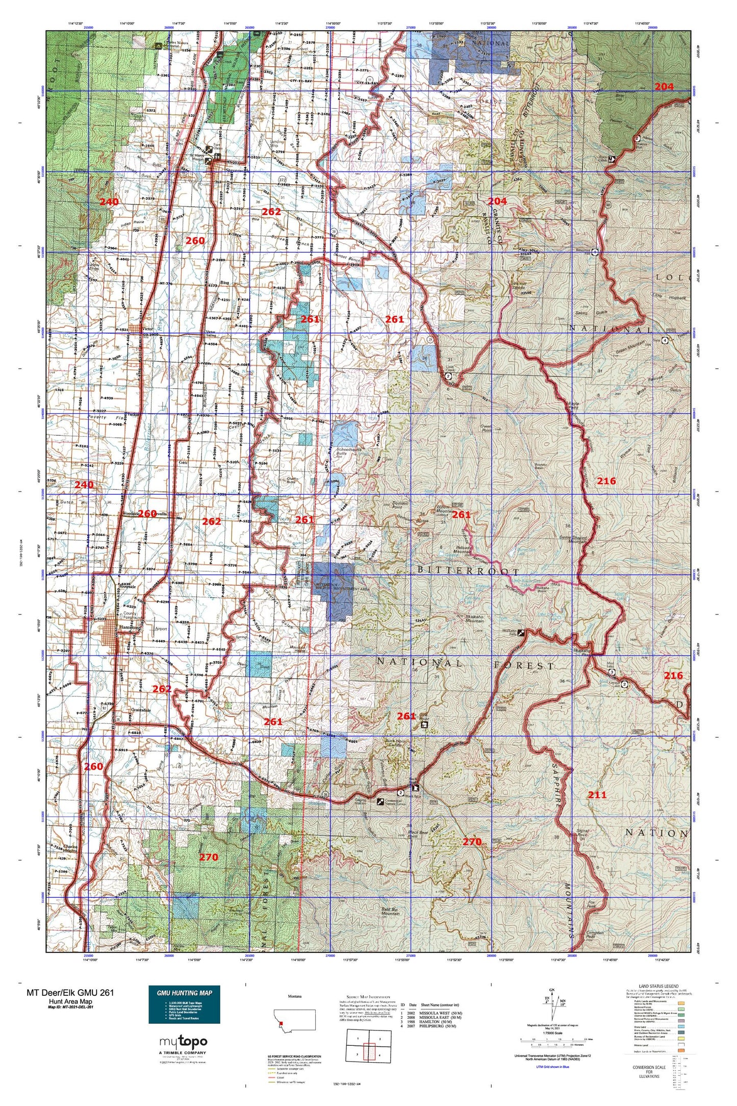
Hunting unit map of Montana Game Management Unit DEL-261 with topographic lines and unit boundaries. This topo map features UTM / MGRS and Latitude/Longitude grids, plus public land ownership. It comes folded on waterproof paper. Be fully prepared for your hunt with a MyTopo GMU map!.
This map contains the following named places: 59828,59870,Alder Creek,Ambrose Creek,American Legion Park,Apple Blossom Court,Arastra Creek,Auriga Dam,Bass,Bass Creek Fishing Access Site,Bear Creek,Bear Gulch,Beartrap Creek,Bela,Bell Crossing,Bell Crossing Fishing Access Site,Big Creek,Big Sky Mobile Home Park,Bing,Birch Creek,Bitterroot Court,Bitterroot Flat Campground,Bitterroot Irrigation District Canal,Bitterroot State Wildlife Management Area Calf Creek Segment,Black Bear Campground,Black Bear Forest Service Station,Black Bear Point,Blacktail Creek,Blodgett Park Recreation Site,Boulder Basin,Brennan Creek,Brookins Gulch,Brooks Creek,Bunkhouse Creek,Burnt Fork,Burnt Fork Bitterroot River,Burnt Fork Campground,Burnt Fork Dam,Burnt Fork Lake,Butte Cabin Creek,Butterfly Creek,Calf Creek,Cantonment Stevens,Chaffin Butte,Charleys Gulch,Chelan Creek,Cinnabar Court,Cinnabar Point,Cinnamon Bear Creek,Cinnamon Bear Point,Claremont Creek,Coalpit Creek,Cobb,Coffee Gulch,Corley Gulch,Corvallis,Corvallis Canal,Corvallis Mobile Home Park,Corvallis Siding,Cougar Creek,Cow Creek,Coyote Gulch,Crooked Creek,Curdys Cove,Cutoff Gulch,Cutoff Gulch Campground,Daly,Daly Creek,Daly Lake Dam,Dam Creek,Dam Creek Lake,Deep Creek,Desert Creek,Dome Shaped Mountain,Dominic Buttes,Dominic Point,Dry Creek,Dry Gulch,Dunbar,Eagle Point,Eastman Creek,Etna,Falls Creek,Falls Gulch,Feather Gulch,Flat Rock Creek,Fool Hen Lake,Fort Owen Historical Marker,Fort Owen State Park,Fort Skedaddle,Fred Burr Creek,Fullerton Gulch,Gibbons Creek,Gird Creek,Gird Point,Gleason Lake,Gleason Lake Dam,Gold Creek,Gold Creek Campground,Gold Creek Trailhead,Grantsdale,Green Mountain,Grizzly Creek,Haacke Creek,Hamilton,Hamilton Division,Hamilton Golf Course,Hamilton Mobile Home Park,Hedge Ditch,Hog Trough Creek,Holloron Gulch,Howell Creek,Iron Cap Creek,Iron Cap Mine,Johnson,Kennedy Gulch,Kneaves Lake,Kootenai Creek,Larson Creek,Laveck Creek,Lavina Creek,Lee Metcalf National Wildlife Refuge,Leisure Village,Lewis and Clark Park,Little Burnt Fork,Little Burnt Fork Lakes,Little Hogback Creek,Little Sleeping Child Creek,Little Threemile Creek,Little Willow Creek,Lower Lateral,Marcus Daly Mansion Historical Marker,McCalla Creek,McCurtney Creek,McKeen,Mill Creek,Mittower,Moly Group,Mountain House,Mountain Shadows Estates,Mountain View Trailer Court,Mud Lake,Mud Lake Campground,NE SE Section 26 Mine,North Bench,North Birch Creek,North Burnt Fork Creek,North Channel Bear Creek,North Fork Willoughby Creek,North Fork Willow Creek,North Swamp Creek,North West Mobile Home Park,NW SW Section 9 Mine,Orchard,Owen Point,Palisade Mountain,Ponderosa Mobile Home Park,Quast,Railroad Creek,Ravalli County Fairgrounds,Reed Butte,Republican Ditch,Riverside,Riverside RV Park,Robertson Creek,Rocky Mountain Laboratory Historical Marker,Saint Clair Creek,Saint Mary Mission,Sand Flower Mini Shops,Sandersville,Sawmill Creek,Schoolhouse Butte,SE NW Section 7 Mine,Sharrott Creek,Sheep Creek,Signal Creek,Signal Rock,Silverthorn,Silverthorn Creek,Skalkaho Basin,Skalkaho Falls,Skalkaho Highline Ditch,Skalkaho Mountain,Skalkaho Wildlife Management Area,Slocum Creek,Smythe Creek,Soft Rock Creek,South Burnt Fork Creek,South Channel Bear Creek,South Fork Willoughby Creek,South Swamp Creek,South Willoughby Creek,Spooner Creek,Spring Creek,Stevensville,Stevensville Division,Stevensville Reservoir,Stevensville Sewage Lagoon Dam,Stevensvillers Ranger Station,Stuart Creek,Sunset Bench,Supply Ditch,SW NE Section 2 Mine,SW NW Section 16 Mine,Sweathouse Creek,Tenderfoot Gulch,Town of Stevensville,Tucker,Tucker Crossing East Fishing Access Site,Tucker Crossing West Fishing Access Site,Tudor,Twomile Creek,Union Ditch,Upper Lateral,Vermiculite Mine,Victor,Victor Crossing,Victor Park,Victor Siding,Wahlquist Creek,Ward Ditch,Weasel Creek,West Fork Alder Creek,Westana Mobile Home Park,Western Montana Experiment Station,Whe-lha-kleh-tseen Mountain,Whitetail Golf Course,Willoughby Creek,Willow Creek,Willow Mountain,Wood Lot Fishing Access Site,Woodside,Woodside Bridge Fishing Access Site,Woodside Crossing,Yellowstone Camp


