MyTopo
Montana Deer/Elk GMU 322 Map
Couldn't load pickup availability
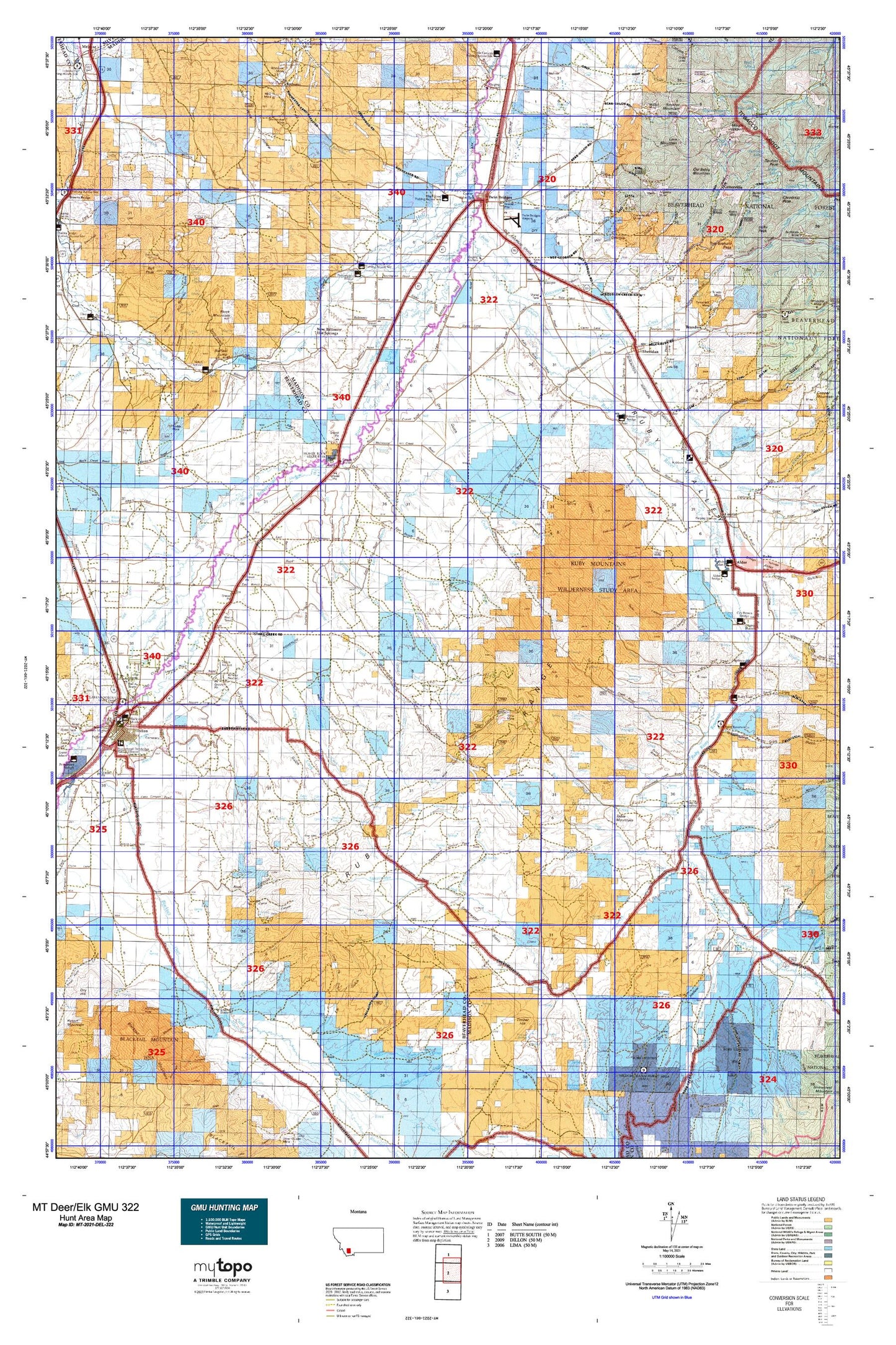
Hunting unit map of Montana Game Management Unit DEL-322 with topographic lines and unit boundaries. This topo map features UTM / MGRS and Latitude/Longitude grids, plus public land ownership. It comes folded on waterproof paper. Be fully prepared for your hunt with a MyTopo GMU map!.
This map contains the following named places: 59754,A P A Mountain,Albers River Ditch,Albers Slough,Alder,Alder Gulch Creek,Alder KOA Kampground,Antelope Basin,Antelope Creek,Ayotte Ditch,Bagdad,Baker Slough,Balkovetz Giem Standvich Whiting Ditch,Ball Place,Ball Ranch,Battle Ranch,Bear Gulch,Beaver Head Rock,Beaverhead Golf Club,Beaverhead River,Beaverhead Rock,Beaverhead Rock Historical Marker,Beaverhead Rock State Park,Bell Peak,Belmont Park Ranch,Benson Creek,Benson Peak,Benson Ranch,Big Dry Creek,Big Hole River,Biltmore Hot Springs,Bishop Place,Bivens Creek,Bivens Gulch,Black Slough,Block Mountain,Bob Peters Ditch,Bokum Lawyer Ditch,Booth Creek,Braach Ditch,Branch Creek,Brandon,Brannan Lakes,Broadhead Slough,Brown Ditch,Brown Ranch,Brunzell Slough,Buhrer-Garrison Ditch,Bullerdick Hyndman Moulton Ditch,Bum Creek,Burdick Place,Burfiend Station,Cabin Creek,California Creek,California Ranch,California Slough,Campbell Place,Carey Ditch,Carter Creek,Centennial Park,Centerville,Charlton Slough,Christensen Ranch,Clark Sennett Ditch,Clear Creek,Cocanougher Ditch,Colterville,Combs Ditch Number Two,Conover Ranch,Co-op Ditch,Cottonwood Creek,Cottonwood Ranch,Cow Creek,Crittenden Creek,Crystal Lake,Currant Creek,Dan Ibey Memorial Park,Davey Creek,Diamond O Ranch,Dillon Canal,Donegan Slough,Drummy Ditch Number Two,Duncan Edelman Ditch,Durham Reservoir,East Bench,East Bench Canal,East Fork Garden Creek,Eclipse Creek,Elser Tilton Ditch,Fairview,Fossil Basin,Fr Co-op Ditch,Fries Place,Gaffney,Garden Creek,Gilbert Ranch,Globe Lake,Greenhorn Creek,Guidici Cowcamp,Guntner Place,Hale Place,Hayden Ditch,Hells Canyon Creek,High Road Fishing Access Site,Hinch Creek,Hoffman Creek,Hoffman Place,Holden Place,Horse Creek,Idaho Creek,Indian Creek,Irishmans Hole,Jack Creek,Jackson Lake,Jacobs Slough,Jasmine Creek,Jessen Park Tourist Area,Kingrey Place,Lakeshore,Lakeshore Mountain,Landon Ranch,Larson Ditch,Larson-Narancich Ditch,Laurin,Lava Mountain,Left Fork Leonard Slough,Left Fork Stone Creek,Leiterville,Leonard Place,Leonard Slough,Lower Boulder Lake,Madison County Fairgrounds,Maloney Ranch,McCammeron,McHessor Creek,Metzel Ranch,Middle Fork Stone Creek,Mill Creek,Mormon Creek,Mount Jackson,Mud Lake,Muriers,Murray Gilbert Slough,Nat Woods Crossing,Nez Perce Creek,Noble Fork,Nobleville,Non Pareil Park,Nonpariel Creek,North Fork Hinch Creek,North Fork Sage Creek,North Fork Sweetwater Creek,Notch Bottom Fishing Access Site,Nugget Creek,Old Baldy Mountain,Owsley Slough,Peacock Creek,Pennington Bridge Fishing Access Site,Peterson Creek,Pogliano Ranch,Poindexter,Point of Rocks,Puller Hot Springs,Quaking Aspen Creek,Ramshorn Creek,Ray Lynch Park,Robb Creek,Robbers Roost,Robbers Roost Historical Marker,Rochester,Rochester Creek,Rock Island Ranch,Rock Spring Ranch,Ruby Reservoir Campground,Ruby River,Ruby River Reservoir,Ruby Valley Historical Marker,Sage Creek,Sailor Lake,Schoolhouse Slough,Seidensticker Ranch,Selway Slough,Sheridan,Sheridan City Park,Sheridan Division,Sheridan Trailer Court,Silver Springs,Skihi Peak,SkyLine RV Park,Slate Stone,Smelter Mountain,Smith Reservoir,Sodak Mill,Sorensen Ranch,South Fork Hinch Creek,South Fork Sage Creek,South Side Reservoir,Spring Brook,Spring Creek,Spring Park Creek,Stardust Country Inn and RV Park,Stevens Slough,Stinking Water,Stodden Slough,Stone Creek,Stones Precinct,Sunrise Lake,Sunrise Peak,Sweetwater,Sweetwater Basin,Sweetwater Creek,Table Mountain,The Iron Mine,The Island,Third Slough,Timber Creek,Timber Hill,Town of Sheridan,Town of Twin Bridges,Trout Creek,Trudau Lake,Twin Bridges,Twin Bridges City Park,Twin Bridges City Park Rest Area,Twin Bridges Division,Upper Boulder Lake,Virginia City Division,West Baker Slough,West Fork Sage Creek,Willard Slough,Willow Spring Creek,Winnipeg Creek,Wisconsin Creek,Wonderly Ranch,Ziegler Reservoir


