MyTopo
Montana Deer/Elk GMU 330 Map
Couldn't load pickup availability
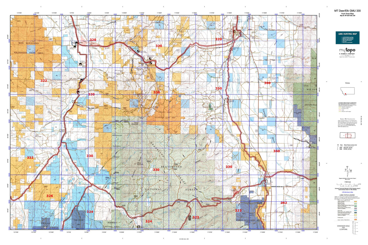
Hunting unit map of Montana Game Management Unit DEL-330 with topographic lines and unit boundaries. This topo map features UTM / MGRS and Latitude/Longitude grids, plus public land ownership. It comes folded on waterproof paper. Be fully prepared for your hunt with a MyTopo GMU map!.
This map contains the following named places: 59710,59755,Abe,Adobe,Adobetown Historical Marker,Alameda Mine,Alder,Alder Gulch Mine,Alder KOA Kampground,Antelope Basin,Apex Mine,Arasta Creek,Axolotl Lake,Axolotl Lakes,Baldy Mountain,Ball Place,Bartlett Mine,Beartown,Belle Mine,Belmont Park Ranch,Big Willow Mine,Black Bear Creek,Black Rock Mine,Blade Mine,Blaine Spring Creek,Blue Lake,Bob Peters Ditch,Boulder Creek,Bowman Place,Broadhead Slough,Brown Bear Creek,Browns Gulch Mining District,Brunzell Slough,Buckskin Creek,Buffalo Creek,Burdick Place,Burger Creek,Burger Ditch,Burnt Tree Fishing Access Site,Call Road Reservoir,Calloway Ditch,Cameron,Cameron Store and Cabins,Campbell Place,Canyon Campground,Canyon Campground Mine,Central City,Cherry Creek,Cherry Lakes,Cinnamon Bear Creek,Cirque Lake,Cook Mine,Copper Mine,Cornucopia Mine,Corral Creek,Cottonwood Creek,Coyote Creek,Cramer Ditch,Cream Creek,Crockett Lake,Crockett Lake Ranger Station,Cyprus Mine,Davey Creek,Davey Creek Mine,Daylight Creek,Don-A-Vera/Jayhill Mine,Donegan Slough,Doubtful Reservoir,Dry Fork,Dryden Creek,Eagle Black Mine,East Fork Garden Creek,East Side Ditch,Eastern Pacific Mine,Easton-Pacific Mine,Eightmile Creek,Eightmile Fishing Access Site,Ennis Cultural Station,Ennis National Fish Hatchery,Fossil Basin,Foster Ranch,Garden Creek,Garrison Cabin,Garrison Mine,General Shafter Mine,Gerard Ranch,Gilbert Ditch,Gilbert Ranch,Giltedge Mine,Granger Ditch,Granite Creek,Grassy Lake,Greenhorn Creek,Gumbo Creek,Hale Place,Haypress Creek,Haypress Lakes,Heart Lake,Highland,Highland Mine,Hinch Creek,Home Park Ranch,Horse Hill,Ice Creek,Idaho Creek,Indian Creek,Indian Creek Ditch,J T C Mine,Jack Creek,Jasmine Creek,Jobe Creek,Junction,Kearsage Mine,Kent Ranch,Kingrey Place,Krauss Sawmill,Kremer Ditch,Kruse Ditch,Laciede Mine,Larrabee Ditch,Ledford Creek,Leonard Place,Leyendecker Powers Ditch,Lichte Ruby Creek Ditch,Little Willow Creek,Madison County,Maloney Ranch,Mapleton Mine,Marietta Mine,McAtee Bridge Sportsmans Access,McDeed Creek,Meadow Fork Greenhorn Creek,Metzel Ranch,Metzel West Side Ditch,Middle Fork Warm Springs Creek,Mill Creek,Moran Creek,Moran Paige Ditch,Mormon Creek,Mountain Chief Mine,Mountain Talc Mine,Nelson Mine,Nevada City,Nevada City Historical Marker,New Gold Bar Mine,Newberry Ditch,North Fork Greenhorn Creek,North Fork Hinch Creek,North Fork Wigwam Creek,NW Section 16 Mine,Olsen Ditch,Olsen Ranch,Pacific Mine,Passamari Ditch,Peggy Ann Mine,Peterson Creek,Peterson Ditch,Peterson Ranch,Phillips Ditch,Pine Grove,Pioneer Ditch,Pole Patch,Prospect Mine,Puller Hot Springs,Putnam Ditch,Randolph Mine,Rankin Ranch,Reeder Place,Reservoir Lake,Robb Creek,Romy Lake,Ruby,Ruby Canyon Ditch,Ruby Creek,Ruby Mine,Ruby Reservoir Campground,Ruby River Reservoir,Ruby Valley Historical Marker,Sage Creek,Saint Lawrence Mine,Sheep Mountain,Shewmaker Ditch,Silver Bell Mine,Slate Stone,Snapp Ditch Number Two,Snapp Donegan Ditch,South Fork Greenhorn Creek,South Fork Hinch Creek,South Fork Ruby Creek,South Fork Sage Creek,South Fork Warm Springs Creek,Spring Creek,Spring Creek Ditch,Stanley Ditch,Still Creek,Stinking Water,Summit,SW Section 16 Mine,SW Section 26 Mine,Swan Lake,Sweetwater,Sweetwater Creek,Table Mountain,Talus Lake,Tate Place,Thexton Ranch,Threemile Creek,Timber Creek,Tolman Creek,Town of Virginia City,Trail Creek,Trudau Lake,Twin Lakes,U S Grant-Upper Mine,Union City,Varney,Varney Bridge Fishing Access Site,Varney Bridge Recreation Site,Virginia City,Virginia City Campground,Virginia City Division,Virginia City Historical Marker,Virginia City Park,Warm Springs Cow Camp,West Bench Canal,West Madison Canal,West Madison Recreation Area,White Bear Creek,Wigwam Creek,Williams Creek,Willow Creek,Wilson-Bell Mine,Wonderly Ranch,Woodward Place,Yankee Mine


